Hypoxia Watch
- Point of Contact
-
The Gulf of Mexico Hypoxia Watch evolved as a cooperative project among the National Oceanic and Atmospheric Administration's (NOAA's) National Marine Fisheries Service (NMFS), the National Coastal Data Development Center (NCDDC), and the CoastWatch-Caribbean/Gulf of Mexico Regional Node. Hypoxia Watch provides near-real-time data and map products using shipboard measurements of bottom-dissolved oxygen. These products form the basis for summertime advisories on anoxic and hypoxic conditions in the north-central Gulf of Mexico.
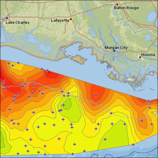
This map provides a near-real-time, geospatially referenced view of dissolved oxygen measurements made during the annual summer Gulf of Mexico Southeastern Monitoring and Assessment Program (SEAMAP) cruise in the northwest and north-central Gulf of Mexico.
Personnel on the NOAA ship Oregon II send data packets to NCDDC every 3-5 days during the cruise. We then process the data and make it available online for download through this map service. The site also makes data measurements available from previous years.
Please Note: You must enable JavaScript and disable pop-up blocking for the map to function properly.
