Delivers quick facts and detailed statistics through interactive visualizations about coastal communities, ecosystems and the economy
Supports the implementation of ecosystem-based management tools in coastal and marine environments and the terrestrial environments that affect them
Platform
Focus Area
Function
Type
Displaying 9 Results
 Benthic Habitat Atlas of Coastal Texas
National Oceanic and Atmospheric Administration
Displays shallow water habitat for Texas coastal bays in an interactive viewer
Esri, Massachusetts Office of Coastal Zone Management, National Oceanic and Atmospheric Administration, Oregon State University
Derives benthic terrain classifications from input bathymetry
National Oceanic and Atmospheric Administration
Enables users to display essential fish habitat and the associated areas protected from fishing
Environmental Protection Agency
Provides an interactive, graphical means to retrieve, view, and save a wide range of estuarine data from multiple sources.
National Oceanic and Atmospheric Administration
Helps to identify priority locations for conservation, restoration, and planning (extension to ArcGIS with Spatial Analyst)
 Marine Geospatial Ecology Tools
Duke University
Includes over 250 geoprocessing tools useful to coastal and marine researchers and GIS analysts
 Mississippi-Alabama Habitat Mapper
Dauphin Island Sea Lab, National Estuary Program, National Oceanic and Atmospheric Administration, The Nature Conservancy
Displays habitat protection priorities in Mobile and Baldwin counties, Alabama
Bureau of Ocean Energy Management, National Oceanic and Atmospheric Administration
Supplies baseline information needed for ocean planning efforts
NatureServe
Supports complex assessments by helping users integrate conservation data with land use planning and resource management information

 Benthic Terrain Modeler
 Essential Fish Habitat Mapper
 Estuary Data Mapper
 Habitat Priority Planner
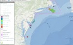 Multipurpose Marine Cadastre
 NatureServe Vista