| new 2013 |
View a list of our archived and upcoming webinars
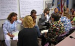
Provides training and resources for GIS, GPS, and online mapping
NGS’s Corbin Training Center provides classes on datums and projections, geodesy, and the National Spatial Reference System.
Delivery Method
Focus Area
Displaying 12 Training Results
Provides an introduction to CanVis software, a visualization tool used in project planning, policy making, and communication efforts; instruction includes tool demos (live or recorded) and classroom and Web-based training
 Climate Adaptation for Coastal Communities
Conveys information and practical skills for incorporating climate considerations into planning processes, and provides time in class to apply what is learned to individual issues
Provides information on coastal inundation issues and teaches spatial techniques for mapping inundation
Provides the knowledge and skills required to use this ArcGIS extension in conservation, restoration, and planning processes; instruction includes web-based and classroom training
 Introducing Green Infrastructure for Coastal Resilience
Teaches green infrastructure concepts that support coastal resilience
Provides an introduction to the concepts of lidar data with application examples for the Pacific region
 Managing Visitor Use in Coastal and Marine Protected Areas
Provides tools to identify and define unacceptable visitor use impacts to natural resources and visitor experiences
Provides the knowledge and skills required to use the Open-source Nonpoint-Source Pollution and Erosion Comparison Tool (OpenNSPECT), a MapWindow GIS plug-in designed to investigate potential water quality impacts from land use and land cover changes
Teaches local and state planners about climate change, as well as the planning processes and actions that can help their communities prepare for climate change impacts
Provides a basic overview of the Public Trust Doctrine; instruction is Web-based and self-guided
 Roadmap for Adapting to Coastal Risk
Provides instruction and online resources for designing a community assessment and planning process that considers coastal risks and vulnerabilities, and identifies strategies for adaptation
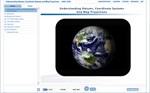 Understanding Map Projections, Datums, and Coordinate Systems
Provides an introduction to the concepts of these mapping elements with application examples for the Pacific region

 CanVis
 Coastal Inundation Mapping
 Habitat Priority Planner
 Introduction to Lidar
 OpenNSPECT
 Planning for Climate Change
 Public Trust Doctrine