
|
This website gives you the tools to create, view, query and print customized maps showing FCC licensing data, regulated towers and market area boundaries. These maps can be extremely helpful in conducting analysis on current service and need/feasibility studies for new services.
The download files are provided in shapefile format which is compatible with ArcExplorer® produced by ESRI, Inc. (other viewers compatible with the shapefile format can be used). In order to get started you must download and install the software package.
From this site, you can download mapping files of the following:
With these data sets, you will be able to determine the locations and limited technical details of existing towers the FCC collects data on (i.e. Cellular, Paging, Microwave, AM, FM, etc...). This information can be extremely helpful in conducting analysis such as; current service deployment, need/feasibility determinations of new services, co-location of antenna structures, inventorying of structures, network planning, etc...
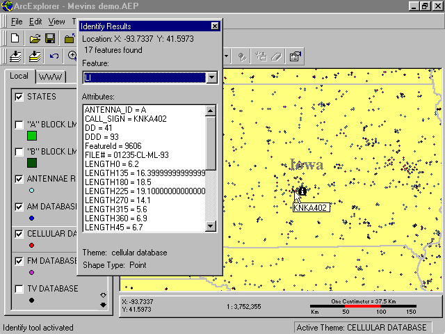
This combination of data and software will allow you to view, query, and thematically create your own maps based on FCC licensing and/or your own compatible data sets. Click on the links below to view actual screenshots:
Also available is a downloadable zip file version of the FCC Mapping 2012 CDROM (zip) (An FCC created CDROM that contains mapping applications/data and distributed at various telecommunications industry trade shows by FCC staff). The zip file contains all the necessary files and directory structures to replicate the FCC Mapping 2010 CDROM. The data supplied on this CDROM is generally the same data available on this web site. Exclusively provided on the CDROM are FCC created ArcExplorer2® and ArcExplorer9® project files. These project files allow the user to immediately begin using all the mapping data resources available on the CDROM with minimum complexity.
Once you download and extract the zip file, read the "readme.txt" file provided for detailed installation instructions. The zip file is 180MB in size. You will need a minimum of 720MB free space to extract all the files.
Notice: Previous versions of the ArcExplorer project file "fcc_geo_internet.axl" no longer work properly. A new version of this project file has been created and can be downloaded here. Download "fcc_geo_internet.axl". (axl)
