|
Foreword The Federal Motor Carrier Safety Administration (FMCSA) has been investigating methods to improve carrier security, particularly in the area of hazardous materials security. The transportation of hazardous materials is the largest security risk area within the motor carrier industry, with more than 800,000 shipments of hazardous materials transported each day in the United States. This project builds on two key FMCSA projects involving secure commercial motor vehicle (CMV) operations: the Hazardous Materials Safety and Security Field Operational Test (Hazmat FOT), and the Untethered Trailer Tracking and Control System. In 2004, the Senate Conference Report 108-401 stated that further CMV tracking capabilities were necessary: "As proposed by the Senate, the conference agreement directs $2,000,000 from funds provided for the high-priority initiative program for an expanded satellite-based communications system to monitor and track hazardous materials and high-value cargo in uncovered areas of the United States." This document outlines the requirements for this expanded satellite-based communications system, provides a detailed breakdown of the individual technologies used, and explains how they will be field-tested to provide evidence that the technologies meet the designated requirements. The information in this document regarding the potential security, safety, and operational efficiency benefits of commercially available trailer tracking technologies, can be used by motor carriers and the public sector emergency response and enforcement communities. Motor carriers may decide to purchase and implement this technology to improve overall safety, security, and operational efficiency. The emergency response and enforcement community could use the technology to better respond to potential trailer security incidents. In Fall 2005, FMCSA conducted a pilot test to develop and test an expanded satellite-based communications system specified in this document. This document does not supersede an earlier report on the subject. Notice This document is disseminated under the sponsorship of the Department of Transportation in the interest of information exchange. The United States Government assumes no liability for its contents or use thereof. This report does not constitute a standard, specification, or regulation. The United States Government does not endorse products or manufacturers. Trade or manufacturers' names appear herein only because they are considered essential to the object of this document. Technical Report Documentation Page 1. Report No. FMCSA-MCRRT-06-005 | 2. Government Accession No. | 3. Recipient's Catalog No. | 4. Title and Subtitle Expanded Satellite-Based Mobile Communications Tracking System Requirements | 5. Report Date March 2006 | 6. Performing Organization Code | 7. Author(s) David Williams (Battelle); Derrick Vercoe, Peggy Erlandson, and Jennifer Wittpenn (QUALCOMM); and Amy Houser (FMCSA) | 8. Performing Organization Report No. | 9. Performing Organization Name and Address Battelle Memorial Institute 505 King Avenue Columbus , OH 43201 | 10. Work Unit No. (TRAIS) | 11. Contract or Grant No. DTMC75-04-F-00105 | 12. Sponsoring Agency Name and Address Department of Transportation Federal Motor Carrier Safety Administration Office of Research and Analysis 400 Virginia Ave. SW, Suite 600 Washington , DC 20024 | 13. Type of Report and Period Covered Interim Report, January 2004 - December 2005 | 14. Sponsoring Agency Code FMCSA | 15. Supplementary Notes This program was administered through the Federal Motor Carrier Safety Administration (FMCSA). The FMCSA Program Manager is Ms. Amy Houser. | 16. Abstract The U.S. Department of Transportation (USDOT), Federal Motor Carrier Safety Administration (FMCSA) funded this pilot test to - Develop generic voluntary requirements for an Expanded Satellite-Based Mobile Communications Tracking System using as a model a proprietary system that includes specific capabilities, and
- Field test a system that meets these requirements.
This document outlines the requirements for this Expanded Satellite-Based Mobile Communications Tracking System and provides a detailed breakdown of the individual technologies tested in the field test. | 17. Key Word Asset Tracking System, Commercial Motor Vehicles, Efficiency, Hazardous Materials, Mobile Communications, Motor Carriers, Safety, Satellite, Satellite-based, Security, Tethered Tracking System, Tractor-Trailers | 18. Distribution Statement | 19. Security Classif. (of this report) Unclassified | 20. Security Classif. (of this page) Unclassified | 21. No. of Pages 29 | 22. Price N/A |
Form DOT F 1700.7 (8-72) Reproduction of completed page authorized. SI* (MODERN METRIC) CONVERSION FACTORS APPROXIMATE CONVERSIONS TO SI UNITS | Symbol | When You Know | Multiply By | To Find | Symbol |
|---|
| LENGTH |
|---|
| In | inches | 25.4 | millimeters | mm | | Ft | feet | 0.305 | meters | m | | Yd | yards | 0.914 | meters | m | | Mi | miles | 1.61 | kilometers | km | | AREA |
|---|
| in2 | square inches | 645.2 | square millimeters | mm2 | | ft2 | square feet | 0.093 | square meters | m2 | | yd2 | square yards | 0.836 | square meters | m2 | | Ac | acres | 0.405 | hectares | ha | | mi2 | square miles | 2.59 | square kilometers | km2 | | VOLUME |
|---|
| fl oz | fluid ounces | 29.57 | milliliters | ml | | Gal | gallons | 3.785 | liters | l | | ft33 | cubic feet | 0.028 | cubic meters | m3 | | yd3 | cubic yards | 0.765 | cubic meters | m3 | | MASS |
|---|
| Oz | ounces | 28.35 | grams | g | | Lb | pounds | 0.454 | kilograms | kg | | T | short tons (2000 lbs) | 0.907 | megagrams | Mg | | TEMPERATURE (exact) |
|---|
| F | Fahrenheit | 5(F-32)/9 | Celsius | C | | | temperature | or (F-32)/1.8 | temperature | | | ILLUMINATION |
|---|
| Fc | foot-candles | 10.76 | lux | lx | | Fl | foot-Lamberts | 3.426 | candela/m2 | cd/m2 | | FORCE and PRESSURE or STRESS |
|---|
| Lbf | pound-force | 4.45 | newtons | N | | Psi | pound-force per square inch | 6.89 | kilopascals | kPa |
APPROXIMATE CONVERSIONS FROM SI UNITS | Symbol | When You Know | Multiply By | To Find | Symbol |
|---|
| LENGTH |
|---|
| mm | millimeters | 0.039 | inches | in | | m | meters | 3.28 | feet | ft | | m | meters | 1.09 | Yards | yd | | km | kilometers | 0.621 | miles | mi | | AREA |
|---|
| mm2 | square millimeters | 0.0016 | square inches | in2 | | m2 | square meters | 10.764 | square feet | ft2 | | m2 | square meters | 1.195 | square yards | yd2 | | ha | hectares | 2.47 | acres | ac | | km2 | square kilometers | 0.386 | square miles | mi2 | | VOLUME |
|---|
| ml | milliliters | 0.034 | fluid ounces | fl oz | | l | liters | 0.264 | gallons | gal | | m3 | cubic meters | 35.71 | cubic feet | ft3 | | m3 | cubic meters | 1.307 | cubic yards | yd3 | | MASS |
|---|
| g | grams | 0.035 | ounces | oz | | kg | kilograms | 2.202 | pounds | lb | | Mg | megagrams | 1.103 | short tons (2000 lbs) | T | | TEMPERATURE (exact) |
|---|
| C | Celsius | 1.8 C + 32 | Fahrenheit | F | | | temperature | | temperature | | | ILLUMINATION |
|---|
| lx | lux | 0.0929 | foot-candles | fc | | cd/m2 | candela/m2 | 0.2919 | foot-Lamberts | fl | | FORCE and PRESSURE or STRESS |
|---|
| N | newtons | 0.225 | pound-force | lbf | | kPa | kilopascals | 0.145 | pound-force per square inch | psi |
* SI is the symbol for the International System of Units. Appropriate rounding should be made to comply with Section 4 of ASTM E380. Acknowledgments The Expanded Satellite-Based Mobile Communications Tracking System Project was administered by the Federal Motor Carrier Safety Administration's (FMCSA) Technology Division. Managed by Ms. Amy Houser of FMCSA, the project included multiple developmental and operational phases. The report was improved with input from government, public sector, and transportation industry professionals. FMCSA established a partnership with a review team comprised of participants from the Transportation Security Administration (TSA), Federal Highway Administration (FHWA), Maritime Administration (MARAD), Pipeline and Hazardous Materials Safety Administration (PHMSA), and Department of Defense (DoD). We would like to thank and recognize the support provided by the following individuals: Joe DeLorenzo, Federal Motor Carrier
Safety Administration Deborah Freund, Federal Motor Carrier
Safety Administration Mike Onder, Federal Highway
Administration Kate Hartman, Federal Highway
Administration Bill Aird, Maritime Administration | Mario Harley, Department of Defense John Lambert, Pipeline and Hazardous
Materials Safety Administration Robby Moss, Transportation Security
Administration Ken Troup, North River Consulting Group Mike Wolfe, North River Consulting Group |
An expert panel comprised of stakeholders from Landstar, J.B. Hunt, GeoLogic Solutions, and Skybitz provided expert opinions and advice for this project. We appreciate the contributions of this group. Elaine Chaudoin, J.B. Hunt Jay Folladori, Landstar | Tom Cuthbertson, GeoLogic Solutions, Inc. Sam Gill, Skybitz |
Table of Contents 1.0 Introduction 2.0 Project Purpose 3.0 Requirements 3.1 Developing Requirements 3.2 Functional Requirements 3.2.1 Messaging from the Satellite-Based Communications System 3.2.2 Mapping and Location of Tractors with the Satellite-Based Communications System. 3.2.3 Mapping and Location of Tethered Trailers with the Tethered Trailer Tracking System 3.2.4 Panic Button Alerts with the Satellite-Based Communications System 3.3 System Interface Requirements 3.3.1 Interface Configurations for the Satellite-Based Communications System .. 3.3.2 Incorporation of Fleet Management Tools with the Satellite-Based Mobile Communications System 3.4 Data Requirements 3.4.1 Test Information Stored 3.4.2 Test Data Collection Rates 3.5 Hardware and Software Requirements 3.5.1 Hardware Requirements 3.5.2 Software Requirements 3.6 Lifecycle Requirements 3.6.1 Hardware Life Expectancy 3.6.2 Ability to Accommodate Future Requirements on the Satellite-Based Communications System 3.7 Test Performance Requirements 3.7.1 Accuracy17 3.7.2 Repeatability 4.0 ACRONYMS 5.0 Definition of Terms 6.0 APPENDIX Introduction The safe and secure transport of hazardous materials (hazmat) and high-value cargo in the United States is a critical concern, particularly in light of the terrorist attacks on September 11, 2001. Over 800,000 hazardous material loads are hauled per day by commercial motor vehicles (CMVs); therefore, these vehicles are potential targets for hijacking and use as mobile weapons of mass destruction (WMD). Furthermore, on a daily basis, over 50,000 loads of high-value commodities (electronics, apparel, pharmaceuticals, etc.) are hauled by large trucks, which are attractive targets for increasingly bold cargo thieves. Theft of high-value cargo incurs costs of millions of dollars per year in losses to trucking companies and their insurance carriers. Reducing the vulnerability of these vehicles to acts of theft and domestic terrorism is vital. In addition, the ability to respond rapidly to hazmat incidents is crucial following an accident or attack. Following September 11, 2001, FMCSA has been testing and evaluating technologies to improve the safety, security, and efficiency of CMV operations. Two key FMCSA projects involving secure CMV include the Hazardous Materials Safety and Security Field Operational Test (Hazmat FOT) and the Untethered Trailer Tracking and Control System Project. In these projects, FMCSA tested and evaluated the effectiveness of vehicle and cargo tracking systems. These systems provide location information to on-site carrier personnel on a regular basis. This information can be shared with carrier-authorized third parties, such as public sector agencies. In 2004, the Senate Conference Report 108-401 stated that further CMV tracking capabilities are necessary: "As proposed by the Senate, the conference agreement directs $2,000,000 from funds provided for the high-priority initiative program for an expanded satellite-based communications system to monitor and track hazardous materials and high-value cargo in uncovered areas of the United States." For the Expanded Satellite-Based Mobile Communications Tracking System (ESCT) project, FMCSA is working in partnership with a review team comprised of participants from the Transportation Security Administration (TSA), Federal Highway Administration (FHWA), Maritime Administration (MARAD), Pipeline and Hazardous Materials Safety Administration (PHMSA), and Department of Defense (DoD). Project Purpose The purpose of the FMCSA ESCT project is to test an effective, wireless, satellite-based mobile communications tracking system to monitor hazmat and high-value cargo that will help eliminate missed calls and improve wireless communications in current uncovered areas of the United States.In these locations, the threat of a theft or hijacking of a large truck transporting hazmat and using it as a weapon of mass destruction is a major concern. In addition, mobile communications services may not be typically deployed in these locations due to unique geography and other factors. As a result, a major goal of this project is to improve communications in the event of an emergency, while enhancing trucking operations en route and for each phase of movement - pick up, delivery, receipt, and storage. Improved communications have the potential to enhanc e the security, safety, and efficiency of commercial vehicles, trailers, and shipments in expanded regions of the United States. The regions selected for the pilot test were Alaska and Hawaii.In Alaska, State and local officials are particularly concerned about the hazmat shipments that are transported along the Dalton Highway from Prudhoe Bay in the north to Anchorage and other cities in the south. If a terrorist attack were to occur in Alaska, authorities believe that the pipeline would be one of the likely first targets. In addition, the vast and harsh nature of the Alaskan region, and limitations in currently available communications systems, make vehicle breakdowns and other emergencies a potentially life-threatening situation. While far smaller in total land mass than Alaska, the Hawaiian Islands share a need for an expanded satellite-based mobile communications tracking system to help address productivity, safety, security, and environmental concerns. A 3-month pilot test will be conducted to provide data on the corridors where hazmat and high-value cargo are regularly hauled. This report provides the functional requirements for the satellite-based communications system that will be tested. Requirements Developing Requirements Table 1 provides an overview of functional requirements for testing and evaluating the technology in the pilot test. These top-level requirements were used to create this Operational Requirements document. Table 1. Top-level Requirements Overview | 1.Messaging - The system shall provide the ability to send and receive text messages and macros between dispatch and the tractors. | 2.Location and Mapping of Tractors - The system shall provide a mapping of tractor locations. It shall provide a location history for a tractor with mapping. | 3.Location and Mapping of Tethered Trailers - The system shall provide trailer location updates from tractor positions when tethered. | 4.Accurate Times of Trailer Connect and Disconnect Activities - The system shall provide time-tagged and position-tagged event messages for connect and disconnect events. | 5.Panic Button Alerts - The system shall automatically send out a panic message displaying time, date, and location. |
The system supplier, QUALCOMM, will provide its satellite-based communications system with panic buttons and a tethered trailer tracking unit in the ESCT pilot test. The two pilot test scenarios are outlined below. Scenario 1: Uncovered Territory: Alaska (High-value Cargo and Hazardous Materials) Scenario 1 includes the use of satellite-based mobile communications terminals, on-board and wireless remote panic buttons, and tethered trailer tracking. This scenario includes tracking the high-value truckload and hazardous material portion of the trucking industry mainly out of the Anchorage and Fairbanks areas. The participants will supply 100 tractors for the installation of the satellite-based communications systems to haul high-value loads and hazmat. The hazardous loads will contain munitions, explosives, fuel, hot oil, and sulfuric acid. The loads will vary throughout the season and will be delivered throughout the State. The key users of the system will be the on-site carrier personnel and drivers. The on-site carrier personnel will utilize the route monitoring, tractor positioning, trailer positioning, messaging to the tractor, and panic button features. The drivers will view, send, and receive text messages using the on-board driver interface unit. The unique characteristics of this scenario are tractor utilization and positioning in remote areas of Alaska. Scenario 2: Uncovered Territory: Hawaii (High-value Cargo and Hazardous Materials) Scenario 2 includes the use of satellite-based mobile communications terminals and on-board and wireless remote panic buttons. This scenario involves the transportation of both hazmat and high-value cargo out of an Oahu, Hawaii terminal. The participant in Hawaii will supply five tractors for the installation of the mobile communications system. The participating carrier is a bulk fuel carrier located on Honolulu, Kahului, and Lihue, Hawaii, and the typical "runs" range from 10-200 miles throughout the Hawaiian Islands. The key users of the system will be the on-site carrier personnel and drivers. The on-site carrier personnel will utilize the satellite-based communications system, route monitoring, positioning, and messaging. During the pilot test, the dispatchers will monitor tractor-trailer locations; send and receive text messages, and receive alerts from panic button activations. The drivers will send and received text messages using the on-board driver interface unit and activate the on-board or wireless panic buttons to report an emergency. Both of these scenarios provide a cross-section of the different types of trucking operations in the uncovered regions. Table 2 depicts the mapping of system functions to the two scenarios. Table 2. Requirements to Scenario Mapping Function | Scenario | 1 | 2 | Messaging | X | X | Location and mapping of tractors | X | X | Location and mapping of tethered trailers | X | | Accurate times of trailer connect and disconnect activities | X | | Panic button alerts | X | X |
Functional Requirements Functional requirements refer to basic system functionality and operation of the satellite-based communications system that will be tested in the pilot test for this project. The ESCT project shall expand the satellite-based mobile communications coverage region in Alaska and Hawaii. The tested system shall include a two-way text messaging system for a driver and a carrier to communicate in "near-real-time" in addition to providing visibility, alert notifications using panic buttons, and tethered trailer tracking systems. The following functions will be tested during the pilot test: - Direct two-way data and text communications between the driver and the carrier, including free form, macro, or binary messages
- Positions of the tractor, including the time and date and the tractor positions associated with any transmitted message
- On-Board and wireless panic notifications
- Trailer connect and disconnect notifications
- Tethered trailer positions and mapping
- Integration into the carrier's back office systems
The following sections contain the definitions, performance constraints, and functional requirements for the systems that will be tested in the pilot test. 3.2.1 Messaging from the Satellite-Based Communications System 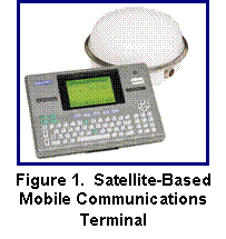
Definition The satellite-based mobile communications terminal is a two-way satellite data communications and tracking system that links a trucking company's tractor to its dispatch center. The QUALCOMM system that will be tested in the pilot test is shown in Figure 1. A Global Positioning System (GPS) receiver provides current tractor positioning with latitude and longitude. Tractor position information is generated with every message. Position information can be generated upon demand from the dispatch computer, and position reporting frequency is configurable. Two-way data communications enable messaging between drivers and on-site carrier personnel 24 hours a day, regardless of the tractor's location. The system consists of rugged hardware for the harsh on-the-road environment, web-based host software, and network services that are fully redundant and operated 24 hours a day to ensure that each message is successfully transmitted. Performance Constraints and Requirements 3.2.1-1. The satellite-based communications system shall provide two-way text communications between driver and on-site carrier personnel in free-form text messages and macros (pre-formatted messages). 3.2.1-2. The satellite-based communications system shall include a driver interface unit which allows the driver to send and view messages to and from on-site carrier personnel. 3.2.1-3. The satellite-based communications system shall allow users the ability to integrate data from the satellite-based communications system to the user's back office systems. This integration capability is described in Section 3.3.2. 3.2.1-4. The satellite-based communications system shall provide a tractor position report with each message. The position report shall include the tractor's latitude and longitude, and the date and time that the message was sent from the tractor. 3.2.1-5. The satellite-based communications system shall include a web-based host software application that displays all messages and tractor positions to the on-site carrier personnel.
3.2.2 Mapping and Location of Tractors with the Satellite-Based Communications System
Definition Using the satellite-based communications system, tractor position information, including the latitude, longitude, date, and time, is shown through a web-based host application. This application enables on-site carrier personnel to track the current position of a tractor and view a history via stored position reports of the tractor?s location on its route. In addition, on-site carrier personnel can view the location of one or more tractors on a map using the web-based host software application that shows the tractor's proximity to a pre-defined town, city, or landmark. Performance Constraints and Requirements 3.2.2-1. The satellite-based communications system host software application provides tractor position information to enable on-site carrier personnel to track a tractor in "near-real-time".* Tractor position information shall include, at a minimum, the tractor's latitude and longitude, and the date and time. 3.2.2-2. The satellite-based communications system host software application shall provide a history of the tractor's positions. Tractor position history information shall include tractor identification number (ID), tractor position (latitude and longitude), date, time, macro (i.e., a message that indicates that the load has been picked up, dropped, etc.), and nearest town and city to the tractor. 3.2.2-3. The satellite-based communications system shall provide tractor position information via the GPS. 3.2.2-4. The satellite-based communications system shall provide a default tractor position frequency of one hour. The tractor position frequency shall be configurable by the user if they desire another position frequency. 3.2.2-5. The satellite-based communications system host software application shall allow users to issue requests to check the position of the tractor in between the scheduled mobile initiated position reports. 3.2.2-6. The satellite-based communications system host software application shall include a mapping application that will display the position of one or more tractors on a map. 3.2.2-7. The satellite-based communications system mapping application shall provide street-level mapping. (There is no maximum limit to the number of tractors that may be displayed on maps, although in an area densely populated with tractors, viewing can be difficult.) 3.2.2-8. The satellite-based communications system host software application shall support the creation, modification, and deletion of custom landmarks by authorized users. 3.2.2-9. The satellite-based communications system host software shall support the display of tractor positions with proximity to the nearest pre-defined landmark, if configured as a user preference. (This allows the user to display all position reports in terms of the tractor's proximity to a landmark.) 3.2.2-10. The satellite-based communications system host software shall support the query for tractors near a specified landmark within a specified distance. (This allows the user to query for any tractor within a certain distance from a landmark.)
3.2.3 Mapping and Location of Tethered Trailers with the Tethered Trailer Tracking System
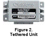
Definition The satellite-based mobile communications tracking system provides tractor-trailer location updates from tethered tractor positions. Using the tethered tracking unit shown in Figure 2, connection and disconnection events are captured and transmitted via the satellite-based communications system terminal to notify the on-site carrier personnel that a trailer has been connected or disconnected from the tractor. For example, a trailer is typically disconnected from the tractor when the tractor-trailer arrives at a destination so that the trailer may remain to be unloaded while the tractor departs to pick up and move another trailer. The tethered trailer tracking system consists of the satellite-based communications system terminal, the tethered trailer tracking unit, and a tethered trailer tracking host software application. Performance Constraints and Requirements 3.2.3-1. The tethered trailer tracking host software application shall store the last known position of each trailer equipped with a tethered trailer tracking unit. (These positions are updated when the system detects a connection or disconnection event from the tethered trailer tracking unit.) 3.2.3-2. The tethered trailer tracking system shall provide alerts notifying on-site carrier personnel of all tractor-trailer connections and disconnections. 3.2.3-3. The tethered trailer tracking host software application shall provide views of all trailers that are connected and disconnected from tractors with the satellite-based communications system terminal at or near a landmark. 3.2.3-4. The tethered trailer tracking host software application shall display on a map the last known trailer positions and trailer position histories of trailers that are connected and disconnected from tractors with the satellite-based mobile communications tracking system terminal. The position information shall include latitude, longitude, date, and time. 3.2.3-5. The tethered trailer tracking host software application shall provide a view of a position history of the tractor trailer's location at a particular time to enable the on-site carrier personnel to track the trailer connected to a tractor with the satellite-based mobile communications tracking system. 3.2.3-6. The tethered trailer tracking host software application shall allow the on-site carrier personnel to view only trailers connected to tractors with the satellite-based mobile communications tracking system. 3.2.3-7. The tethered trailer tracking host software application shall provide printable reports for the system user to view one or all trailer position histories, the last status report for a trailer, idle trailers, and trailers near a specific landmark that were connected or disconnected from a tractor with the satellite-based mobile communications tracking system. 3.2.3-8. The tethered trailer tracking host software application shall provide views of trailer inventory counts by landmark using the last known trailer position of a trailer connected or disconnected from a tractor with the satellite-based mobile communications tracking system. 3.2.3-9. The tethered trailer tracking system shall detect and record the time and position of all tractor-trailer connections and disconnections where the accuracy shall be 100% within 2 minutes of the event. 3.2.3-10. The tethered trailer tracking system shall relay tractor-trailer identification numbers (IDs) with every connection and disconnection event, as well as position, date, and time.
3.2.4 Panic Button Alerts with the Satellite-Based Communications System
Definition In combination with the satellite-based communications system, panic buttons provide real-time emergency alert message notifications by the driver to the on-site carrier personnel. As shown in Figure 3, two panic buttons, wired on-board and wireless, were tested. During the pilot test, the participant designated two points of contact and provided phone numbers to respond to these alerts.  
Figure 3. On-Board and Wireless Panic Buttons Performance Constraints and Requirements 3.2.4-1. The on-board panic button shall be mounted in the tractor's dashboard with the satellite-based communications system terminal. 3.2.4-2. The wireless panic button shall operate within a maximum range of 150 feet from the satellite-based communications system terminal. 3.2.4-3. The satellite-based communications system shall send an email and/or pager alert notification to a user when the panic button is activated. 3.2.4-4. When a panic button is activated, the satellite-based communications system shall send the panic message notification to the web-based host software application for the satellite-based communications system within 2 minutes. This message shall have priority over any other queued messages. 3.2.4-5. When the emergency message is received at the network operations center (NOC), the NOC personnel shall place an emergency call to previously designated points of contact.
3.3 System Interface Requirements
3.3.1 Interface Configurations for the Satellite-Based Communications System
Definition In order for the satellite-based communications system to provide the full functionality of the system, several pieces of hardware will need to be installed on the tractor and trailer, and then integrated. The hardware described below includes the satellite-based communications system, the on-board panic button, the wireless panic button, and the tethered trailer tracking unit. Performance Constraints and Requirements 3.3.1-1. The following satellite-based communications system interfaces shall be supported during the pilot test: - Outdoor Unit (ODU) ? The outdoor unit houses the antenna to send and receive information over the air (OTA) from the NOC. The ODU is mounted on the tractor?s exterior and is connected to the communications unit via a satellite-based communications system's antenna cable.
- Enhanced Display Unit (EDU) ? The EDU is the driver interface to the satellite-based communications system. It is used to send and receive text messages to and from on-site carrier personnel. The EDU is mounted in the tractor's interior and is connected to the communications unit via a cable.
- Communications Unit ? The communications unit contains the operating circuitry and memory for the satellite-based communications system terminal. It is installed in the tractor's interior and connected directly to the engine, where it receives power via a power cable and engine data via a 37-pin I/O cable.
- On-Board and Wireless Panic Buttons ? The panic buttons are used to send panic notifications to the NOC and on-site carrier personnel. The on-board panic button is mounted in the tractor's interior and is connected to the communications unit via the 37-pin I/O cable.
- Tethered Trailer Tracking Unit ? The tethered trailer tracking unit provides tractor-trailer connection and disconnection information to the dispatch center. The tethered trailer tracking unit is installed on the trailer's exterior and connected to the tractor via the tractor's J560 connector (7-way connector). The tethered unit is then connected to the communications unit by connecting the J560 to the 37-pin I/O cable.
- J560 Connector ? The J560 connector is the standard connector used on the electrical cable that bridges the tractor and trailer. The tethered trailer tracking unit will interface with this connector to determine connection and disconnection events. It will also communicate with the tractor communications unit via the J560.
- Host Interface ? The host interface presents information to the user and allows the user to view and send messages, view tractor position reports, position histories, and panic messages, request tractor and trailer position updates, and view trailer connection and disconnection messages. For the pilot test, the host interfaces shall include the satellite-based communications system host software application, and the tethered trailer tracking host software application. The satellite-based communications system host software application shall provide a documented interface for integration to the user's back office systems.
3.3.2 Incorporation of Fleet Management Tools with the Satellite-Based Mobile Communications System
Definition The satellite-based mobile communications systems can be integrated into back office fleet management systems. Fleet management tools include desktop access to summary performance data, timely trailer connection and disconnection status, and mapping. Performance Constraints and Requirements 3.3.2-1. Automated macros and payroll information shall pass through the satellite-based mobile communications system's host software into the user's back office fleet management system. 3.3.2-2. The tethered trailer tracking system shall send all connection and disconnection event notifications to the user?s back office system which may be utilized as an indication of trailer detention time.
3.4 Data Requirements
This section describes the test data requirements for all data saved during the pilot test for the satellite-based mobile communications system.
3.4.1 Test Information Stored
Table 3 describes the information that will be collected and stored during the pilot test. The table outlines the technologies used and the data elements and fields that will be collected, stored, and distributed at least once every 2 weeks for the duration of the test. 3.4.1-1. All user data shall be retained online for a period of time configurable by authorized users ? from a minimum of 14 days to a maximum of 6 months. (Users may create their own systems to capture and store information indefinitely.)
3.4.2 Test Data Collection Rates
Definition The test data collection rate specifies the frequency of recording the pilot test information. Performance Constraints and Requirements 3.4.2-1. Pilot test data shall be continuously recorded from all of the technologies installed on the tractors and trailers in ?near-real-time? throughout the entire pilot test. 3.4.2-2. Pilot test data shall be collected from both host systems at least once every 2 weeks for the test duration. Table 3. Test Data Elements and Fields
3.5 Hardware and Software Requirements
3.5.1 Hardware Requirements
3.5.1-1. For the pilot test, the satellite-based communications system shall consist of the following: - Driver Interface Unit ? Installed inside the tractor, the driver interface unit provides two-way text communications between the driver and the on-site carrier personnel.
- Outdoor Unit ? Installed near the top or on top of the tractor in a position with a clear view to the sky, the outdoor unit includes a transceiver, a GPS antenna for location determination, and an antenna for communication with the satellite.
- Communications Unit ? Installed on the tractor's exterior, the communications unit contains the operating circuitry and memory for the satellite-based communications system terminal.
- Cables ? Cables connect the satellite-based communications system terminal to the installed sensors, tethered trailer tracking unit, tractor power, and battery.
- On-Board Panic Button ? The on-board panic button is installed on the dashboard of the tractor.
- Wireless Panic Button ? The wireless panic button is a key fob.
- Tethered Trailer Tracking Unit ? Installed on the outside of the trailer, the tethered trailer tracking unit provides tractor-trailer connection and disconnection information.
Installation Constraints 3.5.1-2. The satellite-based communications system shall send and receive satellite signals at a 12 degree angle above the horizontal plane of the unit, since it requires an unobstructed line-of-sight view to the satellite to clearly send and receive signals at all angles above 12 degrees. 3.5.1-3. Any obstruction height shall be a maximum of 2.5 inches for every 12 inches away from the satellite-based communications system centerline. Cables/Connectors 3.5.1-4. All connectors shall be differentiated from each other to prevent incorrect attachment. Electromagnetic Interface (EMI) Shielding 3.5.1-5. All EMI shielding shall be built into the terminal and associated hardware; external shielding shall not be required. Marking 3.5.1-6. The external hardware marking shall, at a minimum, clearly identify the manufacturer, part number, and serial number. 3.5.1-7. The external hardware shall include required regulatory markings. Electrical Power Range and Limits 3.5.1-8. The applicable hardware shall support a direct power feed of a 12 volt (V) tractor battery. 3.5.1-9. The hardware shall conform to the electrical test limits of Society of Automotive Engineers (SAE) Standard J1455. 3.5.1-10. The hardware shall conform to SAE Standard J1113-13 Electromagnetic Compatibility Measurement Procedure for Vehicle Components for electromagnetic compatibility and electrostatic discharge. Circuit Protection 3.5.1-11. The hardware shall have no internal fuses or circuit breakers that require manual intervention to reset. (External fuses or circuit breakers may be required for safety purposes.)
3.5.2 Software Requirements
Definition The satellite-based communications system host software applications provide a way for the on-site carrier personnel to view tractor and trailer information, such as messages, tractor positions, panic messages, and trailer positions. The software used with the satellite-based communications system and on-board and wireless panic buttons will be hosted by QUALCOMM and may be accessed by users through the Internet. The user will host the software for the tethered trailer tracking system. Performance Constraints and Requirements Messaging with the Satellite-Based Communications System 3.5.2-1. The web-based host software application for the satellite-based communications system shall support the transmission of freeform or macro messages to every tractor in the fleet with an installed mobile communications unit. 3.5.2-2. The web-based host software application for the satellite-based communications system shall store all incoming messages in the database, including all messages coming from or going to a tractor, trailer connection and disconnection messages, and panic messages. 3.5.2-3. The web-based host software application for the satellite-based communications system shall provide a view all of messages sent to or received from a tractor. Messages include all freeform and macro text messages and alerts generated by the on-board and wireless panic buttons. 3.5.2-4. The web-based host software application for the satellite-based communications system shall support the configuration of satellite-based communications system parameters by authorized users. 3.5.2-5. The satellite-based communications system shall activate a message waiting light to indicate to the driver when a message has been received from the on-site carrier personnel. Tractor Positioning with the Satellite-Based Communications System 3.5.2-6. The web-based host software application for the satellite-based communications system shall store all positions received from tractors. 3.5.2-7. The web-based host software application for the satellite-based communications system shall provide a display of positions and position histories for all tractors, either in a list or on a map. 3.5.2-8. The web-based host software application for the satellite-based communications system shall provide the distance of the tractor from a user-defined place. 3.5.2-9. The web-based host software application for the satellite-based communications system shall provide updated position reports from the satellite-based communications system. 3.5.2-10. The web-based host software application for the satellite-based communications system shall provide a monitoring screen for the user to view all tractors. This will display the tractor?s unit number, most recent position, actual position, date and time, ignition status, and status of tractor record. 3.5.2-11. The web-based host software application for the satellite-based communications system shall provide a monitoring screen for the user to view all messages. This will display the message type, priority, status, unit number, receive time, macro number (if appropriate), and message. 3.5.2-12. The web-based host software application for the satellite-based communications system on shall provide a monitoring screen for the user to view all alerts. This will display the alert, alert time, unit number, tractor position, and alert type. 3.5.2-13. The web-based host software application for the satellite-based communications system shall provide the tractor locations nearest another tractor, landmark, or zip code. Host Administration for the Satellite-Based Communications System 3.5.2-14. The web-based host software application for the satellite-based communications system shall support the administration of system settings including creation, modification and deletion of users, tractors, macros, coverage groups, landmarks, system preferences, and user preferences. 3.5.2-15. The web-based host software application for the satellite-based communications system application shall limit users to only access their own user account data. Web-based Host User Interface 3.5.2-16. The web-based host user interface for the satellite-based communications system shall provide access to the data from an Internet browser. (Microsoft Internet Explorer version 6.0 or later is recommended.) 3.5.2-17. The web-based host user interface for the satellite-based communications system shall support a password-protected secure log-in access to the user?s account for authorized users. Tethered Trailer Tracking with the Satellite-Based Communications System 3.5.2-18. The tethered trailer tracking host software shall allow authorized users to view and edit trailer details including trailer ID, Standard Carrier Alpha Code (SCAC), trailer type, and description. 3.5.2-19. The tethered trailer tracking host software shall display all connection and disconnection events, including event type, date and time of event, and position of tractor-trailer. 3.5.2-20. The tethered trailer tracking host software shall display trailer positions and trailer position histories on a map. 3.5.2-21. The tethered trailer tracking host software shall provide position information, including latitude, longitude, date, and time. 3.5.2-22. The tethered trailer tracking host software shall provide the position history of the trailer?s location at a particular time while connected to a tractor to enable on-site carrier personnel to track the connected trailer in "near-real-time."
3.6 Lifecycle Requirements
Lifecycle requirements include hardware life expectancy and the ability to accommodate future requirements.
3.6.1 Hardware Life Expectancy
Performance Constraints and Requirements The hardware for the tractor and trailer was designed specifically to operate within the harsh environments of CMV. While the actual useful life of the equipment varies with the specific environments where it is exposed, all hardware has been designed to perform within specific performance minimum standards. 3.6.1-1. The satellite-based communications system terminal, tethered trailer tracking unit, and on-board and wireless panic buttons shall have a useful life of at least 5 years from the date of manufacture.
3.6.2 Ability to Accommodate Future Requirements on the Satellite-Based Communications System
Definition The satellite-based communications system terminal will provide upgrade capability allowing patches or upgrades to the satellite-based mobile communications terminal firmware. Local/manual upgrade capability of the satellite-based communications system terminal allows ?bug fixes,? regular maintenance upgrades, and installation of new features to mobile terminal firmware by touching fielded equipment. The local upgrade feature requires the tractor to go into a shop. Performance Constraints and Requirements (Local/Manual) 3.6.2-1. Local upgrades of the satellite-based communications system terminal shall be initiated and controlled by a certified technician. 3.6.2-2. The local upgrade feature of the satellite-based communications system terminal shall allow users to request an upgrade for its entire fleet. 3.6.2-3. The local upgrade feature of the satellite-based communications system terminal shall require the use of a laptop computer with proprietary upgrade programs. 3.6.2-4. The local upgrade feature of the satellite-based communications system terminal shall require a 20-minute download of new parameters and a system verification check.
3.7 Test Performance Requirements The following sections list key requirements for minimum system performance that will be required during the pilot test.
3.7.1 Accuracy
Definition Position accuracy is a function of GPS receiver performance, configuration parameters, satellite visibility of the antenna, satellite constellation, and U.S. Government-controlled Selective Availability (SA). A standard for GPS accuracy has not been defined. Every manufacturer uses its own means of defining, measuring, and calculating position accuracy. Performance Constraints and Requirements 3.7.1-1. The location accuracy of the satellite-based communications system with default configuration parameters shall be 100 meters, 95 percent of the time. (This level of accuracy takes into consideration the uncontrollable variables that may affect performance.)
3.7.2 Repeatability The system shall provide repeatable performance throughout the test period for all functions specified in this document. Availability of the QUALCOMM NOC has been at least 99.9 percent for 5 consecutive years from 1999-2004. This includes both planned and unplanned downtime. The satellite-based communications system is expected to perform with similar reliability, but performance is highly dependent on local conditions during the test. Performance may vary by region and is dependent on variables such as terrain around the mobile terminal. 4.0 Acronym List | CD | Compact Disk | | CDMA | Code Division Multiple Access | | CMV | Commercial Motor Vehicle | | CVO | Commercial Vehicle Operations | | DoD | Department of Defense | | EDU | Enhanced Display Unit, used with OmniTRACS Mobile Units | | EMI | Electromagnetic Interface | | ESCT | Expanded Satellite-Based Mobile Communications Tracking | | FHWA | Federal Highway Administration | | FMCSA | Federal Motor Carrier Safety Administration | | FOT | Field Operational Test | | GLS | Global Locating System | | GPS | Global Positioning System | | Hazmat | Hazardous Materials | | MARAD | Maritime Administration | | MTBF | Mean Time Between Failure | | NOC | Network Operations Center | | ODU | Outdoor Unit | | OTA | Over the Air | | PHMSA | Pipeline and Hazardous Materials Safety Administration | | ROI | Return on Investment | | SA | Selective Ability | | SAE | Society of Automotive Engineers | | SCAC | Standard Carrier Alpha Code | | SMCT | Satellite-Based Mobile Communications Terminal | | TSA | Transportation Security Administration | | WMD | Weapons of Mass Destruction |
Definition of Terms Accept/Reject Load Assignment Macro | Macro that allows driver to accept or reject the load assignment | Arrived Macro | Macro sent by driver when arriving at a stop | Arriving at Consignee Macro | Macro sent by driver when arriving at consignee | Arriving at Shipper Macro | Macro sent by driver when arriving at shipper | Autoconnect | Tethered Trailer Tracking - automatic association of trailer with Mobile Unit | Beep Interval | Global Login - time, in seconds, between audible beeps from EDU prompting driver to log on | Cargo Tracking | Process of monitoring load location | Consignee | Load destination | Depart from Shipper Macro | Macro sent by driver when departing from shipper | Emergency Notification | Process of notifying the carrier and law enforcement of an emergency situation at the tractor | End of Load Macro | Macro sent by driver once the load has been delivered | Free-Form Message | A message composed by the sender with no more than 50 lines or 1,900 characters | Landmark | A specific location or identifiable natural or man-made geographic feature (The landmark database is supplied with the web-based host software and cannot be modified for the purposes of this test.) | Load Assignment Macro | Macro containing all of the load information | Macro Message | A preformatted message that may contain data input fields that the user or an external application fills before sending | Message Priority | Controls the re-transmission scheme and priority of out-bound messages | Nearest City | Any populated area that has a census count of over 100,000 people | Nearest Town | Any populated area that has a census count of between 1 and 100,000 people | NOC | QUALCOMM's Network Operations Center, which processes and manages the messaging traffic between the dispatch center and the fleet | OmniTRACS | Omni (meaning everywhere) Thin Route Alphanumeric Communications System | On-Board Wired Panic Button | QUALCOMM's cab-mounted button used to send panic messages | Outbound Message | Message from NOC to Communicator | Over-the-Air Message | Wireless message, Ku Band, or Terrestrial Code Division Multiple Access (CDMA) | Panic Button | QUALCOMM's on-board or wireless panic button | PICK | The PICK operating system (referred to as "the PICK system" or simply PICK) is based around a unique demand-paged, multiuser time-sharing operating system, "multi-valued" database | Position | Position refers to either a tractor or trailer's latitude and longitude at the time that the position report was sent over the air | Pre-Filled Macro | Macro in which certain fields are automatically filled by the system | QTRACS/Web | QUALCOMM's software interface for mobile communications systems that allows users to send and receive messages and display tractor locations | Satellite-Based Mobile Communications Unit | QUALCOMM's Ku Band OmniTRACS Satellite Mobile Communications Unit | Tethered Trailer Tracking | Tracking with QUALCOMM's tethered trailer tracking unit, which sends trailer connect and disconnect events to the Mobile Unit in the tractor | Trailer Disconnect | Process of disconnecting trailer from tractor | Trailer Connect | Process of connecting trailer to tractor | Wireless Panic Button | QUALCOMM's key fob panic button is comprised of a transmitter and receiver used to send panic messages |
6.0 Appendix
Table 4. References and Applicable Documents Document Number/Name | Description |
|---|
MIL-STD-810E | Environmental Engineering Considerations and Laboratory Tests | MIL-STD-810D | Military Standard Environmental Test Methods and Engineering Guidelines | SAE J1455 | Joint Society of Automotive Engineers/Technology Maintenance Council (SAE/TMC) Recommended Environmental Practices for Electronic Equipment Design (Heavy-Duty Trucks) | SAE J1113-13 | Electromagnetic Compatibility Measurement Procedure for Vehicle Components |
|