Maps and Data
Find maps and charts showing transportation data and trends related to alternative fuels and vehicles.

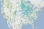
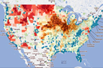
TransAtlas is an interactive map that displays existing and planned alternative fueling stations, alternative fuel production facilities, light-duty vehicle densities, roads, and political boundaries. Users can customize the map display and print and query the underlying data. TransAtlas was developed by the National Renewable Energy Laboratory.