Top News of the Day
Watches &
Warnings
Observations Forecast Graphics Rivers &
Lakes
 Climate  Marine
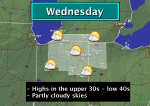
Click on the map below for the latest forecast.
Last map update: Thu, Feb. 14, 2013 at 12:39:28 am EST
Weather Story
Weather Story of the Day - Click to enlarge
Radar
Local Radar for Northern Indiana - Click to enlarge
Satellite
Regional Infrared Satellite Image - Click to enlarge
Weather Map
National Weather Map - Click to enlarge
Quick Access to Text Products
Latest Conditions at Warsaw, IN Choose Your Front Page City
Feb 14
12:35 am
Fair. Click for additional data and forecast.
Fair
32/30
93% RH
Feels Like:


Pressure: 29.78"
Wind: Calm
Vis: 7 SM

CURRENT CONDITIONS
LOCATION TIME WEATHER VSBY
(SM)
TEMP
(ºF)
DEWPT
(ºF)
HUMIDITY
(%)
WIND
(mph)
FEELS
LIKE (ºF)
PRES
(in)
Benton Harbor11:53 Fog/Mist4292792Calm29.74
Chicago10:51Overcast10+363182SW 329.73
Coldwater12:15Fair7322883SW 62629.75
Defiance11:53Overcast10+342879S 92729.79
Fort Wayne11:54A Few Clouds10+312889SW 92329.80
Goshen11:53 Fog/Mist6312785SW 72429.77
Grissom AFB11:55Partly Cloudy10+332988SW 92529.79
Hillsdale12:15Fair7312888S 62629.74
Indianapolis11:54A Few Clouds10+342982S 102629.83
Kalamazoo11:53Fair with Haze6322782S 329.75
Knox11:35Overcast7333294S 62829.77
Kokomo12:15Fair10+362875SW 142729.81
Lafayette11:54Fair10+332778SW 329.81
Logansport12:15Partly Cloudy10+323093S 72529.81
Lima11:53Mostly Cloudy9332675S 92629.81
Marion12:15 Light Snow5332779SW 92629.82
Michigan City11:15Overcast10+343087S 52929.76
LaPorte11:15Overcast7333089SW 329.76
Muncie11:53Fair10+372870SW 122929.82
Rochester12:15Mostly Cloudy10+373281SW 73229.79
South Bend11:54Partly Cloudy8332882SW 72729.76
Sturgis12:15Partly Cloudy7302786SW 329.75
Three Rivers11:14Fair7312887S 52629.75
Toledo11:52Fair7282485S 62229.79
Valparaiso10:53Overcast8343085SW 62929.77
Warsaw12:35Fair7323093Calm29.78
Click on a location for a graph of the past three days weather

CLIMATE
YESTERDAY'S CLIMATE STATISTICS
  SOUTH BEND FORT WAYNE
OBSERVED HIGH: 44 ºF at 509 PM
LOW: 20 ºF at 610 AM
HIGH: 43 ºF at 403 PM
LOW: 25 ºF at 900 AM
NORMAL HIGH: 34ºF
LOW: 20ºF
HIGH: 34ºF
LOW: 20ºF
LAST YEAR HIGH: 34ºF
LOW: 15ºF
HIGH: 33ºF
LOW: 13ºF
RECORDS HIGH: 65ºF in 1938
LOW: -16ºF in 1905
HIGH: 65ºF in 1990
LOW: -14ºF in 1899
PRECIP 0.00 " YESTERDAY
0.92" MONTH TO DATE
5.92"    YEAR TO DATE
0.00 " YESTERDAY
0.38" MONTH TO DATE
3.81"    YEAR TO DATE
SUNRISE
&
SUNSET
FEBRUARY 14
SUNRISE: 742 AM SUNSET: 618 PM
FEBRUARY 15
SUNRISE: 740 AM SUNSET: 619 PM
FEBRUARY 14
SUNRISE: 736 AM SUNSET: 614 PM
FEBRUARY 15
SUNRISE: 735 AM SUNSET: 616 PM
R INDICATES RECORD WAS SET OR TIED
MM INDICATES DATA IS MISSING


On this day in weather history...

1990 -- A destructive ice storm produced glaze 1" thick in Fort Wayne. A combination of freezing rain and sleet piled ice over 4" deep in South Bend.

1991 -- From today into the 16th South Bend received 19.8" of lake effect snow. Of that total, 13.1" fell in 24 hours, which was a record at the time. A state of emergency was declared for Saint Joseph Indiana, Elkhart, and Marshall counties as 30 mph winds blew snow into 5 foot drifts.


USA.gov is the U.S. government's official web portal to all federal, state and local government web resources and services.