


Graphic Forecasts for Hawaiian Islands and surrounding coastal waters |
|||||||||||||||||||||||||
| Pacific Streamline Analysis (130E-110W,30S-30N) |
|
||||||||||||||||||||||||
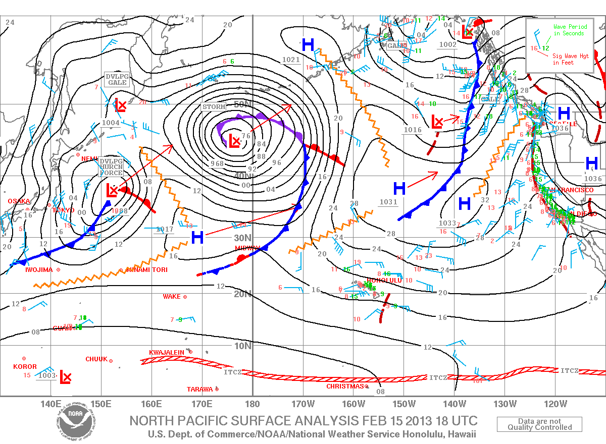
| North Pacific Surface Analysis (130E-110W,EQ-60N) From the Unified Surface Analysis |
|
||||||||||||||||||||||||
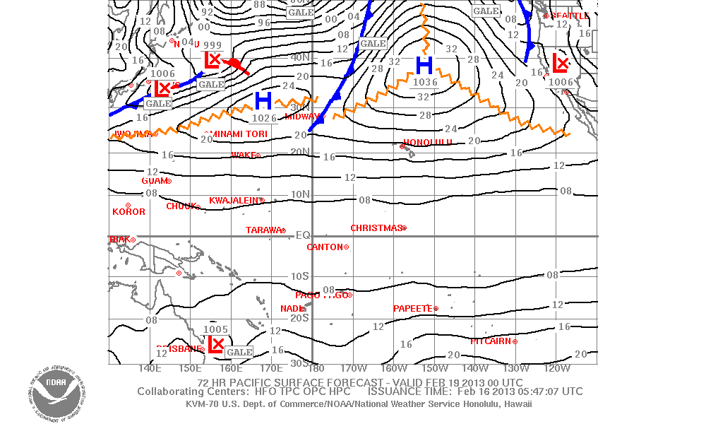
| Pacific Surface Forecast (130E-110W,30S-50N) |
|
||||||||||||||||||||||||
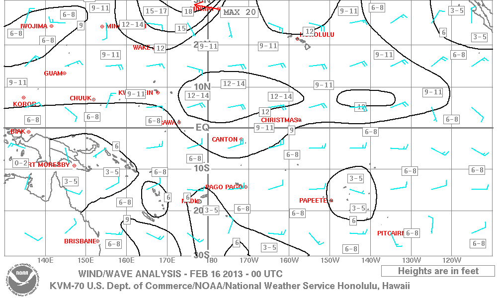
| Pacific Wind Wave Analysis and Forecasts |
|
||||||||||||||||||||||||
| Pacific Significant Cloud Features (160E-110W, 30S-50N) |
|
||||||||||||||||||||||||
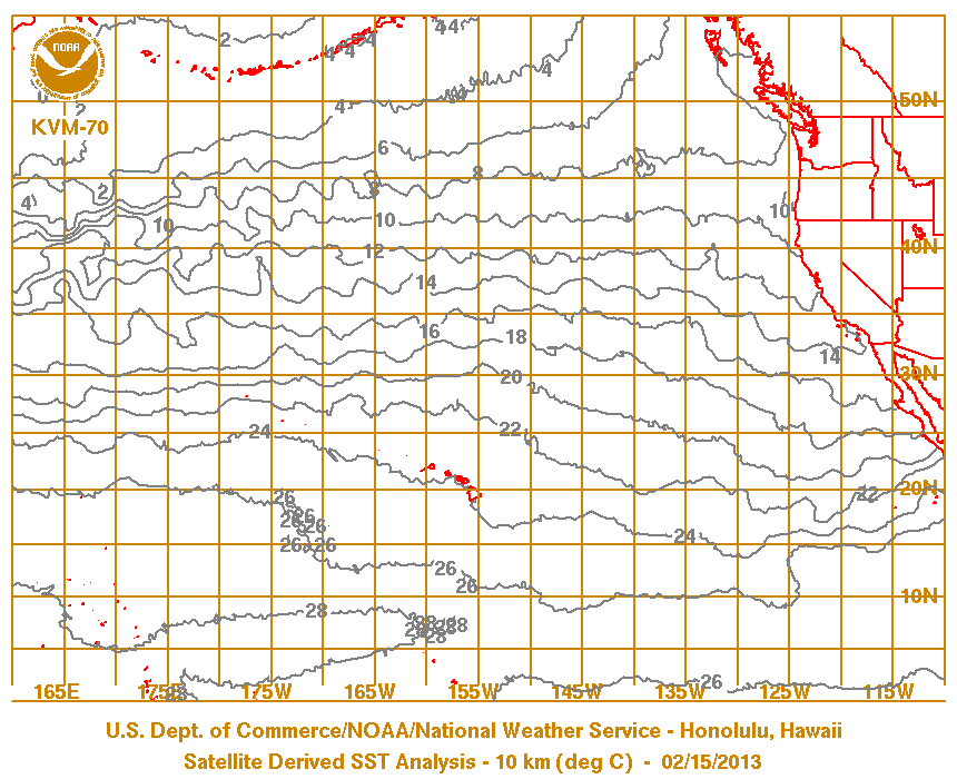
| Pacific Sea Surface Temperature Analysis satellite-derived (updated twice weekly) |
Symbols & Test Chart | ||||||||||||||||||||||||