Sage-grouse Local Working Group Locator
Cache/East Box Elder Local Working Group, Utah
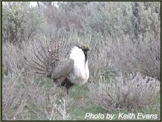
Sage-grouse Species:
Local Conservation Plan:
Cache/East Box Elder Sage-grouse LWG Plan (No plan currently available.)
Local Contacts:

This page shows where the local working group occurs within the state or province. Details about local planning efforts, the conservation plan, and points of contact are provided. Other documents relevant to this group are also included at the bottom of the page. The overview section has information about the total area within the local working group boundary, the breakdown of land ownership, and some environmental characteristics for this area. Below are minutes from previous local working group meetings. If you have minutes to post, please contact us and we will provide that information.
.............
Submit minutes Local Working Group Meeting Minutes:
Please click the "Submit minutes" button to submit minutes for your Local Working Group meetings. An email window will open asking for the Local Working Group name, the meeting date, and the text (or attachment) of the minutes.
Location of the Local Working Group within
Utah

Conservation Planning Efforts
Lead Agency:
Utah Division of Wildlife Resources / Utah's Community-based Conservation Program
Subgroup:
Little Bear River Alliance
Current Activity:
Subgroup newly established and meeting; identifying needs; working towards CCAA
Meeting Schedule:
at least 3x/year
Subgroup:
Northern Cache/East Box Elder subgroup
Current Activity:
Subgroup not meeting yet.
Overview of the Cache/East Box Elder Local Working Group Area
| Total Area: |
2,327,782 acres
(942,024 ha.) |
| Stewardship: |
| Steward |
Area |
% of Total Area |
| Bureau of Land Management: |
24,483 acres
(9,912 ha.) |
1% |
| Department of Defense: |
14,847 acres
(6,011 ha.) |
<1%
|
| National Park Service: |
2,265 acres
(917 ha.) |
<1%
|
| Private ownership: |
1,315,942 acres
(532,770 ha.) |
57% |
| State: |
75,056 acres
(30,387 ha.) |
3% |
| US Forest Service: |
243,070 acres
(98,409 ha.) |
10% |
| US Forest Service/Bureau of Land Management: |
66,152 acres
(26,782 ha.) |
3% |
| US Fish & Wildlife Service: |
38,164 acres
(15,451 ha.) |
2% |
| water: |
546,833 acres
(221,390 ha.) |
24% |
|
| Elevation: |
| |
Min |
Max |
| Feet (meters): |
4219 (1286) |
9964 (3037) |
|
| Climate: |
| |
Summer |
Winter |
| Temperature (F): |
47 - 74 |
12 - 31 |
| Precipitation (inches): |
0.5 - 2.4 |
0.7 - 9.7 |
|
(30-yr averages, 1971 - 2000) |
|
| Floristic Provinces: Read more about Floristic Provinces... |
|
Documents for the Cache/East Box Elder Local Working Group


