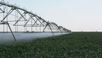
Wisconsin Water-Use Information Program
Wisconsin estimated total water use, excluding thermoelectric power, by county, 2005.

Click map or here to learn more about available water-use data.
Estimates of water use in Wisconsin indicate that about 8,608 million gallons per day (Mgal/d) were withdrawn during 2005.
This map shows Wisconsin counties and their estimated ground-water and surface-water total withdrawl for 2005. Darker counties indicate higher total water use. Thermoelectric power generation water-use data have been removed since this water category is largely surface-water withdrawls that are disproportionate to all other water-use categories.
The Wisconsin Water-Use Information Program is part of the Ground-Water Systems Team and the USGS National Water-Use Information Program. Our principal cooperator in this program is the Wisconsin Department of Natural Resources (WDNR).
The Wisconsin Water-Use Information Program investigates and collects data on:
- water use: quantifying how much, where, and for what purpose,
- water-use trends: tracking and documenting changes
The Water-Use Information Program also works to broaden the understanding of water use in Wisconsin by developing new and strengthening existing partnerships.
Why is water-use information important?
It is essential for water-resources planners and managers as well as ground-water scientists to have information regarding the amount of water used, where and how it is used. This information is critical for:
- better planning and making informed decisions because "You can't manage what you don't measure" (USGS, 2007),
- improving our understanding of the factors that influence water use and future demand,
- identifying where it may be possible to improve water-use efficiency,
- supporting ground-water modeling.
Program objectives
Key objectives of the Wisconsin Water-Use Information Program are:
- to provide expertise and explore uncertainty in various water-use topics,
- reply to water-use information requests from scientists, water managers and planners, and interested persons,
- to develop and maintain key water-use databases.
Program evolution
The USGS Water-Use Information Program is evolving from principally a data collection and database management program into a water-use science program. This change reflects the suggestions put forth by the National Research Council (2002) to emphasize "applied research and techniques development in both the statistical estimation of water use, as well as the determinants and impacts of water-using behaviors" (NRC, 2002).
In a 2002 report to Congress, the USGS stated: "The National Water-Use Information Program should be viewed as much more than a data-collection and database management program. The NWUIP should be elevated to a water-use science program, emphasizing applied research and techniques development in both the statistical estimation of water use, as well as the determinants and impacts of water using behaviors."
In 2007, the USGS Science Strategy stressed these program changes: "Research is needed in developing indirect methods of estimating water use where a direct measure of use is not practical or obtainable and for projecting realistic water-use estimates..." (USGS, 2007).
Collaborators
The Water-Use Information Program collaborators include the WDNR, UW-Extension, WGNHS, USDA DATCP, U.S. Fish and Wildlife Service, Wisconsin Aquaculture Association (WAA), Southeast Wisconsin Regional Planning Commission (SEWRPC), Wisconsin Public Service Commission, Minnesota Department of Natural Resource, and many Wisconsin municipal water utility organizations.
History of the Wisconsin Water Use 5-Year Compilations
As part of the National Water-Use Information Program, the U.S. Geological Survey (USGS) collects, compiles, and estimates data for different categories of water use. Information about sources of water, amounts of water withdrawn, and how the water was used, is available to those involved in establishing water-resource policy and to those managing water resources.
Around 1950, the WI WSC began compiling water-use data at the state level and producing a series of water-supply papers that contained information about source, availability, use and quality of water for a particular population center or region of Wisconsin.
Then, in 1978, the USGS entered into a cooperative program with the Wisconsin DNR to inventory water use in Wisconsin. Since that time, five reports have been periodically published summarizing water use in Wisconsin. A sixth report providing the summary of water use in Wisconsin for water year 2005 is in final preparation. Recent ground-water quantity legislation in Wisconsin has stressed the value of collecting these data. It is hoped that revenues from permit fees for new wells will enable the USGS and WDNR to continue to incorporate ground-water state-of-the-art techniques in water-use science.
Projects incorporating water use in Wisconsin
In 2008, the Wisconsin Water Science Center was conducting 10 projects that incorporated a water-use component. The majority of these investigations sought to integrate water-use data into the construction of hydrologic models to evaluate the impact of water use on water budgets, ground-water-flow paths, and baseflow contribution to surface-water features.
Current projects with a water-use component
References cited
U.S. Geological Survey, 2007, Facing Tomorrow's Challenges-U.S. Geological Survey Science in the Decade 2007-2017: U.S. Geological Survey Circular Report Number 1309, 69 p., available at http://pubs.usgs.gov/circ/2007/1309/
Vision outlined by
U.S. Geological Survey, 2002, Report to Congress - Concepts for National Assessment of Water Availability and Use: U.S. Geological Survey Circular 1223, 34 p., available at http://pubs.usgs.gov/circ/circ1223/html/index.html
National Research Council, 2002, Estimating water use in the United States—A new paradigm for the National Water Use Information Program: Washington, DC, National Academy Press, 176 p.
|