Forecast Tools
Upper Air | Soundings | Mesoanalysis | SREF | SSEO | FireWX Compmaps | Compmaps
| Upper Air Maps |
|---|

|
Maps and derived fields based on twice daily (00 and 12 UTC) radiosonde data over the continental U.S.
|
| Observed Sounding Analysis |
|---|

|
Skew-T charts for all observed soundings across the United States.
Many experimental forecast tools and parameters are shown.
|
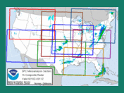
| Mesoanalysis Graphics |
|---|
|
Nine fixed regional sectors and a national sector provide hourly gridded mesoanalysis graphics across the CONUS.
|
| Short-Range Ensemble Forecast (SREF) |
|---|

|
The SPC Short-Range Ensemble Forecast (SREF) is produced by postprocessing the 21 members NCEP SREF
plus the operational WRF-NAM for a total of 22 members.
Special emphasis is placed on high-impact, mesoscale guidance.
|
| Storm-Scale Ensemble of Opportunity (SSEO) |
|---|

|
The SPC Storm-Scale Ensemble of Opportunity (SSEO) is produced by postprocessing seven (7) deterministic
convection-allowing model runs. Special emphasis is placed on hourly maximum storm-attribute fields.
|
| Fire Weather Composite Maps |
|---|

|
Forecast and observational maps for various fire weather variables based on the NAM and RAP models.
|
| Compmap |
|---|

|
This dynamic web page uses Javascript and cascading style sheets to display hourly RAP model graphics, surface weather, and NCEP graphics. The user can overlay the different graphics to produce a web-based "composite map".
|
|
Top/Forecast Products/Home
|


 @NWSSPC