
|
|
|
|
Metadata
|
|
ID
|
S-2-08-MB
|
|
Abstract
|
United States Geological Survey, Menlo Park,
California,United States Geological Survey, Pacific Science
Center,United States Geological Survey, Woods Hole,
Massachusetts. Chief Scientist: David Finlayson. Sidescan
Sonar and Swath Bathymetric data of field activity S-2-08-MB
in Northern Monterey Bay (Directly offshore of Santa Cruz)
from 03/03/2008 to 03/07/2008
|
|
Organization
|
United States Geological Survey, Menlo Park, California
United States Geological Survey, Pacific Science Center
United States Geological Survey, Woods Hole, Massachusetts
|
|
Chief Scientist
|
David Finlayson
|
|
Activity Type
|
Sidescan Sonar and Swath Bathymetric
|
|
Platform
|
Parke Snavely
|
|
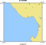
Area of Operation
|
Northern Monterey Bay (Directly offshore of Santa Cruz)
|
|
Location map
|
|
|
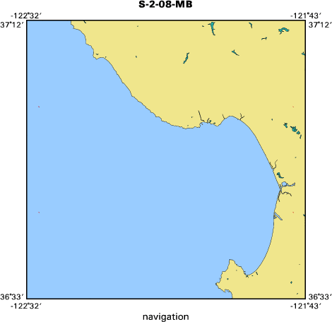
Bounding Coordinates
|
37.00000
-122.50000 -121.75000
36.75000
|
|
Ports
|
LEAVE Santa Cruz Harbor
ARRIVE Santa Cruz Harbor
|
|
Dates
|
03/03/2008 (JD 063) to 03/07/2008 (JD 067)
|
|
Analog Materials
|
No analog holdings.
|
|
Index map
|
|
|
Information Specialist
|
|
|
Crew
|
|
David Finlayson
|
PI
|
|
Larry Kooker
|
ET
|
|
Mike Boyle
|
ET
|
|
Gerry Hatcher
|
OE
|
|
Jackson Currie
|
MT
|
|
Jamie Grover
|
Skipper
|
|
Bill Danforth
|
Observer, USGS, Woods Hole
|
|
Jon Warrick
|
Observer
|
|
Chuck Worley
|
Observer, USGS, Woods Hole
|
|
|
Purpose
|
|
Test the performance of sonar instruments and supporting electronics (MRU, file
|
|
servers, network) aboard the new vessel
|
|
|
Information to be Derived
|
|
Parameters for the calibration and operation of acoustic systems aboard the R/V
|
|
Snavely
|
|
|
Summary
|
|
Repeated bathymetry and acoustic backscatter measurements over a small 500 m x
|
|
700 m patch
|
|
|
Got Help?
|
For S-2-08-MB, we would appreciate any information on -- analog materials, contract, days at sea, dive count, equipment used, funding, kms of navigation, national plan, NGDC Info, notes, owner, project, project number, publications, scanned materials, seismic description, station count, station description, submersible, tabulated info.
|
|


