|
|
|
Metadata
|
|
ID
|
87017
|
|
Also Known As
|
87017
PSAL_DEEP
SPRL
|
|
Abstract
|
United States Geological Survey, Woods Hole, Massachusetts.
Chief Scientists: Brad Butman, Dave Cacchione, Cheryl Ann
Butman. Geological and Geophysical data (sidescansonar,
boxcore, RhoRho, Geoprobe, instrumentmooring) of field
activity 87017 (S-1-87-SC) in Pt. Sal area, Southern
California from 05/05/1987 to 05/09/1987
|
|
Organization
|
United States Geological Survey, Woods Hole, Massachusetts
|
|
Project/Theme
|
California Outer Continental Shelf Phase II Monitoring Program
|
|
Chief Scientist
|
Brad Butman
Dave Cacchione
Cheryl Ann Butman
|
|
Activity Type
|
Geological and Geophysical
|
|
Platform
|
Robert Gordon Sproul
|
|
Area of Operation
|
Pt. Sal area, Southern California
|
|
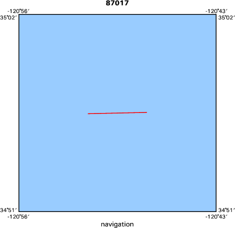
Location map
|

|
|
Bounding Coordinates
|
34.94330
-120.85130 -120.78600
34.94220
|
|
Dates
|
05/05/1987 (JD 125) to 05/09/1987 (JD 129)
|
|
Analog Materials
|
list
|
|
Index map
|
|
|
Crew
|
|
Brad Butman
|
Chief Scientist, USGS Woods Hole
|
|
Bill Strahle
|
Unspecified Investigator, USGS Woods Hole
|
|
John Moody
|
Unspecified Investigator, USGS Woods Hole
|
|
Dave Cacchione
|
Chief Scientist, USGS Western Region
|
|
Dave Drake
|
Unspecified Investigator, USGS Western Region
|
|
George Tate
|
Unspecified Investigator, USGS Western Region
|
|
Rick Vale
|
Unspecified Investigator, USGS Western Region
|
|
Jim Nicholson
|
Unspecified Investigator, USGS Western Region
|
|
Cheryl Ann Butman
|
Chief Scientist, WHOI
|
|
Chris Webb
|
Unspecified Investigator, WHOI
|
|
Jim Campbell
|
Unspecified Investigator, Battelle
|
|
Jim Marzohf
|
Unspecified Investigator, IUC
|
|
|
Equipment Used
|
|
sidescansonar
|
|
boxcore
|
|
RhoRho
|
|
Geoprobe
|
|
instrumentmooring
|
|
|
Purpose
|
|
To assess the transport and fate of drilling muds
|
|
and cuttings discharged from production platforms along the California coast.
|
|
The continental shelf between Pt. Conception and Pt. San Luis is rather narrow,
|
|
only 10-15 km wide. Platform Julius will be located near the edge of the shelf
|
|
in water about 150 m dee; water less than 100 m deep is less than 5 km onshore
|
|
and water greater than 500 m deep is less than 15 km offshore. Muds and cuttings
|
|
discharged from these platforms may initially settle over a wide range of water
|
|
depths where the extent and frequency of sediment movement, as well as the
|
|
processes causing movement, will vary significantly. The field measurements
|
|
described here are designed to describe the near-bottom flow and sediment
|
|
movement in these differenet sedimentary environments.
|
|
|
Information to be Derived
|
|
bedforms, bottom features, vertical profile of sediment grain size, cross-shelf hydrographic sections, temperature, salinity and suspended material.
|
|
|
Summary
|
|
Current moorings were deployed at three sites across the shelf and
|
|
slope in water depths of 83, 148, and 415 m, with instruments at approximately 6
|
|
and 20 meters above bottom (mab) atstations A, B, and C, and an additional
|
|
instrument at 144 m at station C. All instruments at 6 and 20 mab measured
|
|
current, temperature, conductivity and light transmission. Geoprobes were
|
|
deployed at sites A and B; these specialized bottom instrument systems measure
|
|
curretn at 5 levels above the seafloor, every few hours. At each mooring site a
|
|
limited side-scan sonarsurvey was conducted to map any bedforms or other bottom
|
|
featurs. Box cores were collected at inshore of Santa Lucia Bank. The box cores
|
|
were fitted witha special intev als to obtain a detailed vertical profile of
|
|
sediment grain size in the upper 2 cm of the bottom. Two cross-shelf
|
|
hydrographic sections were made to map the regional distribution of temperature,
|
|
salinity and suspended material in the region of the moored observations
|
|
|
Got Help?
|
For 87017, we would appreciate any information on -- contract, days at sea, dive count, funding, information specialist, kms of navigation, national plan, NGDC Info, notes, owner, ports, project number, publications, scanned materials, seismic description, station count, station description, submersible, tabulated info.
|
|


