|
|
|
Metadata
|
|
ID
|
S-1-76-BS
|
|
Abstract
|
United States Geological Survey, Menlo Park,
California,Petty-Ray Geophysical. Chief Scientist:
Unspecified. Data (sparker, 3dot5khz, LoranC) of field
activity S-1-76-BS in St. Georges Basin, Bering Sea, AK from
08/03/1976 to 08/13/1976
|
|
Organization
|
United States Geological Survey, Menlo Park, California
Petty-Ray Geophysical
|
|
Chief Scientist
|
Unspecified
|
|
Platform
|
Sitka
|
|
Area of Operation
|
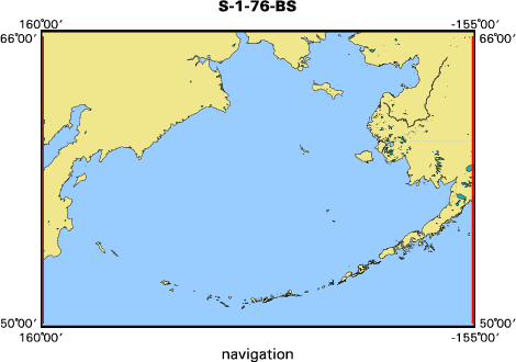
St. Georges Basin, Bering Sea, AK
|
|
Location map
|

|
|
Bounding Coordinates
|
65.75000
160.25000 -155.25000
50.25000
|
|
Dates
|
08/03/1976 (JD 216) to 08/13/1976 (JD 226)
|
|
Analog Materials
|
list
|
|
Index map
|
|
|
Crew
|
|
Unspecified
|
Chief Scientist, Petty-Ray Geophysical
|
|
|
Equipment Used
|
|
|
Information to be Derived
|
|
Reflection profiles of bathymetry and subbottom profile.
|
|
|
Notes
|
|
Petty-Ray Geophysical contract work for sparker and subbottom profiling. Data acquired by Alan Cooper.
|
|
|
Got Help?
|
For S-1-76-BS, we would appreciate any information on -- activity type, contract, days at sea, dive count, funding, information specialist, kms of navigation, national plan, NGDC Info, owner, ports, project, project number, publications, purpose, scanned materials, seismic description, station count, station description, submersible, summary, tabulated info.
|
|