|
|
|
Metadata
|
|
ID
|
S-1-06-PS
|
|
Abstract
|
United States Geological Survey, Pacific Science
Center,Skagit River Systme Cooperative,University of
Washington. Chief Scientist: Eric Grossman. Sampling data
(navigation, vibratingcore, boxcore, vanVeengrab, ADCP, CTD)
of field activity S-1-06-PS in Skagit Delta Bay from
09/18/2006 to 09/22/2006
|
|
Organization
|
United States Geological Survey, Pacific Science Center
Skagit River Systme Cooperative
University of Washington
|
|
Project/Theme
|
Coastal Habitats in Puget Sound
|
|
Chief Scientist
|
Eric Grossman
|
|
Activity Type
|
Sampling
|
|
Platform
|
Swinomish
|
|
Area of Operation
|
Skagit Delta Bay
|
|
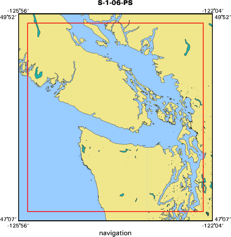
Location map
|

|
|
Bounding Coordinates
|
49.75000
-125.75000 -122.25000
47.25000
|
|
Ports
|
LEAVE La Conner, Washington
ARRIVE La Conner, Washington
|
|
Dates
|
09/18/2006 (JD 261) to 09/22/2006 (JD 265)
|
|
Analog Materials
|
No analog holdings.
|
|
Index map
|
|
|
Information Specialist
|
|
|
Crew
|
|
Eric Grossman
|
Chief Scientist, Research Geologist, USGS/CMG
|
|
Doug George
|
Information Specialist, USGS/CMG
|
|
Renee Takesue
|
Research Geochemist, USGS/CMG
|
|
Reg Resienbichler
|
Co-chief Scientist, Research Fish Biologist, USGS/BRD
|
|
Dennis Rondorf
|
Research Fish Biologist, USGS/BRD
|
|
Theresa Leidke
|
Research Fish Biologist, USGS/BRD
|
|
Anthony Paulson
|
Co-chief Scientist, Research Hydrologist, USGS/WRD
|
|
Chris Curran
|
Hydrologist, USGS/WRD
|
|
Raegan Huffman
|
Hydrologist, USGS/WRD
|
|
Greg Hood
|
Estuarine Ecologist, SRSC
|
|
Eric Beamer
|
Fish Biologist, SRSC
|
|
Todd Mitchell
|
Coordination, Swinomish Office of Planning
|
|
Emily Howe
|
Estuarine Ecologist, Univeristy of Washington
|
|
|
Equipment Used
|
|
navigation
|
|
vibratingcore
|
|
boxcore
|
|
vanVeengrab
|
|
ADCP
|
|
CTD
|
|
|
Purpose
|
|
Characterize habitat and habitat use in select subenvironments of Skagit Delta
|
|
|
Information to be Derived
|
|
Substrate/benthic habitat properties,
|
|
benthic macro/microfauna community composition, sedimentation histories,
|
|
eelgrass biomarker proxies of past eelgrass abundance, porewater and surface
|
|
water chemistry/quality, current velocities/directions, water temperature,
|
|
salinity, turbidity, photosynthetic available radiation, dissolved oxygen,
|
|
Chlorophyll of water column, fish presence and type, eelgrass epiphytes and
|
|
stable isotopes of epiphytes
|
|
|
Notes
|
|
25-ft Whaler, 21-ft Gregor, 21-ft whaler
|
|
Sediment sampling, coring, pore water and surface water, particualte organic
|
|
matter collection, habitat mapping with video, boat-mounted ADCP, CTD, and
|
|
Didson acoustic camera
|
|
|
Got Help?
|
For S-1-06-PS, we would appreciate any information on -- analog materials, contract, days at sea, dive count, funding, kms of navigation, national plan, NGDC Info, owner, project number, publications, scanned materials, seismic description, station count, station description, submersible, summary, tabulated info.
|
|


