|
|
|
Metadata
|
|
ID
|
07001
|
|
Also Known As
|
R-1-07-CD
07001
|
|
Abstract
|
United States Geological Survey, Woods Hole, Massachusetts.
Chief Scientist: Walter Barnhardt, Massachusetts Office of
Coastal Zone Management. Data (sidescansonar,
subbottomprofiler, sidescansonar) of field activity 07001
(R-1-07-CD) in Cape Cod Bay, Massachusetts, United States,
North America, North Atlantic from 04/20/2007 to 05/04/2007
|
|
Organization
|
United States Geological Survey, Woods Hole, Massachusetts
|
|
Project/Theme
|
Geologic mapping of the Massachusetts inner contin
|
|
Chief Scientist
|
Walter Barnhardt
|
|
Platform
|
Rafael
|
|
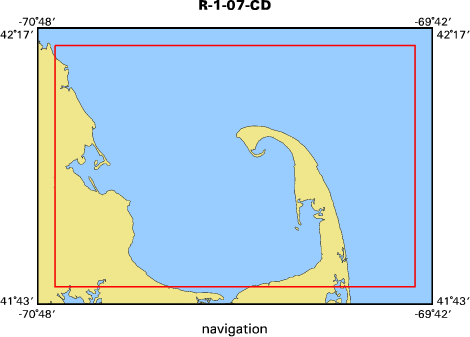
Area of Operation
|
Cape Cod Bay, Massachusetts, United States, North America, North Atlantic
|
|
Location map
|

|
|
Bounding Coordinates
|
42.33333
-70.83333 -70.33333
41.66667
|
|
Ports
|
LEAVE Green Harbor, MA
ARRIVE Green Harbor, MA
|
|
Dates
|
04/20/2007 (JD 110) to 05/04/2007 (JD 124)
|
|
Analog Materials
|
No analog holdings.
|
|
Index map
|
|
|
Information Specialist
|
|
|
Crew
|
|
Walter Barnhardt
|
Massachusetts Office of Coastal Zone Management, Chief Scientist
|
|
Chuck Worley
|
boat captain
|
|
David Foster
|
boat captain
|
|
Bill Danforth
|
|
|
Emile Bergeron
|
marine tech
|
|
Barry Irwin
|
GPS setup
|
|
Brian Andrews
|
|
|
Seth Ackerman
|
|
|
Wayne Baldwin
|
data processor
|
|
Jane Denny
|
director of technology and personnel
|
|
|
Equipment Used
|
|
sidescansonar
|
|
subbottomprofiler
|
|
sidescansonar
|
|
|
Purpose
|
|
seafloor mapping (geophysics only)
|
|
|
Information to be Derived
|
|
Sea Floor Map;Bathymetric Maps;
|
|
|
Summary
|
|
Completed mapping in shallow water along coast, approx from
|
|
Green Harbor-Scituate, to fill in areas not covered by 2006 Megan
|
|
Miller survey. Collected full coverage bathymetry and backscatter
|
|
data, and closely spaced grid of subbottom profiles. Total
|
|
trackline length = 525 km; area mapped = 57 km2; water depths range
|
|
from 4-20 m. Nearshore area south of Green Harbor (off Duxbury
|
|
Beach) was not completed due to weather; will fill gaps during July
|
|
cruise.
|
|
|
Notes
|
Navigation technique: RTK-GPS.
|
|
Cruise was delayed 6 days by a strong nor easter. Lost
|
|
several days at end of cruise due to weather. Took along two data
|
|
processors on this cruise for the first time (usually only one) in
|
|
order to speed up the production. New 4-stroke outboards performed
|
|
well, very quiet and and lots of power. Auto-pilot seldom deviated
|
|
from programmed Hypack lines. New pole mount for chirp worked
|
|
great, allowed tight turns to port w/out prop damage to fish. Now,
|
|
if we could just find a way to launch/recover the big 512i fish!
|
|
14 days at sea.
|
|
525 kms. of continuous data.
|
|
Related web site(s): http://woodshole.er.usgs.gov/project-pages/coastal_mass/
|
|
|
Funding
|
|
|
Got Help?
|
For 07001, we would appreciate any information on -- activity type, analog materials, contract, days at sea, dive count, kms of navigation, national plan, NGDC Info, owner, project number, publications, scanned materials, seismic description, station count, station description, submersible, tabulated info.
|
|