|
|
|
Metadata
|
|
ID
|
08021
|
|
Also Known As
|
O-21-08-NA
08021
|
|
Abstract
|
United States Geological Survey, Woods Hole, Massachusetts.
Chief Scientist: Uri ten Brink WHOI. Bathymetric data (AUV
and ROV Sentry, echosounder) of field activity 08021
(O-21-08-NA) in New England continental slope from 04/18/2008
to 04/24/2008
|
|
Organization
|
United States Geological Survey, Woods Hole, Massachusetts
|
|
Project/Theme
|
Assessment of tsunami hazard to the Atlantic coast
|
|
Chief Scientist
|
Uri ten Brink WHOI
|
|
Activity Type
|
Bathymetric
|
|
Platform
|
Oceanus
|
|
Area of Operation
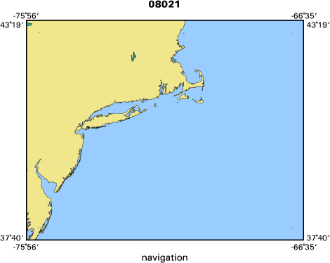
|
New England continental slope
|
|
Location map
|

|
|
Bounding Coordinates
|
43.00000
-75.50000 -67.00000
38.00000
|
|
Ports
|
LEAVE Woods Hole, MA
ARRIVE Woods Hole, MA
|
|
Dates
|
04/18/2008 (JD 109) to 04/24/2008 (JD 115)
|
|
Analog Materials
|
No analog holdings.
|
|
Index map
|
|
|
Information Specialist
|
|
|
Crew
|
|
Uri ten Brink WHOI
|
Chief Scientist
|
|
Jason Chaytor
|
Scientist
|
|
Christopher German
|
Chief Scientist, Woods Hole Oceanographic Institution
|
|
Dana Yoerger
|
Woods Hole Oceanographic Institution
|
|
Rodney Catanach
|
Woods Hole Oceanographic Institution
|
|
Alan Duester
|
Woods Hole Oceanographic Institution
|
|
James Kinsey
|
Woods Hole Oceanographic Institution
|
|
Robert Detrick
|
Woods Hole Oceanographic Institution
|
|
Henrietta Edmonds
|
University of Texas Marine Science Institute, Port Aranasas, Tx
|
|
Alexander Dorsk
|
Woods Hole Oceanographic Institution
|
|
|
Equipment Used
|
|
AUV and ROV Sentry
|
|
echosounder
|
|
|
Purpose
|
|
Map submarine landslides as part of a WHOI test cruise of
|
|
the hybrid AUV and ROV Sentry
|
|
|
Summary
|
|
Using the hull-mounted Knudsen 320BR
|
|
deepwater echosounder on the Oceanus,
|
|
approximately 1065 km of 3.5 kHz sub-bottom data
|
|
were collected over the 6 days of the cruise
|
|
(see map). Data were acquired in both Knudsen
|
|
proprietary binary format (.keb) viewable only
|
|
in the Knudsen Post Survey software and in
|
|
standard SEG-Y format for later processing.
|
|
Multibeam data was not collected in the survey
|
|
area because of technical problems with the
|
|
RESON multibeam sonar aboard the Sentry.
|
|
|
Notes
|
|
This is part of a WHOI enginerring
|
|
testing cruise.
|
|
Map submarine landslides as part of a WHOI test cruise of the hybrid AU
|
|
V and ROV Sentry. The full cruise report is being
|
|
prepared by Drs. Chris German and Dana Yoerger.
|
|
6 days at sea.
|
|
1065 kms. of continuous data.
|
|
4 stations occupied.
|
|
|
Funding
|
|
|
Got Help?
|
For 08021, we would appreciate any information on -- analog materials, contract, days at sea, dive count, information to be derived, kms of navigation, national plan, NGDC Info, owner, project number, publications, scanned materials, seismic description, station count, station description, submersible, tabulated info.
|
|


