|
|
|
Metadata
|
|
ID
|
L-11-80-WO
|
|
Also Known As
|
LB80
|
|
Abstract
|
Chief Scientist: Parke Snavely. Geophysical data
(transitsatellite, dopplersonar, integratednavigation, 12khz,
3dot5khz, magnetics, gravity, uniboom, 24channel, sonobuoy)
of field activity L-11-80-WO in Washington and Oregon from
10/19/1980 to 10/26/1980
|
|
Chief Scientist
|
Parke Snavely
|
|
Activity Type
|
Geophysical
|
|
Platform
|
Samuel Phillips Lee
|
|
Area of Operation
|
Washington and Oregon
|
|
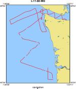
Location map
|
|
|
Bounding Coordinates
|
48.58950
-126.76300 -123.40105
45.71685
|
|
Ports
|
leave Port Angeles, WA
arrive Astoria, OR
|
|
Dates
|
10/19/1980 (JD 293) to 10/26/1980 (JD 300)
|
|
Analog Materials
|
list
|
|
Index map

|
|
|
Crew
|
|
Alan Niem
|
Geologist
|
|
C. Wiley
|
Geologist
|
|
C. Yorath
|
Geologist
|
|
Dennis Mann
|
Geophysicist
|
|
Greg Smith
|
Geophysicist
|
|
Holly Wagner
|
Geologist
|
|
Jackie Eaby
|
Navigator
|
|
Joe Edwards
|
Mechanical Technician
|
|
Jack Lee
|
Electronics Technician
|
|
Jim Saltzgaber
|
Chief Engineer
|
|
Jim Yount
|
Geologist
|
|
Kaye Kinoshita
|
Navigator
|
|
Larry Kooker
|
Electronics Technician
|
|
M. Miller
|
Navigator
|
|
Parke Snavely
|
Chief Scientist
|
|
Paul Wenberg
|
Mechanical Technician
|
|
Richard Heagney
|
Chief Mate
|
|
Ross Vorhees
|
Geophysicist
|
|
Terry Kelley
|
Electronics Technician
|
|
Terry Ruff
|
Ship Captain
|
|
|
Equipment Used
|
|
transitsatellite
|
|
dopplersonar
|
|
integratednavigation
|
|
12khz
|
|
3dot5khz
|
|
magnetics
|
|
gravity
|
|
uniboom
|
|
24channel
|
|
sonobuoy
|
|
|
NGDC Overview
|
|
! Converted to time format with year at start.
|
|
!
|
|
DATA COLLECTION OVERVIEW (use NGDC GEODAS CD to retrieve data)
|
|
|
|
MCG Data Collection ID --- L1180WO
|
|
Institution Data Collection ID --- L1180WO
|
|
NGDC ID --- 06050041
|
|
Funding --- (unspecified)
|
|
Project, Cruise & Leg --- (unspecified)
|
|
Study region --- +49.00000,+45.00000,-127.00000,-123.00000
|
|
Chief Scientist(s) --- Parke Snavely
|
|
Name of vessel --- Lee (surface ship)
|
|
Date field data collection started --- 10/19/80 PORT ANGELES WA
|
|
Date field data collection ended --- 10/26/80 ASTORIA OREGON
|
|
Parameters surveyed ---
|
|
Bathymetry: (unspecified)
|
|
Magnetics: surveyed, contained in data file
|
|
Gravity: (unspecified)
|
|
High-resolution seismics: (unspecified)
|
|
Deep penetration seismics: (unspecified)
|
|
Format --- (I1,A8,F5.2,4I2,F5.3,F8.5,F9.5,I1,F6.4,F6.1,I2,i1,3F6.1,I1,F5.1,F6.0,F7.1,F6.1,F5.1,A8,4I1)
|
|
Date of data input to NGDC --- 06/12/87
|
|
Contributing institution --- USGS Branch of Pacific Marine Geology
|
|
Country --- United States
|
|
|
|
Navigation instrumentation --- SATNAV, LORAN-C, DOPPLER SONAR
|
|
Position determination method --- PRIM-SATNAV, SEC-INTEGRATED NAV
|
|
|
|
Bathymetry instrumentation --- 12KHZ NARROW 1 SEC, 3.5KHZ WIDE 1 SEC
|
|
Additional forms of bathymetric data --- RECORDER ROLLS
|
|
General rate of bathymetry in file --- (unspecified)
|
|
General collection rate of bathymetry --- 20/SECONDS
|
|
Assumed sound velocity --- 1463.0 m/sec
|
|
Bathymetric datum code --- No correction applied (sea level)
|
|
Bathmetry interpolation scheme --- (unspecified)
|
|
|
|
Magnetics instrumentation --- PROTON PRECESSION - GEOMETRICS G-801
|
|
Additional forms of magnetics data --- ANALOG RECORDS
|
|
General rate of magnetics in file --- 4.9 minutes
|
|
General collection rate of magnetics --- 4 seconds
|
|
Magnetic sensor tow distance --- 213 meters
|
|
Magnetic sensor depth --- (unspecified)
|
|
Two sensor horizontal separation --- (unspecified)
|
|
Residual magnetics reference field --- IGRF-75
|
|
Method of applying residual field --- LINEAR INTERP. BETWEEN NAV POINTS
|
|
|
|
Gravity instrumentation --- L&R S-53
|
|
Additional forms of gravity data --- ANALOG RECORDS
|
|
General rate of gravity in file --- (unspecified)
|
|
General collection rate of gravity --- 15 seconds
|
|
Theoretical gravity formula --- International 1930
|
|
Reference system --- System IGSN 71
|
|
Corrections applied --- DRIFT CORRECTIONS
|
|
Starting land tie --- 968871.1 PORT NGELES, WA.
|
|
Ending land tie --- (unspecified)
|
|
|
|
Seismic instrumentation --- UNIBOOM, 24 CHANNEL
|
|
Formats of seismic data --- (unspecified)
|
|
|
Publications
|
|
Snavely, P.D., Jr., Wagner, H.C., Tompkins, D.H., and Tiffin, D.L., 1981, Preliminary geologic
|
|
interpretation of a seismic reflection profile across the Queen Charlotte Island fault system,
|
Dixon Entrance, Canada-United States: U.S. Geological Survey Open-File Report 81-0299, 13 p.
|
|
|
Snavely, P.D., Jr., and Wagner, H.C., 1983, Geophysical data collected across the continental
|
|
margin between Washington and Oregon along line 16, USGS R/V S. P. Lee cruise 11-80: U.S.
|
Geological Survey Open-File Report 83-0020, 1 sheet.
|
|
|
McClellan, P.H., and Snavely, P.D., Jr., 1988, Multichannel seismic-reflection profiles
|
|
collected in 1980 off of the Washington and northern Oregon coast: U.S. Geological Survey
|
Open-File Report 88-0205, 3 p., 1 sheet.
|
|
|
Got Help?
|
For L-11-80-WO, we would appreciate any information on -- contract, days at sea, dive count, funding, information specialist, information to be derived, kms of navigation, national plan, notes, organization, owner, project, project number, purpose, scanned materials, seismic description, station count, station description, submersible, summary, tabulated info.
|
|


