|
|
|
Metadata
|
|
ID
|
K-1-90-GB
|
|
Abstract
|
Chief Scientist: Paul Carlson. Geophysical data
(sidescansonar, gravity, 7khz, 3dot5khz) of field activity
K-1-90-GB in Glacier Bay, Alaska from 06/15/1990 to
06/24/1990
|
|
Chief Scientist
|
Paul Carlson
|
|
Activity Type
|
Geophysical
|
|
Platform
|
Karluk
|
|
Area of Operation
|
Glacier Bay, Alaska
|
|
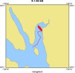
Location map
|
|
|
Bounding Coordinates
|
58.96333
-136.58701 -136.53333
58.90100
|
|
Dates
|
06/15/1990 (JD 166) to 06/24/1990 (JD 175)
|
|
Analog Materials
|
list
|
|
Index map

|
|
|
Crew
|
|
Byron Richards
|
Ship's Captain, USGS WRD
|
|
Paul Carlson
|
Chief Scientist, USGS Western Region
|
|
Dave Hogg
|
Electronic Technician, USGS Western Region
|
|
Lynn Hunter
|
Watchstander, Northern Illinois University
|
|
|
Equipment Used
|
|
sidescansonar
|
|
gravity
|
|
7khz
|
|
3dot5khz
|
|
|
Summary
|
|
10 days in glacier bay, 3 days on the Karluk, 7 days on the Nunatak.
|
|
A phantom ROV was deployed from the Nunatak, looking at glacial discharge
|
|
streams and morainal banks of tidewater glaciers. The Klein side-scan sonar
|
|
from the Karluk was used imaging gulleys and chutes on a pro-delta face in
|
|
Queen Inlet and ice gouges on the moraine at the mouth of Muir Inlet.
|
|
|
Notes
|
|
Nunatak (National Park Service vessel)
|
|
|
Publications
|
|
Carlson, Paul R., Powell, Ross D., and Phillips, Andrew C., 1992, Submarine
|
|
sedimentary features on a fjord delta front, Queen Inlet, Glacier Bay,
|
|
Alaska: Canadian Journal of Earth Science, v. 29, p. 565-573.
|
|
|
Got Help?
|
For K-1-90-GB, we would appreciate any information on -- contract, days at sea, dive count, funding, information specialist, information to be derived, kms of navigation, national plan, NGDC Info, organization, owner, ports, project, project number, purpose, scanned materials, seismic description, station count, station description, submersible, tabulated info.
|
|


