|
|
|
Metadata
|
|
ID
|
K-1-83-NP
|
|
Also Known As
|
K-2-83-CN
|
|
Abstract
|
United States Geological Survey, Menlo Park,
California,Hawaii Institute of Geophysics. Chief Scientists:
Jim Gardner, Mark Holmes. Geophysical data (200khz, 3dot5khz,
gravity, magnetics, sidescansonar, airgun, LoranC,
transitsatellite) of field activity K-1-83-NP in Washington
Coast, North Pacific from 09/16/1983 to 10/07/1983
|
|
Organization
|
United States Geological Survey, Menlo Park, California
Hawaii Institute of Geophysics
|
|
Chief Scientist
|
Jim Gardner
Mark Holmes
|
|
Activity Type
|
Geophysical
|
|
Platform
|
Kana Keoki
|
|
Area of Operation
|
Washington Coast, North Pacific
|
|
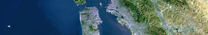
Location map
|

|
|
Bounding Coordinates
|
48.51571
-130.59982 -122.37392
40.86298
|
|
Ports
|
leave Seattle ,WA
arrive Eureka, CA
|
|
Dates
|
09/16/1983 (JD 259) to 10/07/1983 (JD 280)
|
|
Analog Materials
|
list
|
|
Index map

|
|
|
Crew
|
|
Brian Edwards
|
Geologist, USGS Western Region
|
|
Friz Campbell
|
Geologist, U of HI
|
|
Herman Karl
|
Geologist, USGS Western Region
|
|
Jim Gardner
|
Chief Scientist, USGS Western Region
|
|
Mark Holmes
|
Chief Scientist, USGS Western Region
|
|
Paul Carlson
|
Geologist, USGS Western Region
|
|
Paul Johnson
|
Geologist, U of Wash
|
|
|
Equipment Used
|
|
200khz
|
|
3dot5khz
|
|
gravity
|
|
magnetics
|
|
sidescansonar
|
|
airgun
|
|
LoranC
|
|
transitsatellite
|
|
|
Information to be Derived
|
|
Bathymetry, seismic reflection profiles
|
|
|
Publications
|
|
Edwards, B.D., Carlson, P.R., Gardner, J.V., Holmes, M.L., and Karl, Herman A., 1984,
|
|
Surface morphology of the Gorda Ridge as seen by the SeaMARC II seafloor mapping system,
|
|
in Society of Economic Paleontologists and Mineralogists first annual midyear meeting:
|
Society For Sedimentary Geology Midyear Meeting Abstracts , v. 1, p. 29-30.
|
|
|
Holmes, M.L., Gardner, J.V., Johnson, H.P., Campbell, J.F., Carlson, P., Edwards, B., and
|
|
Karl, H.A., 1984, SeaMARC II studies of the Juan de Fuca and Gorda ridges: American Geophysical
|
Union Eos, Transactions, v. 65, no. 16, p. 279.
|
|
|
Carlson and C. Hans Nelson, 1987, Marine geology and resource potential of Cascadia Basin, in D. Scholl, A. Grantz, and J. Vedder, editors, Geology
|
|
and resource potential of the continental margin of W. No. America and adjacent ocean basins: Houston, TX, Circum-Pacific Council for Energy and Mineral
|
|
Resource Earth Science Series, v. 6, p. 523-535.
|
|
|
Got Help?
|
For K-1-83-NP, we would appreciate any information on -- contract, days at sea, dive count, funding, information specialist, kms of navigation, national plan, NGDC Info, notes, owner, project, project number, purpose, scanned materials, seismic description, station count, station description, submersible, summary, tabulated info.
|
|