|
|
|
Metadata
|
|
ID
|
07SCC03
|
|
Also Known As
|
C-3-07-LA
07SCC03
|
|
Abstract
|
United States Geological Survey, St. Petersburg, Florida,
Coastal and Marine Geology Program. Chief Scientist: Jim
Flocks. Bathymetric data of field activity 07SCC03
(C-3-07-LA) in Coastal Chenier Plain, Louisiana from
07/17/2007 to 07/26/2007
|
|
Organization
|
United States Geological Survey, St. Petersburg, Florida, Coastal and Marine Geology Program
|
|
Project/Theme
|
Subsidence and Coastal Change
|
|
Chief Scientist
|
Jim Flocks
|
|
Activity Type
|
Bathymetric
|
|
Platform
|
Survey Cat
|
|
Area of Operation
|
Coastal Chenier Plain, Louisiana
|
|
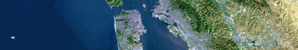
Location map
|

|
|
Bounding Coordinates
|
33.25000
-94.75000 -88.25000
28.25000
|
|
Ports
|
LEAVE Cameron, Louisiana
ARRIVE Cameron, Louisiana
|
|
Dates
|
07/17/2007 (JD 198) to 07/26/2007 (JD 207)
|
|
Analog Materials
|
No analog holdings.
|
|
Index map

|
|
|
Information Specialist
|
|
|
Crew
|
|
Nancy DeWitt
|
|
B.J. Reynolds
|
|
|
Purpose
|
|
Barrier Island Coastal Monitoring
|
|
|
Information to be Derived
|
|
Single beam bathymetry (X, Y, Z) mapping data; purpose being to acquire the latest
|
|
bathymetry to assist in calculating sediment gain/loss and barrier island
|
|
migration or degradation
|
|
|
Summary
|
|
Surveyed more than 511 kilometers of tracklines;
|
|
Collected 10 days of static base station occupation time on U.S. Geological Survey-Florida Integrated Science Center (USGS-FISC) installed benchmarks and National Geodetic Survey (NGS) benchmarks
|
|
|
Got Help?
|
For 07SCC03, we would appreciate any information on -- analog materials, contract, days at sea, dive count, equipment used, funding, kms of navigation, national plan, NGDC Info, notes, owner, project number, publications, scanned materials, seismic description, station count, station description, submersible, tabulated info.
|
|