
|
|
|
|
Metadata
|
|
ID
|
02LCA01
|
|
Also Known As
|
B-3-02-FL
02LCA01
|
|
Abstract
|
United States Geological Survey, St. Petersburg,
Florida,Saint Johns Water Management. Chief Scientist: Jeff
Davis. Chirp and High-Resolution Seismic and Sidescan Sonar
data (boomer, GPS) of field activity 02LCA01 (B-3-02-FL) in
Lakes in central Florida (Hutchinson, Bethel, Gleason, Anne
Marie, Theresa, McGarity, Angela, Dupont) from 05/20/2002 to
05/25/2002
|
|
Organization
|
United States Geological Survey, St. Petersburg, Florida
Saint Johns Water Management
|
|
Project/Theme
|
Lakes and Coastal Aquifers (LCA)
|
|
Chief Scientist
|
Jeff Davis
|
|
Activity Type
|
Chirp and High-Resolution Seismic and Sidescan Sonar
|
|
Platform
|
Boat
|
|
Area of Operation
|
Lakes in central Florida (Hutchinson, Bethel, Gleason, Anne Marie, Theresa, McGarity, Angela, Dupont)
|
|
Location map
|
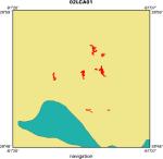
|
|
Bounding Coordinates
|
28.93338
-81.26801 -81.18206
28.84494
|
|
Ports
|
leave Lake Hutchinson
arrive Lake Dupont
|
|
Dates
|
05/20/2002 (JD 140) to 05/25/2002 (JD 145)
|
|
Analog Materials
|
list
|
|
Index map

|
|
|
Information Specialist
|
|
|
Crew
|
|
Jeff Davis
|
Chief Scientist, St. Johns River Water Management District
|
|
John Lombardi
|
Boat Driver/Driller, St. Johns River Water Management District
|
|
Dana Wiese
|
Electronics Tech/Data Manager, USGS St. Petersburg
|
|
|
Equipment Used
|
|
|
Purpose
|
|
Characterize near surface geology as it relates to sinkholes.
|
|
|
Information to be Derived
|
|
|
Summary
|
|
|
Notes
|
|
16' jonboat, 10HP outboard, 4KW generator. Phones on port, 5m back from
|
|
GPS antenna. Sled on starboard, 5m back from GPS antenna. 2 meters apart. Phone
|
|
spacing = .62m. UTM zone 17. Using trigger box to Fire EGG234.
|
|
|
Publications
|
|
Calderon, Karynna, Dadisman, Shawn V., Wiese, Dana S., and Davis, Jeffrey B.,
|
|
2003, Archive of boomer seismic reflection data collected during USGS cruise
|
|
02LCA01 in lakes of southeast Volusia County, Florida, May 20-25, 2002: U. S.
|
|
Geological Survey Open-File Report 03-88.
|
|
|
Got Help?
|
For 02LCA01, we would appreciate any information on -- contract, days at sea, dive count, funding, kms of navigation, national plan, NGDC Info, owner, project number, scanned materials, seismic description, station count, station description, submersible, tabulated info.
|
|


