|
|
|
Metadata
|
|
ID
|
B-1-86-SP
|
|
Abstract
|
United States Geological Survey, Menlo Park, California.
Chief Scientist: Jim Hein. Drilling data (navigation,
samples) of field activity B-1-86-SP in Aitutak, Cook
Islands, South Pacific from 05/01/1986 to 07/01/1986
|
|
Organization
|
United States Geological Survey, Menlo Park, California
|
|
Project/Theme
|
Cook Islands Drilling Program
|
|
Chief Scientist
|
Jim Hein
|
|
Activity Type
|
Drilling
|
|
Platform
|
Barge
|
|
Area of Operation
|
Aitutak, Cook Islands, South Pacific
|
|
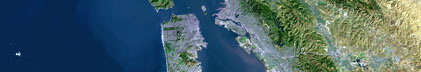
Location map
|

|
|
Bounding Coordinates
|
-18.97133
-159.76317 -159.76317
-18.97133
|
|
Dates
|
05/01/1986 (JD 121) to 07/01/1986 (JD 182)
|
|
Analog Materials
|
list
|
|
Index map

|
|
|
Crew
|
|
Jim Hein
|
Chief Scientist, USGS Western Region
|
|
Lisa Morgenson
|
USGS Western Region
|
|
|
Equipment Used
|
|
|
Purpose
|
|
Pilot project for mineral resources, especially lagoonal phosphorite, by a comprehensive program of drilling, geophysical surveys, and sampling of islands, atolls, and lagoon bottom sediments.
|
|
|
Publications
|
|
Hein, J. R., Richmond, B.M, Gray, S. C., Hausmann, W., Colgan, M. W., El
|
|
Sabbagh, D., and Morgenson, L.M., 1988. Description; Minearalogical, Chemical,
|
|
and Isotopic Compositions; Petrography; Diagenesis; and uranium-series ages
|
|
of drill cores from the lagoon of Aitutaki, Cook Islands. Vol. 1. U.S.
|
|
Geological Survey Open-file Report 88-419.
|
|
|
Got Help?
|
For B-1-86-SP, we would appreciate any information on -- contract, days at sea, dive count, funding, information specialist, information to be derived, kms of navigation, national plan, NGDC Info, notes, owner, ports, project number, scanned materials, seismic description, station count, station description, submersible, summary, tabulated info.
|
|