|
|
|
|
Metadata
|
|
ID
|
05035
|
|
Also Known As
|
05035
B-1-05-CD
|
|
Abstract
|
United States Geological Survey, Woods Hole, Massachusetts.
Chief Scientist: John Bratton, John Colman, USGS-WRD-MA/RI.
Data (Navigation-GPS, Scuba, Sensors-temperature and
salinitySensors-pressure, USGS-WHSC YSI water quality logger,
USGS-WHSC peristaltic pumps, hydraulic sediment squeezer,
sample bottles, tubing, etc., ATV-mounted hydraulic drilling
rig and associated tools, supplied by USGS-WRD; Geoprobe Bulk
Sediment Resistivity Probe, rented by USGS-WRD) of field
activity 05035 (B-1-05-CD) in Cape Cod National Seashore,
Barnstable, Massachusetts, United from 08/22/2005 to
08/26/2005
|
|
Organization
|
United States Geological Survey, Woods Hole, Massachusetts
|
|
Project/Theme
|
Coastal Groundwater Systems
Coastal Change Hazards
|
|
Chief Scientist
|
John Bratton
|
|
Platform
|
Barge
|
|
Area of Operation
|
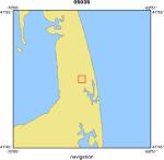
Cape Cod National Seashore, Barnstable, Massachusetts, United
|
|
Location map
|
|
|
Bounding Coordinates
|
41.83790
-69.97500 -69.96310
41.82880
|
|
Ports
|
AUG 22, 2005 - Salt Pond, Eastham, MA
AUG 26, 2005 - Salt Pond, Eastham, MA
|
|
Dates
|
08/22/2005 (JD 234) to 08/26/2005 (JD 238)
|
|
Analog Materials
|
No analog holdings.
|
|
Index map

|
|
|
Information Specialist
|
|
|
Crew
|
|
John Bratton
|
|
John Colman
|
USGS-WRD-MA/RI, Chief Scientist
|
|
John Bratton
|
chief scientist
|
|
Dirk Koopmans
|
technician
|
|
Andy Massey
|
USGS-WRD, drill rig operator
|
|
Tim McCobb
|
|
Mark Avakian
|
|
Len Perry
|
Captain
|
|
|
Equipment Used
|
|
Navigation-GPS
|
|
Scuba
|
|
Sensors-temperature and s
|
(alinitySensors-pressure)
|
|
USGS-WHSC YSI water quali
|
(ty logger)
|
|
USGS-WHSC peristaltic pum
|
(ps)
|
|
hydraulic sediment squeez
|
(er)
|
|
sample bottles, tubing, e
|
(tc.)
|
|
ATV-mounted hydraulic dri
|
(lling rig and associated tools )
|
|
supplied by USGS-WRD; Geo
|
(probe Bulk Sediment Resistivity Probe )
|
|
rented by USGS-WRD
|
|
|
Purpose
|
|
Drilling from barge using ATV-mounted rig (supplied by
|
|
|
Information to be Derived
|
|
Samples and Chemical Analysis;Subsurface electrical
|
|
|
Summary
|
|
Article for Soundwaves By John Bratton September 9, 2005
|
|
|
Notes
|
|
Navigation Techniques: GPS
|
|
TG&B BARGE used
|
|
|
Got Help?
|
For 05035, we would appreciate any information on -- activity type, analog materials, contract, days at sea, dive count, funding, kms of navigation, national plan, NGDC Info, owner, project number, publications, scanned materials, seismic description, station count, station description, submersible, tabulated info.
|
|