|
|
|
Metadata
|
|
ID
|
A-1-03-MD
|
|
Also Known As
|
2002-2003
|
|
Abstract
|
National Oceanic and Atmospheric Administration. Airborne
Topographic data (LIDAR) of field activity A-1-03-MD in
Chesapeake Bay, Maryland from 01/01/2003 to 03/01/2003
|
|
Organization
|
National Oceanic and Atmospheric Administration
|
|
Project/Theme
|
Maryland Mapping 2002-2003
|
|
Activity Type
|
Airborne Topographic
|
|
Platform
|
Airplane
|
|
Area of Operation
|
Chesapeake Bay, Maryland
|
|
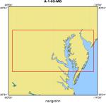
Location map
|
|
|
Bounding Coordinates
|
39.75000
-79.75000 -74.75000
37.75000
|
|
Dates
|
01/01/2003 (JD 001) to 03/01/2003 (JD 060)
|
|
Analog Materials
|
No analog holdings.
|
|
Index map

|
|
|
Information Specialist
|
|
|
Equipment Used
|
|
|
Purpose
|
|
The LIDAR-derived data were collected by the Maryland Department of
|
|
Natural Resources in support of shore erosion studies along the shorelines of
|
|
the Chesapeake Bay. It also supports the Federal Emergency Management Agency's
|
|
specifications for mapping floodplains. These efforts required detailed
|
|
elevation data and models, such as those available from LIDAR sensing. The
|
|
data have also been made available to aid in other projects that require
|
|
detailed surface, vegetation and/or structure elevations.
|
|
|
Notes
|
|
Light Detection and Ranging (LIDAR) is a method of locating objects
|
|
on the ground using aerial-borne equipment. It is similar to RADAR or SONAR in
|
|
that the two-way travel time of an energy beam reflected off an object is
|
|
precisely measured, but this technology uses laser light instead of radio or
|
|
sound waves. This technology has proven very useful in remote sensing of the
|
|
earth. It can be used for determining elevations of both the earth's surface
|
|
and items (natural and man-made) on the surface. Analysis of LIDAR data is
|
|
used in detailed modeling of the earth's surface for drainage and floodplain
|
|
studies, determining how a new structure will affect views from various locations,
|
|
shoreline erosion studies, and other reasons. The Bare Earth Mass Points are
|
|
point elevations that represent the "bare earth." Features that are above the
|
|
ground - such as buildings, bridges, tree tops, etc. - have been eliminated.
|
|
|
Got Help?
|
For A-1-03-MD, we would appreciate any information on -- analog materials, chief scientist, contract, crew, days at sea, dive count, funding, information to be derived, kms of navigation, national plan, NGDC Info, owner, ports, project number, publications, scanned materials, seismic description, station count, station description, submersible, summary, tabulated info.
|
|


