|
|
|
Metadata
|
|
ID
|
03030
|
|
Also Known As
|
03030
A-1-03-CD
A103CD
|
|
Abstract
|
United States Geological Survey, Woods Hole,
Massachusetts,United States Geological Survey, Menlo Park,
California. Chief Scientist: Marinna Martini. Data
(instrumentmooring, GPS) of field activity 03030 (A-1-03-CD)
in Cape Cod Bay, Massachusetts, United States, North America,
North Atlantic from 07/21/2003 to 07/29/2003
|
|
Organization
|
United States Geological Survey, Woods Hole, Massachusetts
United States Geological Survey, Menlo Park, California
|
|
Project/Theme
|
Marthas Vinyard Summertest
|
|
Chief Scientist
|
Marinna Martini
|
|
Platform
|
Asterias
|
|
Area of Operation
|
Cape Cod Bay, Massachusetts, United States, North America, North Atlantic
|
|
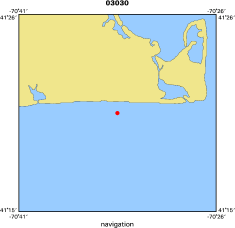
Location map
|

|
|
Bounding Coordinates
|
41.33698
-70.55698 -70.55698
41.33698
|
|
Ports
|
leave Woods Hole, MA
arrive Woods Hole, MA
|
|
Dates
|
07/21/2003 (JD 202) to 07/29/2003 (JD 210)
|
|
Analog Materials
|
No analog holdings.
|
|
Index map
|
|
|
Crew
|
|
Marinna Martini
|
Chief Scientist, USGS Woods Hole
|
|
Amit Bohara
|
Scientist, USGS Woods Hole
|
|
Chris Sherwood
|
Scientist, USGS Woods Hole
|
|
Jonathan Borden
|
Scientist, USGS Woods Hole
|
|
Steve Ruane
|
Scientist, USGS Woods Hole
|
|
Joanne Thede Ferreira
|
Scientist, USGS Menlo Park
|
|
Dave Olmsted
|
Captain
|
|
|
Equipment Used
|
|
|
Purpose
|
|
Deploy and recover tripods for test of instrumentation.
|
|
|
Notes
|
|
Navigation Techniques: DGPS. This is mooring #715.
|
|
|
Got Help?
|
For 03030, we would appreciate any information on -- activity type, analog materials, contract, days at sea, dive count, funding, information specialist, information to be derived, kms of navigation, national plan, NGDC Info, owner, project number, publications, scanned materials, seismic description, station count, station description, submersible, summary, tabulated info.
|
|


