| [+] Home LBA-ECO CD-06 PHYSICAL, POLITICAL, AND HYDROLOGIC MAPS, JI-PARANA RIVER BASIN, BRAZIL | [+]Help @Email | ||
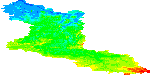
| This data set contains physical, hydrologic, political, demographic, and societal maps for the Ji-Parana River Basin, in the state of Rondonia, Brazil. These data were used as base information in subsequent investigations of land use/land cover, biogeochemistry, soils, and water balance processes (Ballester et al., 2003). This data set includes a Digital Elevation Model (DEM), river networks and morphometric characteristics of the region (derived from the DEM), and a number of social and demographic vector sets (roads as of 2001, county borders, population change from 1970-2000, and settlement projects). The DEM is provided in GeoTIFF format. Other files are provided as shapefiles. Ballester, M.V.R. 2012. LBA-ECO CD-06 Physical, Political, and Hydrologic Maps, Ji-Parana River Basin, Brazil. Data set. Available on-line [http://daac.ornl.gov] from Oak Ridge National Laboratory Distributed Active Archive Center, Oak Ridge, Tennessee, U.S.A. http://dx.doi.org/10.3334/ORNLDAAC/1090 [+] Visualize in Google Earth [+] View Full Metadata [+] Order data set in ORNL DAAC archive (non-WCS) format [+] One-click download this data set Use the links in the table below to view and download data using WCS. |
|||
| This data set contains 1 data granule | ||||||||||||||||||
|
||||||||||||||||||
|
||||||||||||||||||
| Tel: +1 (865) 241-3952 E-mail: USO |
ORNL DAAC | User Services | WebGIS | NASA |  |
||