Alabama Real-Time Network In cooperation with Hover mouse over site for information.
Map Created 3/4/2009 8:06:11 AM
Alabama Real-Time Ground-Water Level Network wells depicted on the state location map As of 3/4/2009 9:18:17 AM
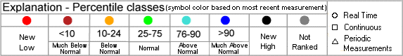
Note: Color shading in the table below indicates multiple wells that plot as a single point on the state location map above.
Note: BLS = Water Level in Feet Below Land Surface, AVD = Water Level in Feet Above Vertical Datum
Map Site ID Site Name Most Recent Date Well Local Aquifer 302416087505501 ww 13-usgs 302416087505501 4.90 BLS 3/2/2009 64.0 Miocene Series 311319086153601 COVINGTON COUNTY WELL 1 9.18 BLS 3/2/2009 26.0 Residuum-south Alabama 322047086214301 K 107 MTG-3 26.85 BLS 3/2/2009 270.0 Eutaw Formation 322500085551201 NAWQA LUSCR1-9 14.89 BLS 3/2/2009 32.0 Eutaw Formation 333204087324601 (TW5 DRY BRANCH WELL) 40.44 BLS 2/28/2009 60.0 Pottsville Formation 335929087021001 CULLMAN CO. WELL NEAR COLD SPRINGS, ALA. 36.34 BLS 3/2/2009 139.0 Pottsville Formation 342718087285601 LAW 3-USGS 342718087285601 9.21 BLS 2/25/2009 40.4 Bangor Limestone 343843085403201 DEKALB-1 21.32 BLS 3/2/2009 37.0 Pottsville Formation 344457086363701 MAD 4-USGS 344457086363701 62.35 BLS 3/2/2009 145.0 Fort Payne Formation
Return to National Page 


 1
1  3
3  5
5  7
7 