
Tides
Multimedia
Lessons and Activities
Real World Data
Background Information
Career Profiles
Knowledge of the times, heights, and the flow of tides is of importance in a wide range of situations such as: navigation through coastal waterways; construction of bridges, docks, breakwaters, and deep-water channels; and for fishing, boating, surfing, and water sports.
The word "tides" is used to define the rise and fall in sea level resulting from the gravitational attraction of the moon and the sun. The result of this pull is a bulge in the ocean water almost in-line with the position of the moon; one bulge toward the moon and one on the opposite side of the earth, away from the moon. When we observe the tides what we are actually seeing is the result of the earth rotating under this bulge.
National Ocean Service
The most familiar evidence of the tides is the observed recurrence of high and low water on the coastline. These tides usually, but not always, reach a high and low level typically about six hours apart. The shape of the coastline, the local depth of the water, and the ocean-floor topography also significantly impact the height and the timing of the tides.
A “spring” tide (from the water “springing up”) occurs when the Earth, moon and sun are inline (around full and new moons). During this event, the combined affect of the moon and sun's pull is at its greatest, resulting in the largest ranges between high and low tide. Seven days later the earth, moon and sun are at right angles and the pull of the moon and sun partially cancel each other out. The resulting tide, called a "neap" tide, has the smallest range between high and low tide.
Educational Connection
The resources included in this collection will provide support to teachers who are instructing students about the causes of tides, but also it includes resources about the impacts of tides on coastal ecosystems and tides as an energy source. Some of the websites allow the teacher and student to view and use real time, historic and predicted data for a large number of tide stations along the coast and in the Great Lakes. Lessons are included that will provide ideas for ways to use this data with students. Changing tides have significant impacts to the ecosystems along the coast. We have included resources that will help teach about the impacts of tides on some of these ecosystems.
Adapted from NOAA's Tides and Currents
Features

Rhode Island's Rising Tide
Oct 22, 2009 (Climate Watch Magazine)
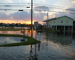
Recurring flooding at a waterfront park in the City of Providence was a tip off to Rhode Island coastal resource managers that something was going on. The city having to close its hurricane gates...
Read More
NOAA Report Explains Sea Level Anomaly this Summer along the U.S. Atlantic Coast
August 31, 2009 (NOAA News)
After observing water levels six inches to two feet higher than originally predicted, NOAA scientists began analyzing data from select tide stations and buoys from Maine to Florida ....
Read More

Tides on Your Cell Phone
Spring 2004 (Center for Operational Oceanographic Products and Services)
NOAA tidal prediction data is now accessible through cell phones. Clear and colorful graphics on the cell phone screen display information for...
Read More