

Northwest Gap Analysis Project
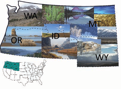
The Northwest Regional Gap Analysis Project (NWGAP) is an update of the Gap Analysis Program's mapping and assessment of biodiversity for the five-state region encompassing Washington, Idaho, Oregon, Montana, and Wyoming. It is a multi-institutional cooperative effort coordinated by the U.S. Geological Survey Gap Analysis Program. The primary objective of the update is to use a coordinated mapping approach to create detailed, seamless GIS maps of land cover, all native terrestrial vertebrate species, land stewardship, and management status, and to analyze this information to identify those biotic elements that are underrepresented on lands managed for their long term conservation, in other words, "gaps". This project began in September 2004.

Previous page: USGS GAP Home
Next page: Landcover