[+] Home >> ISLSCP II CLOUD AND METEOROLOGY PARAMETERS [+]Help   @Email
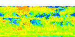
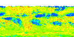
This data set contains cloud and meteorology data on a 1.0 degree x 1.0 degree spatial resolution. There are eight data files (*.zip) with this data set for several cloud parameters (monthly only) and meteorological parameters including monthly surface skin temperature, monthly total column ozone, and water vapor burdens for the period 1986-1995. All monthly parameters include files with a monthly mean value, a monthly standard deviation, and monthly minimum and maximum values.

Stackhouse, P. W., and S. K. Gupta. 2012. ISLSCP II Cloud and Meteorology Parameters. In Hall, Forrest G., G. Collatz, B. Meeson, S. Los, E. Brown de Colstoun, and D. Landis (eds.). ISLSCP Initiative II Collection. Data set. Available on-line [http://daac.ornl.gov/] from Oak Ridge National Laboratory Distributed Active Archive Center, Oak Ridge, Tennessee, U.S.A. http://dx.doi.org/10.3334/ORNLDAAC/1073
    
       [+] Visualize in Google Earth
       [+] View Full Metadata
       [+] Order data set in ORNL DAAC archive (non-WCS) format
       [+] One-click download this data set

Use the links in the table below to view and download data using WCS.
This data set contains 320 data granules
Page    Records per Page   
Granule Name Variables Metadata Preview Image
    ISLSCP II Short Radiation Surface Cloud Liquid Water Path Maximum (One Degree - All Months) 1986 Cloud Liquid Water Path Projection: WGS 84
Spatial Extent: N: 90, S: -90, E: 180, W: -180
Start DateTime: 1986-01
End DateTime: 1986-12
ISLSCP II Short Radiation Surface Cloud Liquid Water Path Maximum  (One Degree - All Months) 1986
 
    ISLSCP II Short Radiation Surface Cloud Liquid Water Path Maximum (One Degree - All Months) 1987 Cloud Liquid Water Path Projection: WGS 84
Spatial Extent: N: 90, S: -90, E: 180, W: -180
Start DateTime: 1987-01
End DateTime: 1987-12
ISLSCP II Short Radiation Surface Cloud Liquid Water Path Maximum  (One Degree - All Months) 1987
 
    ISLSCP II Short Radiation Surface Cloud Liquid Water Path Maximum (One Degree - All Months) 1988 Cloud Liquid Water Path Projection: WGS 84
Spatial Extent: N: 90, S: -90, E: 180, W: -180
Start DateTime: 1988-01
End DateTime: 1988-12
ISLSCP II Short Radiation Surface Cloud Liquid Water Path Maximum  (One Degree - All Months) 1988
 
    ISLSCP II Short Radiation Surface Cloud Liquid Water Path Maximum (One Degree - All Months) 1989 Cloud Liquid Water Path Projection: WGS 84
Spatial Extent: N: 90, S: -90, E: 180, W: -180
Start DateTime: 1989-01
End DateTime: 1989-12
ISLSCP II Short Radiation Surface Cloud Liquid Water Path Maximum  (One Degree - All Months) 1989
 
    ISLSCP II Short Radiation Surface Cloud Liquid Water Path Maximum (One Degree - All Months) 1990 Cloud Liquid Water Path Projection: WGS 84
Spatial Extent: N: 90, S: -90, E: 180, W: -180
Start DateTime: 1990-01
End DateTime: 1990-12
ISLSCP II Short Radiation Surface Cloud Liquid Water Path Maximum  (One Degree - All Months) 1990
 
    ISLSCP II Short Radiation Surface Cloud Liquid Water Path Maximum (One Degree - All Months) 1991 Cloud Liquid Water Path Projection: WGS 84
Spatial Extent: N: 90, S: -90, E: 180, W: -180
Start DateTime: 1991-01
End DateTime: 1991-12
ISLSCP II Short Radiation Surface Cloud Liquid Water Path Maximum  (One Degree - All Months) 1991
 
    ISLSCP II Short Radiation Surface Cloud Liquid Water Path Maximum (One Degree - All Months) 1992 Cloud Liquid Water Path Projection: WGS 84
Spatial Extent: N: 90, S: -90, E: 180, W: -180
Start DateTime: 1992-01
End DateTime: 1992-12
ISLSCP II Short Radiation Surface Cloud Liquid Water Path Maximum  (One Degree - All Months) 1992
 
    ISLSCP II Short Radiation Surface Cloud Liquid Water Path Maximum (One Degree - All Months) 1993 Cloud Liquid Water Path Projection: WGS 84
Spatial Extent: N: 90, S: -90, E: 180, W: -180
Start DateTime: 1993-01
End DateTime: 1993-12
ISLSCP II Short Radiation Surface Cloud Liquid Water Path Maximum  (One Degree - All Months) 1993
 
    ISLSCP II Short Radiation Surface Cloud Liquid Water Path Maximum (One Degree - All Months) 1994 Cloud Liquid Water Path Projection: WGS 84
Spatial Extent: N: 90, S: -90, E: 180, W: -180
Start DateTime: 1994-01
End DateTime: 1994-12
ISLSCP II Short Radiation Surface Cloud Liquid Water Path Maximum  (One Degree - All Months) 1994
 
    ISLSCP II Short Radiation Surface Cloud Liquid Water Path Maximum (One Degree - All Months) 1995 Cloud Liquid Water Path Projection: WGS 84
Spatial Extent: N: 90, S: -90, E: 180, W: -180
Start DateTime: 1995-01
End DateTime: 1995-12
ISLSCP II Short Radiation Surface Cloud Liquid Water Path Maximum  (One Degree - All Months) 1995