Below Normal Water-LevelsLatest News...


Iowa Below Normal Groundwater Levels

Hover mouse over site for information.
Click site to open page with county information and site selection.

IOWA Site: 424023095571401 - Buena Vista County Site: 431613095251801 - Osceola County Site: 430913096033201 - Sioux County Site: 430140095573101 - Sioux County Site: 425610095250611 - O'Brien County Site: 425249096125001 - Plymouth County Site: 424348095231602 - Cherokee County Site: 432828095283611 - Osceola County Site: 424132095480211 - Cherokee County Site: 410057095075101 - Montgomery County Site: 422500095084801 - Sac County Site: 421149091403301 - Linn County Site: 420508091395811 - Linn County Site: 420340091431601 - Linn County Site: 414315091252002 - Johnson County Site: 424348095231601 - Cherokee County


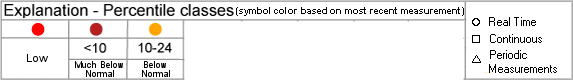
Map generated 2/6/2014 6:34:02 PM
Groundwater Watch
Help Page
   Download Google
Earth Version
   Display
interactive map

Iowa Counties depicted on the state location map with active wells

CountiesWell CountReal-TimeContinuousPeriodic
Buena Vista County 1--1
Cherokee County 3--3
Johnson County 11--
Linn County 3--3
Montgomery County 11--
O'Brien County 1--1
Osceola County 2--2
Plymouth County 1--1
Sac County 1--1
Sioux County 2--2

Number of IA wells:16214


*References to non-Department of the Interior (DOI) products do not constitute an endorsement by the DOI.
By viewing the Google Maps API on this web site the user agrees to these TERMS.

Accessibility FOIA Privacy Policies and Notices

Take Pride in America logo USA.gov logo U.S. Department of the Interior | U.S. Geological Survey | Water Resources Discipline | Office of Groundwater

URL: http://groundwaterwatch.usgs.gov/statemap/IA.html
Page Contact Information: OGW Webmaster
Last update: Thursday, February 06, 2014 at 18:34