Flooding Hazards in Wisconsin
Why floods occur. Factors affecting the magnitude of maximum discharges for streams in Wisconsin are:
- drainage area;
- storage (the percentage of drainage area covered by lakes, ponds, swamps, and wetlands);
- heavy rainfall, snowfall, or snowmelt;
- soil permeability of the least-permeable soil horizon; and
- forest and vegetation cover (the percentage of drainage area covered).
The factors that are significant for flooding in urban areas are:
- drainage area and
- percentage of drainage area that is impervious (parking lots, roads, rooftops).
 Flood Management Benefits of USGS Streamgage Program by the National Hydrologic Warning Council, October 19, 2006, (.pdf, 71M) Flood Management Benefits of USGS Streamgage Program by the National Hydrologic Warning Council, October 19, 2006, (.pdf, 71M)
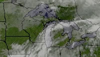
Wisconsin hydroclimatology. The principal moisture-bearing airmasses for Wisconsin originate in the Gulf of Mexico. Moisture is also brought from airmasses originating in the Pacific Ocean, but these airmasses lose most of their moisture crossing the Rocky Mountains. Lake-effect precipitation is a minor source of moisture for Wisconsin. The lake effect is most noticeable in the early winter when the cold air blowing over the unfrozen Great Lakes absorbs moisture, which then is precipitated as snow on the lake shores.
Real-time Flood and Water Data
Wisconsin flood stage data
Stream gage data
Precipitation Data
Flood and Lake Publications
Press Releases
Flood publications
Lake publications
Bridge scour and related surface water issues
USGS Wisconsin stream gages at high flow or flood stage


 View a larger map. View a larger map.
Flood information
at other USGS centers
Flood information
at other agencies
Flood Images
 Images Images
Historical Water Data Resources
Publications
Data
|