Map
Map of Hampshire County, Massachusetts /

| Format |
Map |
|---|---|
| Contributors |
Barker, Wm. J. |
| Dates |
1854 |
| Location |
Hampshire County Massachusetts Northampton United States |
| Language |
English |
| Subjects |
Central Business Districts Hampshire County Hampshire County (Mass.) Massachusetts Northampton Real Property United States Villages |
- Title
- Map of Hampshire County, Massachusetts /
- Description
-
General map showing buildings and householders' names.
-
Relief shown by hachures.
-
Available also through the Library of Congress Web site as a raster image.
-
Includes ill. of buildings, advertisement, miscellaneous statistical tables, inset of downtown Northampton, and 16 insets of villages.
-
Copy imperfect: Brittle, torn, darkened, stained, backed by cloth. DLC
-
1 map : hand col. ; 97 x 133 cm.
- Creator
- Barker, Wm. J.
- Created Published
-
Philadelphia : Published by James D. Scott & Owen McLeran, 1854
- Subject Headings
-
-
Hampshire County (Mass.)
-
-
Real property--Massachusetts--Hampshire County
-
-
Central business districts--Massachusetts--Northampton
-
-
Villages--Massachusetts--Hampshire County
-
-
United States--Massachusetts--Hampshire County.
- Notes
-
-
General map showing buildings and householders' names.
-
-
Relief shown by hachures.
-
-
Available also through the Library of Congress Web site as a raster image.
-
-
Includes ill. of buildings, advertisement, miscellaneous statistical tables, inset of downtown Northampton, and 16 insets of villages.
-
-
Copy imperfect: Brittle, torn, darkened, stained, backed by cloth. DLC
- Medium
-
1 map : hand col. ; 97 x 133 cm.
- Call Number
-
G3763.H4 1854 .B3
- Repository
-
Library of Congress Geography and Map Division Washington, D.C. 20540-4650 USA dcu
- Digital Id
-
g3763h la002020 http://hdl.loc.gov/loc.gmd/g3763h.la002020
- Library of Congress Catalog Number
- 2008624301
Rights & Access
The maps in the Map Collections materials were either published prior to 1922, produced by the United States government, or both (see catalogue records that accompany each map for information regarding date of publication and source). The Library of Congress is providing access to these materials for educational and research purposes and is not aware of any U.S. copyright protection (see Title 17 of the United States Code) or any other restrictions in the Map Collection materials.
Note that the written permission of the copyright owners and/or other rights holders (such as publicity and/or privacy rights) is required for distribution, reproduction, or other use of protected items beyond that allowed by fair use or other statutory exemptions. Responsibility for making an independent legal assessment of an item and securing any necessary permissions ultimately rests with persons desiring to use the item.
More about Copyright and other Restrictions
For guidance about compiling full citations consult Citing Primary Sources.
Part of...
-
Cultural Landscapes
[1623]
-
Geography And Maps Division
[60803]
-
American Memory
[1121009]
More maps like this
-
 Map of the county of Hampshire, Massachusetts /
Contributor:
Walling, Henry Francis
Site:
American Memory-cultural
Original Format:
Map
Date:
1860
Map of the county of Hampshire, Massachusetts /
Contributor:
Walling, Henry Francis
Site:
American Memory-cultural
Original Format:
Map
Date:
1860
-
 [Plat of a survey for William Hughes, Jr. of 460 acres in Frederick County, Va. on the Cacapon River].
Contributor:
Washington, George
Site:
American Memory-cultural, Main Catalog
Original Format:
Map
Date:
1750
View catalog record
[Plat of a survey for William Hughes, Jr. of 460 acres in Frederick County, Va. on the Cacapon River].
Contributor:
Washington, George
Site:
American Memory-cultural, Main Catalog
Original Format:
Map
Date:
1750
View catalog record
-
 Sanborn Fire Insurance Map from Hatfield, Hampshire County, Massachusetts.
Site:
American Memory-cultural
Original Format:
Map
Date:
1915-01-01
Sanborn Fire Insurance Map from Hatfield, Hampshire County, Massachusetts.
Site:
American Memory-cultural
Original Format:
Map
Date:
1915-01-01
-
 [Map of portions of Hampshire and Mineral Counties, W. Va., and Garrett County, Md.].
Site:
American Memory-cultural, Main Catalog
Original Format:
Map
Date:
1861
View catalog record
[Map of portions of Hampshire and Mineral Counties, W. Va., and Garrett County, Md.].
Site:
American Memory-cultural, Main Catalog
Original Format:
Map
Date:
1861
View catalog record
-
 Lands End, Rockport, Mass.
Contributor:
O.H. Bailey & Co
Site:
American Memory-cultural, Main Catalog
Original Format:
Map
View catalog record
Lands End, Rockport, Mass.
Contributor:
O.H. Bailey & Co
Site:
American Memory-cultural, Main Catalog
Original Format:
Map
View catalog record
-
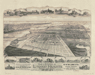 Plat & environs of Lagoon Heights, Cottage City, Mass. : showing property owned by the Lagoon Heights Land Co., 53 State St., 610 Exchange B'd'g., ...
Contributor:
O.H. Bailey & Co
Site:
American Memory-cultural, Main Catalog
Original Format:
Map
View catalog record
Plat & environs of Lagoon Heights, Cottage City, Mass. : showing property owned by the Lagoon Heights Land Co., 53 State St., 610 Exchange B'd'g., ...
Contributor:
O.H. Bailey & Co
Site:
American Memory-cultural, Main Catalog
Original Format:
Map
View catalog record
-
 Map of the town of Braintree, Norfolk County, Mass. /
Contributor:
Walling, Henry Francis
Site:
American Memory-cultural, Main Catalog
Original Format:
Map
Date:
1856
View catalog record
Map of the town of Braintree, Norfolk County, Mass. /
Contributor:
Walling, Henry Francis
Site:
American Memory-cultural, Main Catalog
Original Format:
Map
Date:
1856
View catalog record
-
 Map of the town of Medfield /
Contributor:
Walling, Henry Francis
Site:
American Memory-cultural
Original Format:
Map
Date:
1852
Map of the town of Medfield /
Contributor:
Walling, Henry Francis
Site:
American Memory-cultural
Original Format:
Map
Date:
1852
-
 Atlas of the city of New Bedford, Massachusetts : based on plans in the office of the city engineer.
Contributor:
Walker Lith. & Pub. Co
Site:
American Memory-cultural, Main Catalog
Original Format:
Map
Date:
1911
View catalog record
Atlas of the city of New Bedford, Massachusetts : based on plans in the office of the city engineer.
Contributor:
Walker Lith. & Pub. Co
Site:
American Memory-cultural, Main Catalog
Original Format:
Map
Date:
1911
View catalog record
-
 Atlas of the city of Boston, West Roxbury : from actual surveys and official plans /
Contributor:
Bromley, George Washington
Site:
American Memory-cultural, Main Catalog
Original Format:
Map
Date:
1924
View catalog record
Atlas of the city of Boston, West Roxbury : from actual surveys and official plans /
Contributor:
Bromley, George Washington
Site:
American Memory-cultural, Main Catalog
Original Format:
Map
Date:
1924
View catalog record
-
 Atlas of the city of Boston, Dorchester : from actual surveys and official plans.
Contributor:
G.W. Bromley & Co
Site:
American Memory-cultural, Main Catalog
Original Format:
Map
Date:
1933
View catalog record
Atlas of the city of Boston, Dorchester : from actual surveys and official plans.
Contributor:
G.W. Bromley & Co
Site:
American Memory-cultural, Main Catalog
Original Format:
Map
Date:
1933
View catalog record
-
 Atlas of the town of Framingham, Mass. /
Contributor:
Barnes & Jenks
Site:
American Memory-cultural, Main Catalog
Original Format:
Map
Date:
1895
View catalog record
Atlas of the town of Framingham, Mass. /
Contributor:
Barnes & Jenks
Site:
American Memory-cultural, Main Catalog
Original Format:
Map
Date:
1895
View catalog record
-
 Plan of sections 1, 2 & 3, East Boston.
Site:
American Memory-cultural, Main Catalog
Original Format:
Map
Date:
1836
View catalog record
Plan of sections 1, 2 & 3, East Boston.
Site:
American Memory-cultural, Main Catalog
Original Format:
Map
Date:
1836
View catalog record
-
 A plan of West Springfield : [Massachusetts] /
Contributor:
Lathrop, J.
Site:
American Memory-cultural, Main Catalog
Original Format:
Map
Date:
1831
View catalog record
A plan of West Springfield : [Massachusetts] /
Contributor:
Lathrop, J.
Site:
American Memory-cultural, Main Catalog
Original Format:
Map
Date:
1831
View catalog record
-
 Atlas of the city of Boston, Brighton : from actual surveys and official plans /
Contributor:
Bromley, George Washington
Site:
American Memory-cultural, Main Catalog
Original Format:
Map
Date:
1925
View catalog record
Atlas of the city of Boston, Brighton : from actual surveys and official plans /
Contributor:
Bromley, George Washington
Site:
American Memory-cultural, Main Catalog
Original Format:
Map
Date:
1925
View catalog record
-
 Plan of Charlestown peninsula in the state of Massachusetts /
Contributor:
Tufts, Peter
Site:
American Memory-cultural, Main Catalog
Original Format:
Map
Date:
1818
View catalog record
Plan of Charlestown peninsula in the state of Massachusetts /
Contributor:
Tufts, Peter
Site:
American Memory-cultural, Main Catalog
Original Format:
Map
Date:
1818
View catalog record
You might also like
-
 Women Accepted for Voluntary Emergency Service. Smith College, Northampton, Massachusetts, becomes the home for WAVES in training. Here, midshipmen take on a heavy schedule to ...
Contributor:
United States. Office of War Information
Site:
Prints & Photographs
Original Format:
Photo, Print, Drawing
Date:
1942
Women Accepted for Voluntary Emergency Service. Smith College, Northampton, Massachusetts, becomes the home for WAVES in training. Here, midshipmen take on a heavy schedule to ...
Contributor:
United States. Office of War Information
Site:
Prints & Photographs
Original Format:
Photo, Print, Drawing
Date:
1942
-
 Women Accepted for Voluntary Emergency Service. Hep, two, three, four clipping of a brisk cadence, enlisted WAVES cross their first bridge enroute to their initial ...
Contributor:
United States. Office of War Information
Site:
Prints & Photographs
Original Format:
Photo, Print, Drawing
Date:
1942
Women Accepted for Voluntary Emergency Service. Hep, two, three, four clipping of a brisk cadence, enlisted WAVES cross their first bridge enroute to their initial ...
Contributor:
United States. Office of War Information
Site:
Prints & Photographs
Original Format:
Photo, Print, Drawing
Date:
1942
-
 Women Accepted for Voluntary Emergency Service. Smith College, Northampton, Massachusetts, becomes the home for WAVES in training. Here, midshipmen take on heavy schedule to learn ...
Contributor:
United States. Office of War Information
Site:
Prints & Photographs
Original Format:
Photo, Print, Drawing
Date:
1942
Women Accepted for Voluntary Emergency Service. Smith College, Northampton, Massachusetts, becomes the home for WAVES in training. Here, midshipmen take on heavy schedule to learn ...
Contributor:
United States. Office of War Information
Site:
Prints & Photographs
Original Format:
Photo, Print, Drawing
Date:
1942