Map
Atlas of the city of Boston, West Roxbury : from actual surveys and official plans /
Views

| Format |
Map |
|---|---|
| Contributors |
Bromley, George Washington |
| Dates |
1924 |
| Location |
Boston Massachusetts United States West Roxbury |
| Language |
English |
| Subjects |
Boston Landowners Massachusetts Real Property United States West Roxbury (Boston) West Roxbury (Boston, Mass.) |
- Title
- Atlas of the city of Boston, West Roxbury : from actual surveys and official plans /
- Description
-
Available also through the Library of Congress Web site as a raster image.
-
Includes index.
-
LC copy imperfect: Liquid staining along lower portion of atlas. DLC
-
1 atlas ([4] p., 31 [i.e. 32] double leaves of plates) : hand col. maps ; 59 cm.
- Creator
- Bromley, George Washington.
- Created Published
-
Philadelphia : G.W. Bromley and Co., 1924.
- Subject Headings
-
-
West Roxbury (Boston, Mass.)
-
-
Real property--Massachusetts--Boston
-
-
Landowners--Massachusetts--Boston
-
-
United States--Massachusetts--West Roxbury (Boston)
-
-
United States--Massachusetts--Boston.
- Notes
-
-
Available also through the Library of Congress Web site as a raster image.
-
-
Includes index.
-
-
LC copy imperfect: Liquid staining along lower portion of atlas. DLC
- Medium
-
1 atlas ([4] p., 31 [i.e. 32] double leaves of plates) : hand col. maps ; 59 cm.
- Call Number
-
G1234.B6:2W4 B7 1924
- Repository
-
Library of Congress Geography and Map Division Washington, D.C. 20540-4650 USA dcu
- Digital Id
-
g3764bm gla00102 http://hdl.loc.gov/loc.gmd/g3764bm.gla00102
- Library of Congress Catalog Number
- 2008629007
Rights & Access
The maps in the Map Collections materials were either published prior to 1922, produced by the United States government, or both (see catalogue records that accompany each map for information regarding date of publication and source). The Library of Congress is providing access to these materials for educational and research purposes and is not aware of any U.S. copyright protection (see Title 17 of the United States Code) or any other restrictions in the Map Collection materials.
Note that the written permission of the copyright owners and/or other rights holders (such as publicity and/or privacy rights) is required for distribution, reproduction, or other use of protected items beyond that allowed by fair use or other statutory exemptions. Responsibility for making an independent legal assessment of an item and securing any necessary permissions ultimately rests with persons desiring to use the item.
More about Copyright and other Restrictions
For guidance about compiling full citations consult Citing Primary Sources.
Part of...
-
Cultural Landscapes
[1623]
-
Geography And Maps Division
[60803]
-
American Memory
[1121009]
More maps like this
-
 Atlas of the city of Boston, Brighton : from actual surveys and official plans /
Contributor:
Bromley, George Washington
Site:
American Memory-cultural, Main Catalog
Original Format:
Map
Date:
1925
View catalog record
Atlas of the city of Boston, Brighton : from actual surveys and official plans /
Contributor:
Bromley, George Washington
Site:
American Memory-cultural, Main Catalog
Original Format:
Map
Date:
1925
View catalog record
-
 Atlas of the city of Boston, Dorchester : from actual surveys and official plans.
Contributor:
G.W. Bromley & Co
Site:
American Memory-cultural, Main Catalog
Original Format:
Map
Date:
1933
View catalog record
Atlas of the city of Boston, Dorchester : from actual surveys and official plans.
Contributor:
G.W. Bromley & Co
Site:
American Memory-cultural, Main Catalog
Original Format:
Map
Date:
1933
View catalog record
-
 Plan of Charlestown peninsula in the state of Massachusetts /
Contributor:
Tufts, Peter
Site:
American Memory-cultural, Main Catalog
Original Format:
Map
Date:
1818
View catalog record
Plan of Charlestown peninsula in the state of Massachusetts /
Contributor:
Tufts, Peter
Site:
American Memory-cultural, Main Catalog
Original Format:
Map
Date:
1818
View catalog record
-
 Plan of sections 1, 2 & 3, East Boston.
Site:
American Memory-cultural, Main Catalog
Original Format:
Map
Date:
1836
View catalog record
Plan of sections 1, 2 & 3, East Boston.
Site:
American Memory-cultural, Main Catalog
Original Format:
Map
Date:
1836
View catalog record
-
 Atlas of the city of New Bedford, Massachusetts : based on plans in the office of the city engineer.
Contributor:
Walker Lith. & Pub. Co
Site:
American Memory-cultural, Main Catalog
Original Format:
Map
Date:
1911
View catalog record
Atlas of the city of New Bedford, Massachusetts : based on plans in the office of the city engineer.
Contributor:
Walker Lith. & Pub. Co
Site:
American Memory-cultural, Main Catalog
Original Format:
Map
Date:
1911
View catalog record
-
 Atlas of the town of Framingham, Mass. /
Contributor:
Barnes & Jenks
Site:
American Memory-cultural, Main Catalog
Original Format:
Map
Date:
1895
View catalog record
Atlas of the town of Framingham, Mass. /
Contributor:
Barnes & Jenks
Site:
American Memory-cultural, Main Catalog
Original Format:
Map
Date:
1895
View catalog record
-
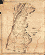 A plan of West Springfield : [Massachusetts] /
Contributor:
Lathrop, J.
Site:
American Memory-cultural, Main Catalog
Original Format:
Map
Date:
1831
View catalog record
A plan of West Springfield : [Massachusetts] /
Contributor:
Lathrop, J.
Site:
American Memory-cultural, Main Catalog
Original Format:
Map
Date:
1831
View catalog record
-
 Map of East Bridgewater, Mass. /
Contributor:
Bates, M.
Site:
American Memory-cultural, Main Catalog
Original Format:
Map
Date:
1848
View catalog record
Map of East Bridgewater, Mass. /
Contributor:
Bates, M.
Site:
American Memory-cultural, Main Catalog
Original Format:
Map
Date:
1848
View catalog record
-
 Springfield, 1827 : surveyed by direction of the town, 1826 /
Contributor:
Bowles, Samuel
Site:
American Memory-cultural
Original Format:
Map
Date:
1827
Springfield, 1827 : surveyed by direction of the town, 1826 /
Contributor:
Bowles, Samuel
Site:
American Memory-cultural
Original Format:
Map
Date:
1827
-
 Twentieth century Boston.
Contributor:
Poole, A. F.
Site:
American Memory-cultural, Main Catalog
Original Format:
Map
Date:
1905
View catalog record
Twentieth century Boston.
Contributor:
Poole, A. F.
Site:
American Memory-cultural, Main Catalog
Original Format:
Map
Date:
1905
View catalog record
-
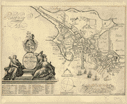 To his excellency William Burnet, esqr., this plan of Boston in New England is humbly dedicated by his excellencys most obedient and humble servant Will ...
Contributor:
Burgis, William
Site:
American Memory-cultural, Main Catalog
Original Format:
Map
Date:
1728
View catalog record
To his excellency William Burnet, esqr., this plan of Boston in New England is humbly dedicated by his excellencys most obedient and humble servant Will ...
Contributor:
Burgis, William
Site:
American Memory-cultural, Main Catalog
Original Format:
Map
Date:
1728
View catalog record
-
 Naval Hospital grounds, Chelsea, Mass. /
Contributor:
Vinal, W. I.
Site:
American Memory-cultural, Main Catalog
Original Format:
Map
Date:
1894
View catalog record
Naval Hospital grounds, Chelsea, Mass. /
Contributor:
Vinal, W. I.
Site:
American Memory-cultural, Main Catalog
Original Format:
Map
Date:
1894
View catalog record
-
 Grundriss von der Stadt Boston und ihren Gegenden.
Site:
American Memory-cultural, Main Catalog
Original Format:
Map
Date:
1758
View catalog record
Grundriss von der Stadt Boston und ihren Gegenden.
Site:
American Memory-cultural, Main Catalog
Original Format:
Map
Date:
1758
View catalog record
-
 Plan of the town of Dorchester /
Contributor:
Davis, Thomas W.
Site:
American Memory-cultural, Main Catalog
Original Format:
Map
Date:
1870
View catalog record
Plan of the town of Dorchester /
Contributor:
Davis, Thomas W.
Site:
American Memory-cultural, Main Catalog
Original Format:
Map
Date:
1870
View catalog record
-
 A new plan of ye great town of Boston in New England in America with the many additionall buildings & new streets, to the year, ...
Contributor:
Price, William
Site:
American Memory-cultural, Main Catalog
Original Format:
Map
Date:
1769
View catalog record
A new plan of ye great town of Boston in New England in America with the many additionall buildings & new streets, to the year, ...
Contributor:
Price, William
Site:
American Memory-cultural, Main Catalog
Original Format:
Map
Date:
1769
View catalog record
-
 Indexed map of Boston.
Contributor:
Walker Lith. & Pub. Co
Site:
American Memory-cultural, Main Catalog
Original Format:
Map
View catalog record
Indexed map of Boston.
Contributor:
Walker Lith. & Pub. Co
Site:
American Memory-cultural, Main Catalog
Original Format:
Map
View catalog record
You might also like
-
 ... Pompeii. A. W. A. Cedar Hill, West Roxbury. [1871].
Contributor:
Austin, Arthur W.
Site:
American Memory-cultural
Original Format:
Book
Date:
1871
... Pompeii. A. W. A. Cedar Hill, West Roxbury. [1871].
Contributor:
Austin, Arthur W.
Site:
American Memory-cultural
Original Format:
Book
Date:
1871
-

 The book of possessions.
Contributor:
Suffolk County (Mass.)
Site:
Main Catalog
Original Format:
Book
Date:
1902
The book of possessions.
Contributor:
Suffolk County (Mass.)
Site:
Main Catalog
Original Format:
Book
Date:
1902
-
["Gleaner" articles]
Contributor:
Bowditch, N. I.
Site:
Main Catalog
Original Format:
Book
Date:
1880
-
"Gleaner" articles.
Contributor:
Bowditch, N. I.
Site:
Main Catalog
Original Format:
Book
Date:
1887
-
 Brook Farms, landscape, West Roxbury, MA
Site:
American Memory-cultural
Original Format:
Photo, Print, Drawing
Date:
1894
Brook Farms, landscape, West Roxbury, MA
Site:
American Memory-cultural
Original Format:
Photo, Print, Drawing
Date:
1894
-
The A B C of taxation,
Contributor:
Fillebrown, Charles Bowdoin
Site:
Main Catalog
Original Format:
Book
Date:
1909