


![A correct map of a section of the United States showing the allignment [sic] of the Pittsburgh, Marion, and Chicago Railway between Chewton, Penna. and Marion, Ohio and connections.](https://webarchive.library.unt.edu/web/20121227013323im_/http://www.loc.gov/collections/static/railroad-maps-1828-to-1900/images/rr005350.jpg)


Overview
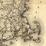
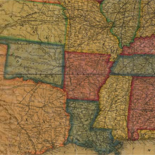
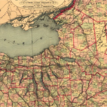
The Railroad maps represent an important historical record, illustrating the growth of travel and settlement as well as the development of industry and agriculture in the United States. They depict the development of cartographic style and technique, highlighting the achievement of early railroaders. Included in the collection are progress report surveys for individual lines, official government surveys, promotional maps, maps showing land grants and rights-of-way, and route guides published by commercial firms.
All of the items presented here are documented in RAILROAD MAPS of the United States compiled by Andrew M. Modelski in 1975. The bibliography contains 623 railroad maps of the United States.
To satisfy Americans' keen interest in the routes of railroads, cartographers have shown rail lines on maps since the first tracks were laid in the United States. There are in the collections of the Library of Congress thousands of American railroad maps as well as numerous general maps showing railroad routes as part of the transportation network. The maps, which are in the custody of the Geography and Map Division, vary widely in area, content, and scale. Some cover major segments of our country and depict the interrelationship of various modes of transportation. Others resemble contemporary strip road maps and show only a ribbon of land immediately adjacent to a specific railroad right-of-way.
The Library's holdings include railroad maps issued for a variety of purposes. Among the collections are official printed government surveys conducted to determine the most practical railroad routes, Pacific Railroad Surveys, U.S. General Land Office maps which show land grants to railroads, surveys for specific rights-of-way, and general surveys prepared to accompany progress reports of individual railroads. Other maps were published specifically to promote particular lines, some of which were never built. Also represented in the collection are maps issued by commercial publishers, intended for ticket agents and the public, as route guides to encourage commerce and travel to the newly settled areas west of the Mississippi River.
The maps presented here are a selection from the Geography and Map Division holdings, based on the popular cartobibliography, Railroad Maps of the United States: A Selective Annotated Bibliography of Original 19th-century Maps in the Geography and Map Division of the Library of Congress, compiled by Andrew M. Modelski (Washington: Library of Congress, 1975). This annotated list reveals the scope of the railroad map collection and highlights the development of railroad mapping in 19th-century America. Described are 623 maps chosen from more than 3,000 railroad maps and about 2,000 regional, state, and county maps, and other maps which show "internal improvements" of the past century.
The maps selected represent a profile of the development of cartographic style and technique and are not intended to inventory all maps in the division which show railroads. The list does reflect, however, the important achievements of early railroaders in reaching their ultimate goal of providing a transportation network spanning the country and linking the Atlantic and Pacific Oceans.
The list includes only separate printed and manuscript maps preserved in the Geography and Map Division. Excluded are photocopies, facsimiles, atlases, and maps which are included in annual railroad company reports or which illustrate volumes classed elsewhere in the Library of Congress.
Rights And Access
While the Library of Congress is not aware of any U.S. copyright protection (see Title 17 U.S.C.) or any other restrictions in the railroad maps materials, there may be content protected by copyright law. Additionally, the reproduction of some materials may be restricted by privacy or other rights. The Library of Congress is providing access to these materials for educational and research purposes. The written permission of the copyright owners and/or other rights holders (such as publicity and/or privacy rights) is required for distribution, reproduction, or other use of protected items beyond that allowed by fair use or other statutory exemptions. Responsibility for making an independent legal assessment of an item and securing any necessary permissions ultimately rests with persons desiring to use the item.
More about American Memory, Copyright and other Restrictions
Credit Line: Library of Congress, Geography and Map Division.
Citing Primary Souces on the Teachers Page.