Map
Atlas of Andrew County, Missouri : including plats of the villiages [sic], cities and townships of the county, a map of the state and of the United States, patrons' directory, together with an analysis of the system of U.S. land surveys.
Views

| Format |
Map |
|---|---|
| Contributors |
Acme Publishing Co. (Philadelphia, Pa.) |
| Dates |
1898 |
| Location |
Andrew County Missouri United States |
| Language |
English |
| Subjects |
Andrew County Andrew County (Mo.) Landowners Missouri Real Property United States |
- Title
- Atlas of Andrew County, Missouri : including plats of the villiages [sic], cities and townships of the county, a map of the state and of the United States, patrons' directory, together with an analysis of the system of U.S. land surveys.
- Description
-
LeGear. Atlases of the United States, 5184
-
Available also through the Library of Congress Web site as a raster image.
-
Includes index.
-
Annotations in pencil and colored pencil on some maps. DLC
-
LC copy imperfect: Newspaper clipping pasted along right edge of t.p. Front and rear board separated from binding. DLC
-
1 atlas ([4], 9-67 p.) : hand col. maps ; 46 cm.
- Creator
- Acme Publishing Co. (Philadelphia, Pa.)
- Created Published
-
Philadelphia : Acme Pub. Co., [1898]
- Subject Headings
-
-
Andrew County (Mo.)
-
-
Real property--Missouri--Andrew County
-
-
Landowners--Missouri--Andrew County
-
-
Andrew County (Mo.)
-
-
United States--Missouri--Andrew County.
- Notes
-
-
LeGear. Atlases of the United States, 5184
-
-
Available also through the Library of Congress Web site as a raster image.
-
-
Includes index.
-
-
Annotations in pencil and colored pencil on some maps. DLC
-
-
LC copy imperfect: Newspaper clipping pasted along right edge of t.p. Front and rear board separated from binding. DLC
- Medium
-
1 atlas ([4], 9-67 p.) : hand col. maps ; 46 cm.
- Call Number
-
G1438.A5 A3 1898
- Repository
-
Library of Congress Geography and Map Division Washington, D.C. 20540-4650 USA dcu
- Digital Id
-
g4163am gla00039 http://hdl.loc.gov/loc.gmd/g4163am.gla00039
- Library of Congress Catalog Number
- 2007626766
Rights & Access
The maps in the Map Collections materials were either published prior to 1922, produced by the United States government, or both (see catalogue records that accompany each map for information regarding date of publication and source). The Library of Congress is providing access to these materials for educational and research purposes and is not aware of any U.S. copyright protection (see Title 17 of the United States Code) or any other restrictions in the Map Collection materials.
Note that the written permission of the copyright owners and/or other rights holders (such as publicity and/or privacy rights) is required for distribution, reproduction, or other use of protected items beyond that allowed by fair use or other statutory exemptions. Responsibility for making an independent legal assessment of an item and securing any necessary permissions ultimately rests with persons desiring to use the item.
More about Copyright and other Restrictions
For guidance about compiling full citations consult Citing Primary Sources.
Part of...
-
Cultural Landscapes
[1623]
-
Geography And Maps Division
[60803]
-
American Memory
[1121009]
More maps like this
-
 Plat book of Andrew County, Missouri /
Contributor:
Stinson, A. R.
Site:
American Memory-cultural, Main Catalog
Original Format:
Map
Date:
1909
View catalog record
Plat book of Andrew County, Missouri /
Contributor:
Stinson, A. R.
Site:
American Memory-cultural, Main Catalog
Original Format:
Map
Date:
1909
View catalog record
-
 Illustrated historical atlas of Cooper County, Missouri : compiled and published from official records and personal examination /
Contributor:
Central Map Co
Site:
American Memory-cultural, Main Catalog
Original Format:
Map
Date:
1897
View catalog record
Illustrated historical atlas of Cooper County, Missouri : compiled and published from official records and personal examination /
Contributor:
Central Map Co
Site:
American Memory-cultural, Main Catalog
Original Format:
Map
Date:
1897
View catalog record
-
 Atlas of Lafayette County, Missouri.
Contributor:
W.W. Hixson & Co
Site:
American Memory-cultural, Main Catalog
Original Format:
Map
Date:
1920
View catalog record
Atlas of Lafayette County, Missouri.
Contributor:
W.W. Hixson & Co
Site:
American Memory-cultural, Main Catalog
Original Format:
Map
Date:
1920
View catalog record
-
 An illustrated historical atlas map of Holt County, Mo. : carefully compiled from personal examinations and surveys.
Contributor:
Brink, McDonough & Co
Site:
American Memory-cultural, Main Catalog
Original Format:
Map
Date:
1877
View catalog record
An illustrated historical atlas map of Holt County, Mo. : carefully compiled from personal examinations and surveys.
Contributor:
Brink, McDonough & Co
Site:
American Memory-cultural, Main Catalog
Original Format:
Map
Date:
1877
View catalog record
-
 Standard atlas of Cedar County, Missouri : including a plat book of the villages, cities and townships of the county, map of the state, United ...
Contributor:
Geo. A. Ogle & Co
Site:
American Memory-cultural, Main Catalog
Original Format:
Map
Date:
1908
View catalog record
Standard atlas of Cedar County, Missouri : including a plat book of the villages, cities and townships of the county, map of the state, United ...
Contributor:
Geo. A. Ogle & Co
Site:
American Memory-cultural, Main Catalog
Original Format:
Map
Date:
1908
View catalog record
-
 City of St. Louis /
Contributor:
Hutawa, Julius
Site:
American Memory-cultural, Main Catalog
Original Format:
Map
Date:
1870
View catalog record
City of St. Louis /
Contributor:
Hutawa, Julius
Site:
American Memory-cultural, Main Catalog
Original Format:
Map
Date:
1870
View catalog record
-
 Standard atlas of Macon County, Missouri : including a plat book of the villages, cities and townships of the county, map of the state, United ...
Contributor:
Geo. A. Ogle & Co
Site:
American Memory-cultural, Main Catalog
Original Format:
Map
Date:
1897
View catalog record
Standard atlas of Macon County, Missouri : including a plat book of the villages, cities and townships of the county, map of the state, United ...
Contributor:
Geo. A. Ogle & Co
Site:
American Memory-cultural, Main Catalog
Original Format:
Map
Date:
1897
View catalog record
-
 Plat book of Greene County, Missouri : compiled from county records and actual surveys /
Contributor:
Missouri Publishing Co
Site:
American Memory-cultural, Main Catalog
Original Format:
Map
Date:
1904
View catalog record
Plat book of Greene County, Missouri : compiled from county records and actual surveys /
Contributor:
Missouri Publishing Co
Site:
American Memory-cultural, Main Catalog
Original Format:
Map
Date:
1904
View catalog record
-
 Plat book of St. Charles County, Missouri : compiled from county records and actual surveys /
Contributor:
North West Publishing Co
Site:
American Memory-cultural, Main Catalog
Original Format:
Map
Date:
1905
View catalog record
Plat book of St. Charles County, Missouri : compiled from county records and actual surveys /
Contributor:
North West Publishing Co
Site:
American Memory-cultural, Main Catalog
Original Format:
Map
Date:
1905
View catalog record
-
 Plat book of Vernon County, Missouri : compiled from county records and actual surveys /
Contributor:
North West Publishing Co
Site:
American Memory-cultural, Main Catalog
Original Format:
Map
Date:
1903
View catalog record
Plat book of Vernon County, Missouri : compiled from county records and actual surveys /
Contributor:
North West Publishing Co
Site:
American Memory-cultural, Main Catalog
Original Format:
Map
Date:
1903
View catalog record
-
 Plat book of Jackson County, Missouri : compiled from county records and actual surveys /
Contributor:
North West Publishing Co
Site:
American Memory-cultural, Main Catalog
Original Format:
Map
Date:
1904
View catalog record
Plat book of Jackson County, Missouri : compiled from county records and actual surveys /
Contributor:
North West Publishing Co
Site:
American Memory-cultural, Main Catalog
Original Format:
Map
Date:
1904
View catalog record
-
 Plat book of La Clede County, Missouri : containing maps of villages, cities and townships of the county, and of the state, United States and ...
Contributor:
Western Publishing Company (Chicago, Ill.)
Site:
American Memory-cultural, Main Catalog
Original Format:
Map
Date:
1912
View catalog record
Plat book of La Clede County, Missouri : containing maps of villages, cities and townships of the county, and of the state, United States and ...
Contributor:
Western Publishing Company (Chicago, Ill.)
Site:
American Memory-cultural, Main Catalog
Original Format:
Map
Date:
1912
View catalog record
-
 Standard atlas of Shelby County, Missouri : including a plat book of the villages, cities and townships of the county, map of the state, United ...
Contributor:
Geo. A. Ogle & Co
Site:
American Memory-cultural, Main Catalog
Original Format:
Map
Date:
1902
View catalog record
Standard atlas of Shelby County, Missouri : including a plat book of the villages, cities and townships of the county, map of the state, United ...
Contributor:
Geo. A. Ogle & Co
Site:
American Memory-cultural, Main Catalog
Original Format:
Map
Date:
1902
View catalog record
-
 Township plats : [Saline County, Missouri].
Contributor:
Missouri Publishing Co
Site:
American Memory-cultural, Main Catalog
Original Format:
Map
Date:
1876
View catalog record
Township plats : [Saline County, Missouri].
Contributor:
Missouri Publishing Co
Site:
American Memory-cultural, Main Catalog
Original Format:
Map
Date:
1876
View catalog record
-
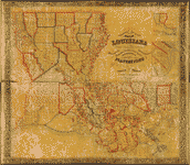 La Tourrette's reference map of the state of Louisiana : from the original surveys of the United States, which show the townships, sections, or mile ...
Contributor:
La Tourrette, John
Site:
American Memory-cultural, Main Catalog
Original Format:
Map
Date:
1848
View catalog record
La Tourrette's reference map of the state of Louisiana : from the original surveys of the United States, which show the townships, sections, or mile ...
Contributor:
La Tourrette, John
Site:
American Memory-cultural, Main Catalog
Original Format:
Map
Date:
1848
View catalog record
-
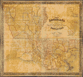 La Tourrette's reference map of the state of Louisiana : from the original surveys of the United States, which show the townships, sections, or mile ...
Contributor:
La Tourrette, John
Site:
American Memory-cultural, Main Catalog
Original Format:
Map
Date:
1853
View catalog record
La Tourrette's reference map of the state of Louisiana : from the original surveys of the United States, which show the townships, sections, or mile ...
Contributor:
La Tourrette, John
Site:
American Memory-cultural, Main Catalog
Original Format:
Map
Date:
1853
View catalog record
You might also like
-
-
 All varieties of tubers were preserved by the Labor Rehabilitation families. Here a young wife is picking up potatoes for storage for winter. Southeast Missouri
Contributor:
Strong
Site:
Prints & Photographs
Original Format:
Photo, Print, Drawing
Date:
1935
All varieties of tubers were preserved by the Labor Rehabilitation families. Here a young wife is picking up potatoes for storage for winter. Southeast Missouri
Contributor:
Strong
Site:
Prints & Photographs
Original Format:
Photo, Print, Drawing
Date:
1935
-
 Families who received grants under the Labor Rehabilitation Program agreed to build food storages to preserve canned foods, set at eighty quarts per person. Here ...
Contributor:
Strong
Site:
Prints & Photographs
Original Format:
Photo, Print, Drawing
Date:
1935
Families who received grants under the Labor Rehabilitation Program agreed to build food storages to preserve canned foods, set at eighty quarts per person. Here ...
Contributor:
Strong
Site:
Prints & Photographs
Original Format:
Photo, Print, Drawing
Date:
1935
-
 Farm workers in Southeastern Missouri augumenting their sparse income by growing their own food in a spring garden. (Labor Rehabilitation Program)
Contributor:
Dryden
Site:
Prints & Photographs
Original Format:
Photo, Print, Drawing
Date:
1935
Farm workers in Southeastern Missouri augumenting their sparse income by growing their own food in a spring garden. (Labor Rehabilitation Program)
Contributor:
Dryden
Site:
Prints & Photographs
Original Format:
Photo, Print, Drawing
Date:
1935
-

 Vindication of Major General John C. Fremont : against the attacks of the slave power and its allies /
Contributor:
Shanks, John Peter Clever
Site:
Main Catalog
Original Format:
Book
Date:
1862
Vindication of Major General John C. Fremont : against the attacks of the slave power and its allies /
Contributor:
Shanks, John Peter Clever
Site:
Main Catalog
Original Format:
Book
Date:
1862
-
 Directions taken from an act passed in the state of Louisiana providing for the inspection of beef and pork in the City of New Orleans ...
Contributor:
Louisiana. Laws, statutes, etc
Site:
American Memory-cultural
Original Format:
Book
Directions taken from an act passed in the state of Louisiana providing for the inspection of beef and pork in the City of New Orleans ...
Contributor:
Louisiana. Laws, statutes, etc
Site:
American Memory-cultural
Original Format:
Book
