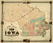
Map
A new map of Iowa : accompanied with notes by W. Barrows /

| Format |
Map |
|---|---|
| Contributors |
Barrows, Willard |
| Dates |
1845 |
| Location |
Iowa United States |
| Language |
English |
| Subjects |
Indians of North America Iowa United States |
- Title
- A new map of Iowa : accompanied with notes by W. Barrows /
- Description
-
Also shows territory occupied by Native American tribes.
-
Prime meridians: Greenwich and Washington, D.C.
-
Includes ill.
-
Available also through the Library of Congress Web site as a raster image.
-
Mounted on cloth, mounted on paper. DLC
-
LC copy imperfect: Wanting notes. DLC
-
1 map : hand col. ; 46 x 58 cm.
- Creator
- Barrows, Willard,
- Created Published
-
Cincinnati : Engraved & published by Doolittle & Munson, 1845.
- Subject Headings
-
-
Iowa
-
-
Indians of North America--Iowa
-
-
United States--Iowa.
- Notes
-
-
Also shows territory occupied by Native American tribes.
-
-
Prime meridians: Greenwich and Washington, D.C.
-
-
Includes ill.
-
-
Available also through the Library of Congress Web site as a raster image.
-
-
Mounted on cloth, mounted on paper. DLC
-
-
LC copy imperfect: Wanting notes. DLC
- Medium
-
1 map : hand col. ; 46 x 58 cm.
- Call Number
-
G4150 1845 .B3
- Repository
-
Library of Congress Geography and Map Division Washington, D.C. 20540-4650 USA dcu
- Digital Id
-
g4150 ct002299 http://hdl.loc.gov/loc.gmd/g4150.ct002299
- Library of Congress Catalog Number
- 2007626856
Rights & Access
The maps in the Map Collections materials were either published prior to 1922, produced by the United States government, or both (see catalogue records that accompany each map for information regarding date of publication and source). The Library of Congress is providing access to these materials for educational and research purposes and is not aware of any U.S. copyright protection (see Title 17 of the United States Code) or any other restrictions in the Map Collection materials.
Note that the written permission of the copyright owners and/or other rights holders (such as publicity and/or privacy rights) is required for distribution, reproduction, or other use of protected items beyond that allowed by fair use or other statutory exemptions. Responsibility for making an independent legal assessment of an item and securing any necessary permissions ultimately rests with persons desiring to use the item.
More about Copyright and other Restrictions
For guidance about compiling full citations consult Citing Primary Sources.
Part of...
-
General Maps
[2477]
-
Geography And Maps Division
[60803]
-
American Memory
[1121009]
More maps like this
-
 Map of Iowa exhibiting the townships, cities, villages post offices, railroads, common roads & other improvements.
Contributor:
Mendenhall, Edward
Site:
American Memory-cultural, Main Catalog
Original Format:
Map
Date:
1855
View catalog record
Map of Iowa exhibiting the townships, cities, villages post offices, railroads, common roads & other improvements.
Contributor:
Mendenhall, Edward
Site:
American Memory-cultural, Main Catalog
Original Format:
Map
Date:
1855
View catalog record
-
 Sectional map of the state of Iowa, compiled from the United States surveys also exhibiting the internal improvements, distances between towns & villages, lines of ...
Contributor:
Carleton, Guy H.
Site:
American Memory-cultural, Main Catalog
Original Format:
Map
Date:
1850
View catalog record
Sectional map of the state of Iowa, compiled from the United States surveys also exhibiting the internal improvements, distances between towns & villages, lines of ...
Contributor:
Carleton, Guy H.
Site:
American Memory-cultural, Main Catalog
Original Format:
Map
Date:
1850
View catalog record
-
 Galbraith's railway mail service maps, Iowa.
Contributor:
Galbraith, Frank H.
Site:
American Memory-cultural, Main Catalog
Original Format:
Map
Date:
1897
View catalog record
Galbraith's railway mail service maps, Iowa.
Contributor:
Galbraith, Frank H.
Site:
American Memory-cultural, Main Catalog
Original Format:
Map
Date:
1897
View catalog record
-
 Railroad map of Iowa.
Contributor:
Iowa. Railroad Commissioners
Site:
American Memory-cultural, Main Catalog
Original Format:
Map
Date:
1881
View catalog record
Railroad map of Iowa.
Contributor:
Iowa. Railroad Commissioners
Site:
American Memory-cultural, Main Catalog
Original Format:
Map
Date:
1881
View catalog record
-
 Parker's sectional & geological map of Iowa exhibiting her iron, lead, copper, coal and other geological resources and all rail roads completed in progress, and ...
Contributor:
Parker, Nathan H.
Site:
American Memory-cultural, Main Catalog
Original Format:
Map
Date:
1856
View catalog record
Parker's sectional & geological map of Iowa exhibiting her iron, lead, copper, coal and other geological resources and all rail roads completed in progress, and ...
Contributor:
Parker, Nathan H.
Site:
American Memory-cultural, Main Catalog
Original Format:
Map
Date:
1856
View catalog record
-
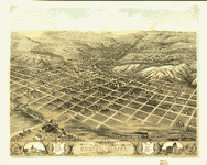 Bird's eye view of the city of Council Bluffs, Pottawattamie Co., Iowa 1868.
Contributor:
Ruger, A.
Site:
American Memory-cultural, Main Catalog
Original Format:
Map
Date:
1868
View catalog record
Bird's eye view of the city of Council Bluffs, Pottawattamie Co., Iowa 1868.
Contributor:
Ruger, A.
Site:
American Memory-cultural, Main Catalog
Original Format:
Map
Date:
1868
View catalog record
-
 Bird's eye view of Guttenberg, Clayton County, Iowa 1869.
Contributor:
Ruger, A.
Site:
American Memory-cultural, Main Catalog
Original Format:
Map
Date:
1869
View catalog record
Bird's eye view of Guttenberg, Clayton County, Iowa 1869.
Contributor:
Ruger, A.
Site:
American Memory-cultural, Main Catalog
Original Format:
Map
Date:
1869
View catalog record
-
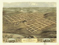
 Bird's eye view of the city of Marengo, Iowa Co., Iowa 1868.
Contributor:
Ruger, A.
Site:
American Memory-cultural, Main Catalog
Original Format:
Map
Date:
1868
View catalog record
Bird's eye view of the city of Marengo, Iowa Co., Iowa 1868.
Contributor:
Ruger, A.
Site:
American Memory-cultural, Main Catalog
Original Format:
Map
Date:
1868
View catalog record
-
 Birds eye view of the city of De Witt, Clinton Co., Iowa 1868.
Contributor:
Ruger, A.
Site:
American Memory-cultural, Main Catalog
Original Format:
Map
Date:
1868
View catalog record
Birds eye view of the city of De Witt, Clinton Co., Iowa 1868.
Contributor:
Ruger, A.
Site:
American Memory-cultural, Main Catalog
Original Format:
Map
Date:
1868
View catalog record
-
 Bird's eye view of the city of Marshalltown, Marshall Co., Iowa 1868.
Contributor:
Ruger, A.
Site:
American Memory-cultural, Main Catalog
Original Format:
Map
Date:
1868
View catalog record
Bird's eye view of the city of Marshalltown, Marshall Co., Iowa 1868.
Contributor:
Ruger, A.
Site:
American Memory-cultural, Main Catalog
Original Format:
Map
Date:
1868
View catalog record
-
 Bird's eye view of Blairstown, Benton Co., Iowa 1868.
Contributor:
Ruger, A.
Site:
American Memory-cultural, Main Catalog
Original Format:
Map
Date:
1868
View catalog record
Bird's eye view of Blairstown, Benton Co., Iowa 1868.
Contributor:
Ruger, A.
Site:
American Memory-cultural, Main Catalog
Original Format:
Map
Date:
1868
View catalog record
-
 Bird's eye view of the city of Des Moines, the capital of Iowa 1868.
Contributor:
Ruger, A.
Site:
American Memory-cultural, Main Catalog
Original Format:
Map
Date:
1868
View catalog record
Bird's eye view of the city of Des Moines, the capital of Iowa 1868.
Contributor:
Ruger, A.
Site:
American Memory-cultural, Main Catalog
Original Format:
Map
Date:
1868
View catalog record
-
 Bird's eye view of the city of Montana, Boone Co., Iowa 1868.
Contributor:
Ruger, A.
Site:
American Memory-cultural, Main Catalog
Original Format:
Map
Date:
1868
View catalog record
Bird's eye view of the city of Montana, Boone Co., Iowa 1868.
Contributor:
Ruger, A.
Site:
American Memory-cultural, Main Catalog
Original Format:
Map
Date:
1868
View catalog record
-
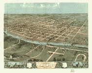 Bird's eye view of Iowa City, Johnson Co., Iowa 1868.
Contributor:
Ruger, A.
Site:
American Memory-cultural, Main Catalog
Original Format:
Map
Date:
1868
View catalog record
Bird's eye view of Iowa City, Johnson Co., Iowa 1868.
Contributor:
Ruger, A.
Site:
American Memory-cultural, Main Catalog
Original Format:
Map
Date:
1868
View catalog record
-
 Decorah, Winneshiek County, Iowa 1870.
Contributor:
Ruger, A.
Site:
American Memory-cultural, Main Catalog
Original Format:
Map
Date:
1870
View catalog record
Decorah, Winneshiek County, Iowa 1870.
Contributor:
Ruger, A.
Site:
American Memory-cultural, Main Catalog
Original Format:
Map
Date:
1870
View catalog record
-
 Bird's eye view of the city of Lyons, Clinton Co., Iowa 1868.
Contributor:
Ruger, A.
Site:
American Memory-cultural, Main Catalog
Original Format:
Map
Date:
1868
View catalog record
Bird's eye view of the city of Lyons, Clinton Co., Iowa 1868.
Contributor:
Ruger, A.
Site:
American Memory-cultural, Main Catalog
Original Format:
Map
Date:
1868
View catalog record
You might also like
-

 The Spirit Lake Massacre,
Contributor:
Teakle, Thomas
Site:
Main Catalog
Original Format:
Book
Date:
1918
The Spirit Lake Massacre,
Contributor:
Teakle, Thomas
Site:
Main Catalog
Original Format:
Book
Date:
1918
-
John Brown among the Quakers, and other sketches,
Contributor:
Richman, Irving Berdine
Site:
Main Catalog
Original Format:
Book
Date:
1894
-
John Brown among the Quakers, and other sketches,
Contributor:
Richman, Irving Berdine
Site:
Main Catalog
Original Format:
Book
Date:
1897
-
 Interview with Lauren Hickman, Iowa, November 9, 2001
Contributor:
unidentified, Hickman, Lauren
Site:
American Memory-cultural
Original Format:
Audio
Date:
2001-11-09
Interview with Lauren Hickman, Iowa, November 9, 2001
Contributor:
unidentified, Hickman, Lauren
Site:
American Memory-cultural
Original Format:
Audio
Date:
2001-11-09
-
 Portraits and scenes of Northeastern tribes and individuals
Site:
Prints & Photographs
Original Format:
Photo, Print, Drawing
Date:
1894
Portraits and scenes of Northeastern tribes and individuals
Site:
Prints & Photographs
Original Format:
Photo, Print, Drawing
Date:
1894
-
 [Children and teachers posed outside of Mesquakie Day School, near Toledo, Iowa]
Site:
Prints & Photographs, Main Catalog
Original Format:
Photo, Print, Drawing
Date:
1909
View catalog record
[Children and teachers posed outside of Mesquakie Day School, near Toledo, Iowa]
Site:
Prints & Photographs, Main Catalog
Original Format:
Photo, Print, Drawing
Date:
1909
View catalog record