Map
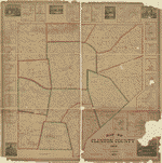
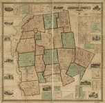
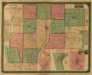
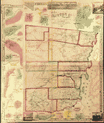
Map of Clinton County, Ohio /
| Format |
Map |
|---|---|
| Contributors |
Walling, Henry Francis |
| Dates |
1859 |
| Location |
Clinton County Ohio United States |
| Language |
English |
| Subjects |
Clinton County Landowners Ohio Real Property United States |
- Title
- Map of Clinton County, Ohio /
- Description
-
"Entered according to Act of Congress in the year 1858 by HF Walling in the clerks office of the District Court of the United States for the Southern District of New York."
-
LC Land ownership maps, 608
-
Available also through the Library of Congress Web site as a raster image.
-
Includes insets Sligo (Adams), New Burlington (Chester), Reesville (Richland), Cuba (Washington), Martinsville (Clark), Lumberton (Liberty), Port William (Liberty), Westborough (Jefferson), Gurneyville (Liberty & Union), Bloomington (Wilson), Blanchester (Marion), Sabina (Richland), Centreville (Wayne), Burtonville (Union), New Vienna (Green), Clarksville (Vernon), and Wilmington (Union).
-
1 map : color ; 53 x 54 cm
- Creator
- Walling, Henry Francis, 1825-1888.
- Subject Headings
-
-
Landowners--Ohio
-
-
Real property--Ohio
-
-
United States--Ohio--Clinton County.
- Notes
-
-
"Entered according to Act of Congress in the year 1858 by HF Walling in the clerks office of the District Court of the United States for the Southern District of New York."
-
-
LC Land ownership maps, 608
-
-
Available also through the Library of Congress Web site as a raster image.
-
-
Includes insets Sligo (Adams), New Burlington (Chester), Reesville (Richland), Cuba (Washington), Martinsville (Clark), Lumberton (Liberty), Port William (Liberty), Westborough (Jefferson), Gurneyville (Liberty & Union), Bloomington (Wilson), Blanchester (Marion), Sabina (Richland), Centreville (Wayne), Burtonville (Union), New Vienna (Green), Clarksville (Vernon), and Wilmington (Union).
- Medium
-
1 map : color ; 53 x 54 cm
- Call Number
-
G4083.C5G46 1859 .W3
- Repository
-
Library of Congress Geography and Map Division Washington, D.C. 20540-4650 USA dcu
- Digital Id
-
g4083c la000608 http://hdl.loc.gov/loc.gmd/g4083c.la000608
Rights & Access
The maps in the Map Collections materials were either published prior to 1922, produced by the United States government, or both (see catalogue records that accompany each map for information regarding date of publication and source). The Library of Congress is providing access to these materials for educational and research purposes and is not aware of any U.S. copyright protection (see Title 17 of the United States Code) or any other restrictions in the Map Collection materials.
Note that the written permission of the copyright owners and/or other rights holders (such as publicity and/or privacy rights) is required for distribution, reproduction, or other use of protected items beyond that allowed by fair use or other statutory exemptions. Responsibility for making an independent legal assessment of an item and securing any necessary permissions ultimately rests with persons desiring to use the item.
More about Copyright and other Restrictions
For guidance about compiling full citations consult Citing Primary Sources.
Part of...
-
Cultural Landscapes
[1623]
-
Geography And Maps Division
[60803]
-
American Memory
[1121009]
More maps like this
-
 Map of the counties of Franklin and Grand Isle, Vermont : from actual surveys /
Contributor:
Walling, Henry Francis
Site:
American Memory-cultural, Main Catalog
Original Format:
Map
Date:
1857
View catalog record
Map of the counties of Franklin and Grand Isle, Vermont : from actual surveys /
Contributor:
Walling, Henry Francis
Site:
American Memory-cultural, Main Catalog
Original Format:
Map
Date:
1857
View catalog record
-
 Map of Wayne County, New York /
Contributor:
Walling, Henry Francis
Site:
American Memory-cultural, Main Catalog
Original Format:
Map
Date:
1853
View catalog record
Map of Wayne County, New York /
Contributor:
Walling, Henry Francis
Site:
American Memory-cultural, Main Catalog
Original Format:
Map
Date:
1853
View catalog record
-
 Map of Addison County, Vermont /
Contributor:
Walling, Henry Francis
Site:
American Memory-cultural, Main Catalog
Original Format:
Map
Date:
1857
View catalog record
Map of Addison County, Vermont /
Contributor:
Walling, Henry Francis
Site:
American Memory-cultural, Main Catalog
Original Format:
Map
Date:
1857
View catalog record
-
 Map of Norfolk County, Massachusetts /
Contributor:
Walling, Henry Francis
Site:
American Memory-cultural
Original Format:
Map
Date:
1853
Map of Norfolk County, Massachusetts /
Contributor:
Walling, Henry Francis
Site:
American Memory-cultural
Original Format:
Map
Date:
1853
-
 Map of the county of Hampshire, Massachusetts /
Contributor:
Walling, Henry Francis
Site:
American Memory-cultural
Original Format:
Map
Date:
1860
Map of the county of Hampshire, Massachusetts /
Contributor:
Walling, Henry Francis
Site:
American Memory-cultural
Original Format:
Map
Date:
1860
-
 Map of Middlesex County, Connecticut.
Contributor:
Walling, Henry Francis
Site:
American Memory-cultural, Main Catalog
Original Format:
Map
Date:
1859
View catalog record
Map of Middlesex County, Connecticut.
Contributor:
Walling, Henry Francis
Site:
American Memory-cultural, Main Catalog
Original Format:
Map
Date:
1859
View catalog record
-
 Map of New London County, Connecticut.
Contributor:
Walling, Henry Francis
Site:
American Memory-cultural, Main Catalog
Original Format:
Map
Date:
1854
View catalog record
Map of New London County, Connecticut.
Contributor:
Walling, Henry Francis
Site:
American Memory-cultural, Main Catalog
Original Format:
Map
Date:
1854
View catalog record
-
 Topographical map of Centre Co., Pennsylvania : from actual surveys /
Contributor:
Walling, Henry Francis
Site:
American Memory-cultural, Main Catalog
Original Format:
Map
Date:
1861
View catalog record
Topographical map of Centre Co., Pennsylvania : from actual surveys /
Contributor:
Walling, Henry Francis
Site:
American Memory-cultural, Main Catalog
Original Format:
Map
Date:
1861
View catalog record
-
 Map of the town of Braintree, Norfolk County, Mass. /
Contributor:
Walling, Henry Francis
Site:
American Memory-cultural, Main Catalog
Original Format:
Map
Date:
1856
View catalog record
Map of the town of Braintree, Norfolk County, Mass. /
Contributor:
Walling, Henry Francis
Site:
American Memory-cultural, Main Catalog
Original Format:
Map
Date:
1856
View catalog record
-
 Map of the town of Medfield /
Contributor:
Walling, Henry Francis
Site:
American Memory-cultural
Original Format:
Map
Date:
1852
Map of the town of Medfield /
Contributor:
Walling, Henry Francis
Site:
American Memory-cultural
Original Format:
Map
Date:
1852
-
 Map of the city of Augusta, capital of the state of Maine /
Contributor:
Walling, Henry Francis
Site:
American Memory-cultural, Main Catalog
Original Format:
Map
Date:
1851
View catalog record
Map of the city of Augusta, capital of the state of Maine /
Contributor:
Walling, Henry Francis
Site:
American Memory-cultural, Main Catalog
Original Format:
Map
Date:
1851
View catalog record
-
 Map of Chittenden County, Vermont : from actual surveys /
Contributor:
Walling, Henry Francis
Site:
American Memory-cultural, Main Catalog
Original Format:
Map
Date:
1857
View catalog record
Map of Chittenden County, Vermont : from actual surveys /
Contributor:
Walling, Henry Francis
Site:
American Memory-cultural, Main Catalog
Original Format:
Map
Date:
1857
View catalog record
-
 Map of Ontario County, New York : from actual surveys /
Contributor:
Walling, Henry Francis
Site:
American Memory-cultural, Main Catalog
Original Format:
Map
Date:
1852
View catalog record
Map of Ontario County, New York : from actual surveys /
Contributor:
Walling, Henry Francis
Site:
American Memory-cultural, Main Catalog
Original Format:
Map
Date:
1852
View catalog record
-
 20th century atlas of Clinton County, Indiana : containing maps of villages, cities and townships of the county, of the state, United States and world, ...
Contributor:
Middle-West Publishing Co
Site:
American Memory-cultural, Main Catalog
Original Format:
Map
Date:
1903
View catalog record
20th century atlas of Clinton County, Indiana : containing maps of villages, cities and townships of the county, of the state, United States and world, ...
Contributor:
Middle-West Publishing Co
Site:
American Memory-cultural, Main Catalog
Original Format:
Map
Date:
1903
View catalog record
-
 Map of Clinton Co., New York /
Contributor:
Ligowsky, A.
Site:
American Memory-cultural, Main Catalog
Original Format:
Map
Date:
1856
View catalog record
Map of Clinton Co., New York /
Contributor:
Ligowsky, A.
Site:
American Memory-cultural, Main Catalog
Original Format:
Map
Date:
1856
View catalog record
You might also like
-
 E. Harris House, State Route No. 73, New Vienna, Clinton County, OH
Contributor:
Historic American Buildings Survey
Site:
Prints & Photographs
Original Format:
Photo, Print, Drawing
E. Harris House, State Route No. 73, New Vienna, Clinton County, OH
Contributor:
Historic American Buildings Survey
Site:
Prints & Photographs
Original Format:
Photo, Print, Drawing
-
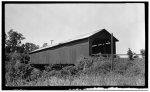 Covered Bridge, Route 3, Clarksville, Clinton County, OH
Contributor:
Historic American Buildings Survey
Site:
Prints & Photographs
Original Format:
Photo, Print, Drawing
Covered Bridge, Route 3, Clarksville, Clinton County, OH
Contributor:
Historic American Buildings Survey
Site:
Prints & Photographs
Original Format:
Photo, Print, Drawing
-
 Midland School Building, Northwest corner of Broadway & Cuba Avenue, Midland, Clinton County, OH
Contributor:
Historic American Buildings Survey
Site:
Prints & Photographs
Original Format:
Photo, Print, Drawing
Midland School Building, Northwest corner of Broadway & Cuba Avenue, Midland, Clinton County, OH
Contributor:
Historic American Buildings Survey
Site:
Prints & Photographs
Original Format:
Photo, Print, Drawing
-
 Laymon Road Bridge, J. W. Denver Williams Park, Wilmington, Clinton County, OH
Contributor:
Historic American Engineering Record, Davenport, Joseph, Massillion Bridge Company, Madrid
Site:
Prints & Photographs
Original Format:
Photo, Print, Drawing
Laymon Road Bridge, J. W. Denver Williams Park, Wilmington, Clinton County, OH
Contributor:
Historic American Engineering Record, Davenport, Joseph, Massillion Bridge Company, Madrid
Site:
Prints & Photographs
Original Format:
Photo, Print, Drawing
-
1. GENERAL VIEW OF SOUTH (LEFT) AND EAST (RIGHT) FROM SOUTHEAST - E. Harris House, State Route No. 73, New Vienna, Clinton County, OH
Site:
Prints & Photographs
Original Format:
Photo, Print, Drawing
-
 2. DETAIL OF SOUTH (FRONT) ENTRANCE - E. Harris House, State Route No. 73, New Vienna, Clinton County, OH
Site:
Prints & Photographs
Original Format:
Photo, Print, Drawing
2. DETAIL OF SOUTH (FRONT) ENTRANCE - E. Harris House, State Route No. 73, New Vienna, Clinton County, OH
Site:
Prints & Photographs
Original Format:
Photo, Print, Drawing