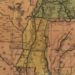

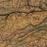
![A correct map of a section of the United States showing the allignment [sic] of the Pittsburgh, Marion, and Chicago Railway between Chewton, Penna. and Marion, Ohio and connections.](https://webarchive.library.unt.edu/web/20121101182714im_/http://www.loc.gov/collections/static/railroad-maps-1828-to-1900/images/rr005350.jpg)


Results
Refined by:
Part Of: Railroad Maps, 1828 1900-

New county and rail road map of the western states and valley of the Mississippi.
Scale [ca. 1:2,400,000].
Contributor: Watson, Gaylord Site: American Memory-cultural - Main Catalog Original Format: Map Date: 1874 View catalog record -

Lloyd's new map of the United States, the Canadas and New Brunswick, from the latest surveys, showing every railroad & station finished to June 1863, ...
Scale ca. 1:2,250,000.
Contributor: Lloyd, James T. Site: American Memory-cultural - Main Catalog Original Format: Map Date: 1863 View catalog record -

State of Alabama. October. 2nd. 1866.
Scale ca. 1:200,000.
Contributor: United States. General Land Office Site: American Memory-cultural - Main Catalog Original Format: Map Date: 1866 View catalog record -

Colton's railroad map (intermediate size) of the United States reduced from "Colton's railroad and commercial map of the United States."
Scale 1:2,217,600.
Contributor: G.W. & C.B. Colton & Co Site: American Memory-cultural - Main Catalog Original Format: Map Date: 1870 View catalog record -

Railroad map of the state of New York to accompany the twelfth annual report of the Board of Railroad Commissioners of the State of New ...
Scale not given.
Contributor: G.W. & C.B. Colton & Co Site: American Memory-cultural - Main Catalog Original Format: Map Date: 1894 View catalog record -

Map showing the line of the Virginia, Tennessee, & Georgia Air Line composed of the Shenandoah Valley R.R., Norfolk & Western R.R. and the East ...
Scale 1:3,800,000.
Contributor: G.W. & C.B. Colton & Co Site: American Memory-cultural - Main Catalog Original Format: Map Date: 1881 View catalog record -

New enlarged scale railroad and county map of California showing every railroad station and post office in the state.
Scale ca.1:1,200,000.
Contributor: Rand McNally and Company Site: American Memory-cultural - Main Catalog Original Format: Map Date: 1883 View catalog record -

Map of the Lexington and Big Sandy Railroad showing the connections, 1853, J. B. Westbrook, Chief Engineer.
Scale ca. 1:1,700,000.
Contributor: Westbrook, J. B. Site: American Memory-cultural - Main Catalog Original Format: Map Date: 1853 View catalog record -

New trans-continental map of the Pacific R.R. and routes of overland travel to Colorado, Nebraska, the Black Hills, Utah, Idaho, Nevada, Montana, California and the ...
Scale ca. 1:3,500,000.
Contributor: Williams, Henry T. Site: American Memory-cultural - Main Catalog Original Format: Map Date: 1877 View catalog record -

Sketch showing the route of the New Orleans, Opelousas & Great Western Rail Road, J. G. Gibbes, Chief Engr., lithographie [sic] agent D. Theuret, Exange ...
Scale 1:3,041,280.
Contributor: Okelomski, F. A. Site: American Memory-cultural - Main Catalog Original Format: Map Date: 1853 View catalog record -

Map showing the Delaware and North River Railroad and its connections between Kingston, Port Jarvis and Stroudsburg.
Scale ca. 1:1,250,000.
Contributor: G.W. & C.B. Colton & Co Site: American Memory-cultural - Main Catalog Original Format: Map Date: 1890 View catalog record -

Railway and county map of the Southern States; embracing the States of N. Carolina, S. Carolina, Georgia, Alabama, Florida, Mississippi, Louisiana, Arkansas, and Tennessee exhibiting ...
Scale ca. 1:1,950,000.
Contributor: Mendenhall, Edward Site: American Memory-cultural - Main Catalog Original Format: Map Date: 1864 View catalog record -

Galbraith's railway mail service maps, Michigan.
Scale not given.
Contributor: Galbraith, Frank H. Site: American Memory-cultural - Main Catalog Original Format: Map Date: 1897 View catalog record -

Coltons railroad map of part of the United States north of the 37th parallel embracing the country between the Atlantic Ocean and the 96th Meridian ...
Scale not given.
Contributor: G.W. & C.B. Colton & Co Site: American Memory-cultural - Main Catalog Original Format: Map Date: 1883 View catalog record -

Map of the various channels for conveying the trade of the north west to the Atlantic sea-board exhibiting the tributaries & drainage of the trade ...
Scale 1:3,800,000.
Contributor: Vaughan, David Site: American Memory-cultural - Main Catalog Original Format: Map Date: 1853 View catalog record -

St. Paul to Riviere des Lacs : from explorations and surveys /
Scale 1:1,200,000.
Contributor: Lambert, John Site: American Memory-cultural - Main Catalog Original Format: Map Date: 1859 View catalog record -

Map of the Marietta and Pittsburgh Railroad and its connections.
Scale 1:1,300,000.
Contributor: G.W. & C.B. Colton & Co Site: American Memory-cultural - Main Catalog Original Format: Map Date: 1871 View catalog record -

Chicago, Burlington & Quincy R.R. and intersecting lines, 1883.
Scale ca. 1:500,000.
Contributor: Rand McNally and Company Site: American Memory-cultural - Main Catalog Original Format: Map Date: 1883 View catalog record -

Indiana, Illinois, Missouri & Iowa with parts of adjoining states.
Scale 1:1,267,200; 20 statute miles to an in.
Contributor: Colton, G. Woolworth Site: American Memory-cultural - Main Catalog Original Format: Map Date: 1858 View catalog record -

Map of New York City, Brooklyn, and vicinity showing surface & elevated railroads in operation and proposed.
Scale ca. 1:30,000.
Contributor: G.W. & C.B. Colton & Co Site: American Memory-cultural - Main Catalog Original Format: Map Date: 1885 View catalog record