

![[Rough sketch of the Rich Mountain battle area extending from Beverly, W. Va. to Clarksburg].](https://webarchive.library.unt.edu/web/20121106205519im_/http://www.loc.gov/collections/static/hotchkiss-maps/images/cwh00078.jpg)


![[December 18, 1944], HQ Twelfth Army Group situation map.](https://webarchive.library.unt.edu/web/20121106205519im_/http://www.loc.gov/collections/static/world-war-II-maps-military-situation-maps-from-1944-to-1945/images/ict21197.jpg)
![[Map of Chancellorsville battlefield, May 3-4, 1863].](https://webarchive.library.unt.edu/web/20121106205519im_/http://www.loc.gov/collections/static/hotchkiss-maps/images/cwh00138.jpg)
![Plan général du Fort Septentrional du Detour des Anglois, tel qu'il est présentement : [Louisiana]](https://webarchive.library.unt.edu/web/20121106205519im_/http://www.loc.gov/collections/static/louisiana-european-explorations-and-the-louisiana-purchase/images/lh000949.jpg)


Results
Refined by:
Original Format: Map-

[September 28, 1944], HQ Twelfth Army Group situation map.
Available also through the Library of Congress web site as a raster image.
Contributor: Allied Forces. Army Group, 12th. Engineer Section Site: American Memory-cultural - Main Catalog Original Format: Map Date: 1944-09-28 View catalog record -

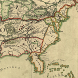
Stratford on Avon.
Bird's-eye view showing Shakespearean landmarks and other points of interest.
Contributor: Brown, J. Ross Site: American Memory-cultural - Main Catalog Original Format: Map Date: 1908 View catalog record -

Plan of the fort and fortress at Crown Point with their environs. With the disposition of the English Army under the command of Genl. Amherst ...
Scale 1:7,200; 200 yards to an in.
Site: American Memory-cultural - Main Catalog Original Format: Map Date: 1759 View catalog record -

Plano de la Bahía del Guantánamo en la costa del S. de la ya. de Cuba en la latd. N. de 20p0s y en 301p0s27ʹ ...
Relief shown pictorially. Depths shown by soundings.
Site: American Memory-cultural - Main Catalog Original Format: Map Date: 1700 View catalog record -

A map of Louisiana, with the course of the Missisipi, and the adjacent rivers, the nations of the natives, the French establishments and the mines; ...
Scale ca. 1:8,500,000.
Contributor: Le Page du Pratz Site: American Memory-cultural - Main Catalog Original Format: Map Date: 1763 View catalog record -

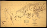
[Sketch of the battle of Rich Mountain, July 11-12, 1861].
Title from Stephenson's Civil War maps, 1989.
Site: American Memory-cultural - Main Catalog Original Format: Map Date: 1861 View catalog record -

Genl. Q. A. Gillmore's line of earthworks in front of Fort Wagner, Morris Island, S.C., July 1863
Color coding indicates the location of Union and Confederate forces.
Contributor: Sneden, Robert Knox Site: American Memory-cultural Original Format: Map Date: 1861 -

Routes of the Interborough Rapid Transit Company.
"J.W.G. 3/17/24".
Contributor: Interborough Rapid Transit Company Site: American Memory-cultural - Main Catalog Original Format: Map Date: 1924 View catalog record -

Sanborn Fire Insurance Map from Troy, Lincoln County, Missouri.
2 Sheet(s). Jun 1902.
Site: American Memory-cultural Original Format: Map Date: 1902-01-01 -

Map of a reconnoissance [sic] of the approaches to Philadelphia showing the positions and lines of defence on the west front of the city /
Topographic map of western Philadelphia and small adjacent parts of Montgomery and Delaware counties showing 1st- and 2nd-order Civil War earthworks and batteries.
Contributor: United States Coast Survey Site: American Memory-cultural - Main Catalog Original Format: Map Date: 1863 View catalog record -

A map of the state of Tennessee taken from survey /
Relief shown by hachures.
Contributor: Rhea, Matthew Site: American Memory-cultural - Main Catalog Original Format: Map Date: 1832 View catalog record -

Plano geométrico del Río Guayaquil desde el surgidero de la punta hasta la ciudad /
Shows Guayas River.
Site: American Memory-cultural - Main Catalog Original Format: Map Date: 1780 View catalog record -

Skhematicheskai︠a︡ karta Amurskoĭ oblasti /
Shows land areas allotted and occupied by peasants, areas already inspected, areas being inspected, areas occupied by Cossacks, and forest reserves.
Contributor: Zhivnerev Site: American Memory-cultural - Main Catalog Original Format: Map View catalog record -

Sanborn Fire Insurance Map from Bel Air, Harford County, Maryland.
7 Sheet(s). May 1921.
Site: American Memory-cultural Original Format: Map Date: 1921-01-01 -

Gray County, state of Texas.
Shows land ownership.
Contributor: Texas. General Land Office Site: American Memory-cultural - Main Catalog Original Format: Map Date: 1889 View catalog record -

Carte réduite du Golphe du Mexique et des isles de l'Amérique.
Scale ca. 1:12,000,000.
Contributor: Bellin, Jacques Nicolas Site: American Memory-cultural - Main Catalog Original Format: Map Date: 1764 View catalog record -

Map of Mount Desert Island and the coast of Maine.
Available also through the Library of Congress web site as a raster image.
Contributor: Rand Avery, Supply Co Site: American Memory-cultural - Main Catalog Original Format: Map View catalog record -

Sanborn Fire Insurance Map from Newnan, Coweta County, Georgia.
3 Sheet(s). Apr 1889.
Site: American Memory-cultural Original Format: Map Date: 1889-01-01 -
Map of wagon routes in Utah Territory [] / explored & opened by Capt. J.H. Simpson topl. engrs. U.S.A. Assisted by Lieuts. J. L. K. ...
1:1,000,000
Contributor: Simpson, J. H. (James Hervey) Site: American Memory-cultural Original Format: Map Date: 1876 -

Africa, population density.
Scale ca. 1:48,000,000.
Contributor: [United States. Central Intelligence Agency] Site: American Memory-cultural - Main Catalog Original Format: Map Date: 1979 View catalog record