

Periods of rain and mountain snow will continue in the Pacific Northwest through Sunday as a cold front moves across the region. Winter Storm Watches are now in effect for the Northern Sierra Mountains for Monday as a strong storm brings the first snows of the season. Coastal locations in California will receive their first significant rainfall event as this storm moves inland on Monday.
Read More...
These images show the most recent image of the United States, from NOAA geostationary (GOES) satellites. They are generated every 30 minutes using either the Visible, Infrared, Shortwave Infrared (4um), or the Water Vapor images into one larger composite image using GOES East and West Imagers.
Other Areas: Alaska | Hawaii | Guam | Puerto Rico | American Samoa
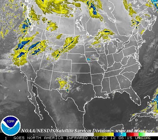
This image is taken in the infrared band of light and show relative warmth of objects. Colder objects are brighter and warmer objects are darker. Lower layers of clouds, generally warmer and lower in altitude, are colored gray. Colder and generally higher clouds tops are highlighted in colors. Infrared imagery is useful for determining cloud features both at day and night.
This image is taken in visible light, or how the human eye would see from the satellite. Sunrise and set can be tracked in this image.

This image is taken using a wavelength sensitive to the content of water vapor in the atmosphere. Bright and colored areas indicate high water vapor (moisture) content (colored and white areas indicate the presence of both high moisture content and/or ice crystals). Black and brown areas indicate little or no moisture present. Water vapor imagery is useful for both determining locations of moisture and atmospheric circulations.

This infrared image of Alaska is normally updated every 30 minutes.

This infrared image of Hawaii is normally updated every 30 minutes.
This infrared image of Guam is normally updated every 30 minutes.

This infrared image of Puerto Rico is normally updated every 30 minutes.

This infrared image of American Samoa is normally updated every 30 minutes.

