Mysteries of Sonoran Desert life are slowly revealed and abundantly displayed at Organ Pipe Cactus National Monument. This International Biosphere Reserve, is an ecorich collection of plants and animals that have adapted to living throughout this surprisingly diverse geological landscape. Scenic drives, wilderness hikes and camping can lead to unravelling the mysteries that await your discovery.
Photo: National Park Service
Yosemite Falls is flowing again! Thanks to recent rain and snow, it should continue flowing at least until mid to late summer next year.
Rising above a scene rich with extraordinary wildlife, pristine lakes, and alpine terrain, the Teton Range stands monument to the people who fought to protect it. These are mountains of the imagination. Mountains that led to the creation of Grand Teton National Park where you can explore over two hundred miles of trails, float the Snake River or enjoy the serenity of this remarkable place.
Photo: D. Lehle, National Park Service
Red Rock Canyon was designated as Nevada’s first National Conservation Area. Red Rock Canyon is located 17 miles west of the Las Vegas Strip on Charleston Boulevard/State Route 159. The area is 195,819 acres and is visited by more than one million people each year. In marked contrast to a town geared to entertainment and gaming, Red Rock Canyon offers enticements of a different nature including a 13-mile scenic drive, more than 30 miles of hiking trails, rock climbing, horseback riding, mountain biking, road biking, picnic areas, nature observing and visitor center with exhibit rooms and a book store.
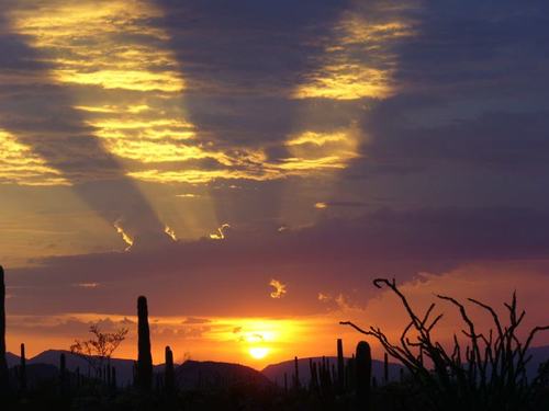
The summer night sky in the Piper Mountain Wilderness Area in Inyo County, California. Alluvial fans cover large portions of the eastern side of the wilderness, with plains and hills also part of the landscape. Desert bighorn sheep habitat can be found in three areas within this wilderness. Sagebrush and juniper-pinyon woodland are the common vegetation, with conifer trees on the higher elevations. At the base of the Inyo Mountains lies one of the northernmost stands of Joshua trees, as seen in this picture. Piper Mountain Wilderness and many other BLM land areas are far from city lights and offer incredible night sky viewing opportunities.
Photo credit: Bob Wick, BLM-California
If you are not following the mypubliclands Tumblr, we suggest you go over and do so today. They’re posting a lot of great photos (like the ones posted here) from lands managed by the Bureau of Land Management (which is part of the Department of the Interior.
Alaska Autumn foliage offers amazing colors and spectacular scenery. The changing of leaves makes for one of the most popular getaways for families. Checkout www.blm.gov/ak for fantastic Fall camping ideas. (Photos: Matt Vos and Craig McCaa)
-Matt Vos
Rising above a scene rich with extraordinary wildlife, pristine lakes, and alpine terrain, the Teton Range stands monument to the people who fought to protect it. These are mountains of the imagination. Mountains that led to the creation of Grand Teton National Park where you can explore over two hundred miles of trails, float the Snake River or enjoy the serenity of this remarkable place.
Photo: D. Lehle
As part of President Obama’s initiative to fuel the economy and create jobs by promoting travel and tourism, the administration today announced a new design, improved navigation tools and expanded content for Recreation.Gov, the interagency website that guides visitors to 90,000 sites on federal lands such as national parks, wildlife refuges, waterways, forests and recreation areas.
The redesign of www.recreation.gov is an initial step in a multi-year strategy to engage visitors with enhanced interactive content and more multimedia, mobile, trip-planning tools. The seven million visitors who use the web site every year will be able to make reservations, see ready-made itineraries for destination cities, and search for activities on an interactive map.
We put together this short video to show all the amazing places you can visit through www.recreation.gov.
The majestic South Fork of the Snake River flows 66 miles across southeastern Idaho, through high mountain valleys, rugged canyons, and broad flood plains to its confluence with the Henry’s Fork near Menan Buttes. Since 1985, the river has been eligible for inclusion in the nation’s Wild and Scenic River System.
The South Fork supports the largest riparian cottonwood gallery forest in the West and is among the most unique and diverse ecosystems in Idaho. It is also home to 126 bird species, including 21 raptors, meriting a “National Important Bird Area” designation. The river also supports the largest native cutthroat fishery outside of Yellowstone National Park. The corridor is also home for an impressive array of other wildlife including moose, deer, elk, mountain goats, mountain lions, black bears, bobcats, coyotes, river otter, beaver, fox, and mink.
Among recreationists throughout the country, the South Fork is known as a premier blue ribbon trout fishery, and was selected as the host site for the 1997 World Fly-Fishing Championship. More than 300,000 visitors each year enjoy fishing, camping, hiking, and boating.
Photo: Bureau of Land Management
This is the Birch Creek area along the National Landscape Conservation System’s Nez Perce National Historic Trail. Congress established the Nez Perce National Historic Trail in 1986. The trail stretches from Wallowa Lake, Oregon and across Idaho to the Bear Paw National Historic Trail in Chinook, Montana.


 Privacy