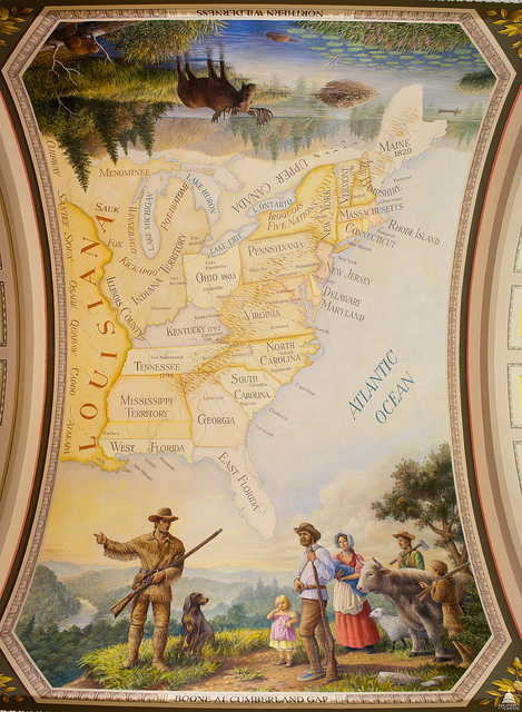
From the Atlantic Ocean to the Mississippi River
EverGreene Painting Studios
Oil on Canvas
1993-1994
Westward Expansion Corridor
Cox Corridors
The map shows the states and territories between the Atlantic Ocean
and the Mississippi River. Important cities (state capitals, trade
centers, or otherwise influential in westward expansion) are
indicated, and the names of Native American tribes appear to the north
and west.
This official Architect of the Capitol photograph is being made available for educational, scholarly, news or personal purposes (not advertising or any other commercial use). When any of these images is used the photographic credit line should read “Architect of the Capitol.” These images may not be used in any way that would imply endorsement by the Architect of the Capitol or the United States Congress of a product, service or point of view. For more information visit www.aoc.gov.


