![[Sketch of the Manassas battlefield].](https://webarchive.library.unt.edu/web/20121017064705im_/http://www.loc.gov/collections/static/hotchkiss-maps/images/cwh00108.jpg)


![[January 18, 1945], HQ Twelfth Army Group situation map.](https://webarchive.library.unt.edu/web/20121017064705im_/http://www.loc.gov/collections/static/world-war-II-maps-military-situation-maps-from-1944-to-1945/images/ict21228.jpg)


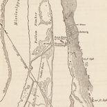
![[Detailed map of part of Virginia from Alexandria to the Potomac River above Washington, D.C. 1886].](https://webarchive.library.unt.edu/web/20121017064705im_/http://www.loc.gov/collections/static/civil-war-maps/images/cw0523000.jpg)


![[December 23, 1944], HQ Twelfth Army Group situation map.](https://webarchive.library.unt.edu/web/20121017064705im_/http://www.loc.gov/collections/static/world-war-II-maps-military-situation-maps-from-1944-to-1945/images/ict21202.jpg)


![[January 3, 1945], HQ Twelfth Army Group situation map.](https://webarchive.library.unt.edu/web/20121017064705im_/http://www.loc.gov/collections/static/world-war-II-maps-military-situation-maps-from-1944-to-1945/images/ict21213.jpg)
![Plan général du Fort Septentrional du Detour des Anglois, tel qu'il est présentement : [Louisiana]](https://webarchive.library.unt.edu/web/20121017064705im_/http://www.loc.gov/collections/static/louisiana-european-explorations-and-the-louisiana-purchase/images/lh000949.jpg)


Results
Refined by:
Original Format: Map-

A Plan of the Rosalij Compy. Estates, the property of His Excelly. Charles O'Harra, the Honble. Leiut. Gov. Will. Stuart, James Clarke & Rob. & ...
Scale ca. 1:3,960.
Site: American Memory-cultural - Main Catalog Original Format: Map Date: 1776 View catalog record -

A map illustrative of the route of the proposed railroad : from St. Louis to the Bay of San Francisco /
Scale ca. 1:3,000,000.
Contributor: Dearborn, W. L. Site: American Memory-cultural - Main Catalog Original Format: Map Date: 1850 View catalog record -

Map of the state of Nebraska showing the lands of the Burlington & Missouri Riv. R.R. Co. in Nebraska.
Scale ca. 1:1,000,000.
Contributor: G.W. & C.B. Colton & Co Site: American Memory-cultural - Main Catalog Original Format: Map Date: 1876 View catalog record -

A map of the most inhabited part of New England, containing the provinces of Massachusets Bay and New Hampshire, with the colonies of Conecticut and ...
Scale ca. 1:800,000.
Contributor: Bowles, Carington Site: American Memory-cultural - Main Catalog Original Format: Map Date: 1771 View catalog record -

Eastern China 1:50,000 /
"For use by War and Navy Department Agencies only"--On top of map.
Contributor: Great Britain. War Office Site: American Memory-cultural - Main Catalog Original Format: Map Date: 1927 View catalog record -

Carte generale des États Unis de l'Amerique Septentrionale, avec les limites de chacun des dits Etats, convenus par le traité provisional du mois de novembre ...
Scale ca. 1:3,330,000.
Contributor: Eliot, J. B. Site: American Memory-cultural - Main Catalog Original Format: Map Date: 1783 View catalog record -

Kashmir region.
"763537AI (R00744) 5-03."
Contributor: United States. Central Intelligence Agency Site: American Memory-cultural - Main Catalog Original Format: Map Date: 2003 View catalog record -

La Luisiana cedida al Rei N. S. por S. M. Christianisima, con la Nueva Orleans, è isla en que se halla esta ciudad. Construida sobre ...
Scale ca. 1:1,250,000.
Contributor: López de Vargas Machuca, Tomás - López de Vargas Machuca, Tomás Site: American Memory-cultural - Main Catalog Original Format: Map Date: 1762 View catalog record -

Ierusalem.
Relief shown pictorially.
Contributor: Jagen, Jan van Site: American Memory-cultural - Main Catalog Original Format: Map View catalog record -

[January 7, 1945], HQ Twelfth Army Group situation map.
Available also through the Library of Congress web site as a raster image.
Contributor: Allied Forces. Army Group, 12th. Engineer Section Site: American Memory-cultural - Main Catalog Original Format: Map Date: 1945-01-07 View catalog record -

Potomac River (in four sheets): Sheet no. 4, from Indian Head to Georgetown
Scale 1:40,000.
Contributor: United States Coast Survey Site: American Memory-cultural - Main Catalog Original Format: Map Date: 1864 View catalog record -

Aero view of Middletown, Connecticut 1915 /
Perspective map not drawn to scale.
Contributor: Fowler, T. M. Site: American Memory-cultural - Main Catalog Original Format: Map Date: 1915 View catalog record -

Zambia.
"Base 802737 (B00492) 2-01."
Contributor: United States. Central Intelligence Agency Site: American Memory-cultural - Main Catalog Original Format: Map Date: 2001 View catalog record -

N.W. parts of New York, no. 156.
Scale not given.
Site: American Memory-cultural - Main Catalog Original Format: Map Date: 1750 View catalog record -

Bird's eye view of Boston Harbor and South Shore to Provincetown : showing steamboat routes.
Title from cover.
Contributor: Federal Engraving and Publishing Co Site: American Memory-cultural - Main Catalog Original Format: Map Date: 1905 View catalog record -

French Guiana (France).
Also shows arrondissement boundaries.
Contributor: United States. Central Intelligence Agency Site: American Memory-cultural - Main Catalog Original Format: Map Date: 1992 View catalog record -

Nova carta do Brazil e da America portugueza, anno de 1821.
Relief shown by hachures.
Site: American Memory-cultural - Main Catalog Original Format: Map Date: 1821 View catalog record -

Bird's eye view of the 1881 city of Holyoke, and village of South Hadley Falls, Mass.
Perspective map not drawn to scale.
Contributor: Poole, A. F. Site: American Memory-cultural - Main Catalog Original Format: Map Date: 1881 View catalog record -

Carta esferica de la costa comprehendida desde Acapulco a Sn. Blas trabajada abordo de las corberas de la Marina Real Descubierta y Atrevida, año de ...
Shows coast of Mexico between Acapulco and San Blas.
Site: American Memory-cultural - Main Catalog Original Format: Map Date: 1791 View catalog record -

Map of St. Lawrence Co. New York /
Seventeen views.
Contributor: Rogerson, A. E. Site: American Memory-cultural Original Format: Map Date: 1858