Science Features
 Loading Page...
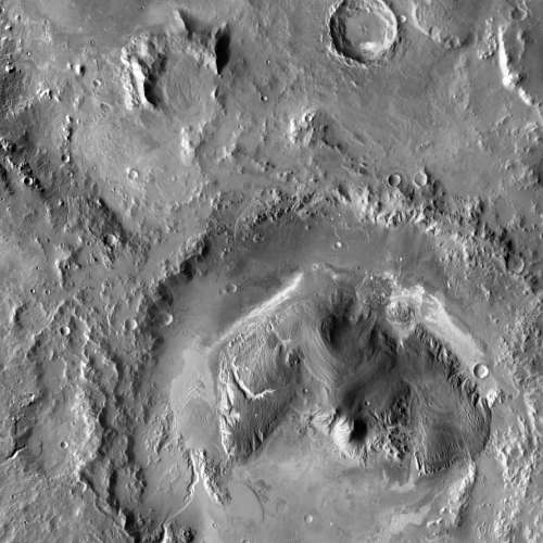
Carbon dioxide (CO2) is a major greenhouse gas and its concentrations in the atmosphere have increased and are contributing to global warming. USGS scientists are assessing the potential to remove CO2 from the atmosphere for storage in other Earth systems through a process called carbon sequestration. There are two primary approaches to carbon sequestration: 1) storing CO2 in underground rock formations, which is known as geologic carbon sequestration, and 2) storing carbon in vegetation, soils and sediments, which is known as biological carbon sequestration.
Research on carbon sequestration provides critical information for considering mitigation options for greenhouse gas emissions to the atmosphere and adaptation opportunities for climate change. These research and assessments activities are conducted under the requirements of the Energy Independence and Security Act of 2007 (P.L. 110-140).

This USGS graphic shows the concept of geologic carbon sequestration.
Geologic Carbon Sequestration:
USGS scientists are conducting a national assessment to assess the capacity to store CO2 in geologic formations. They will be using a USGS science-based methodology for this assessment. This USGS method will also serve as the first step in developing a global sequestration roadmap by the International Energy Agency and as an international standard for global geologic carbon sequestration assessment potential. In addition, the USGS is conducting research to understand what happens in the subsurface when CO2 is injected into rocks, to better understand the effects of this practice.
Biological Carbon Sequestration:
The USGS is working to create a series of national maps depicting annual carbon storage for U.S. ecosystems. This project will allow the United States to be the first nation in the world to complete such a cutting-edge biological assessment. This product will help land managers visualize and understand the effects of land use, management practices, and wildfire on carbon storage and greenhouse gas emissions. The USGS previously developed a science-based method for conducting a national assessment of biological carbon sequestration, and that is being used to produce these maps.

This USGS graphic shows the concept of biological carbon sequestration
For more information on the USGS methodology for geologic carbon sequestration, visit http://pubs.usgs.gov/of/2010/1127/. For more information on biological carbon sequestration, visit http://pubs.usgs.gov/sir/2010/5233/.
Contact: Jessica Robertson (703) 648-6624
While Curiosity investigates the Red Planet, USGS expertise will help protect the rover from hazards and analyze the data it transmits to Earth. Read more

These 3 young scientists have forged ahead with innovative research at the frontiers of science. Learn more
Maximizing alternative energy’s potential – how science can help grow the nation’s energy portfolio. Read more

Please comment on the USGS’ draft science strategies! Read more

Minerals are elementary to your everyday life, come find out how! Read more

The USGS released a new world estimate for conventional oil and gas resources.

Science or Soundbite? Is the recent increase in midcontinent earthquakes natural or man-made? Find out here.
Timing is everything! Consider helping track changes in spring’s arrival
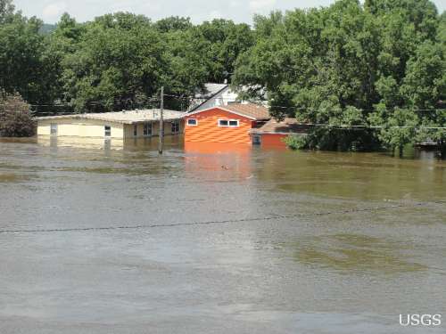
Flood Safety Awareness Week is March. 12-16. What can you do to prepare?
National Groundwater Awareness Week is Mar. 11-17, 2012. See how USGS science is connecting groundwater and surface water.

Five USGS employees honored with Distinguished Service Awards for their service to the nation

For the first time, the USGS has estimated the potential of undiscovered, technically recoverable oil and gas resources in source rocks of the Alaska North Slope.
The proposed USGS budget reflects research priorities to respond to nationally relevant issues, including water quantity and quality, ecosystem restoration, hydraulic fracturing, natural disasters such as floods and earthquakes, and support for the National Ocean Policy, and has a large R&D component.
It’s not just the U.S. military working to bring a better future to Afghanistan. How the USGS is helping
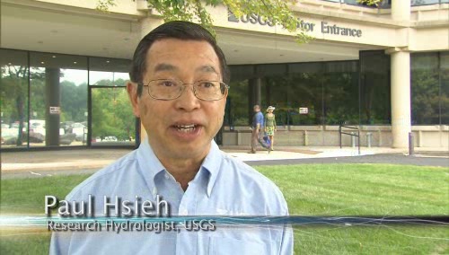
As the team of responders struggled to end the worst oil spill in our Nation’s history, USGS scientist Paul Hsieh provided the critical scientific information needed to make a crucial decision.

On September 11, 2001, as the twin towers of the World Trade Center exploded and collapsed, clouds of dust billowed into the sky and across the city.
Now that field work has wrapped up at the Ice Age "Snowmastodon" fossil site near Snowmass Village, Colo., USGS and other scientists will begin work on unraveling the climate and environmental history of the area.
USGS crews continue to measure streamflow and collect water quality and sediment samples in the Ohio and Mississippi River basins using state-of-art instruments.
For over 120 years, USGS has studied and mapped the National Capital region revealing a rich and diverse geologic past. Join us July 6 in Reston, Va., and learn the story of the formation and destruction of continents and oceans, the eruption of ancient volcanoes, climatic and sea level changes, as well as the hazards of modern landslides, earthquakes and karst.
Magnetic storms can cause loss of radio communication, affect global-positioning systems, damage satellite electronics and cause electrical blackouts. USGS scientists are constantly collecting geomagnetic data, and you can view new updates in near-real time.

The most recent earthquake in Japan affected water levels in groundwater wells all over the country. Water level fluctuations were recorded as far away as Illinois, Virginia, Missouri and Florida.

Soluble rock layers called “Karst” exist throughout the nation. While Karst aquifers produce half the nation’s drinking water, rock layers underneath karst dissolve easily sometimes creating sinkholes that threaten life and property. Join us May 4th to learn more about this unseen world beneath our feet.

Early maps of America, documents establishing the provenance of the Hope Diamond and documentation of explorations of the American West-- Join us in discovering the many treasures of the USGS Library.

Please answer questions about USGS Energy & Minerals science.
The need for multiple sources of energy, including the increasing demand for renewable energy, leads USGS scientists to study geothermal energy resources.
Demand for alternative energy sources leads scientists to consider microbes as potential sources of power.
Looking for information on natural resources, natural hazards, geospatial data, and more? The USGS Education site provides great resources, including lessons, data, maps, and more, to support teaching, learning, K-12 education, and university-level inquiry and research.
The USGS PAGER system (Prompt Assessment of Global Earthquakes for Response) will now include estimated economic loss and casualty information. This system is used by emergency responders, government and aid officials, and the public to understand the scope of the disaster to develop the best response.
USGS is playing a critical role in the federal government's coordinated Deepwater Horizon response efforts.
The USGS Science Strategy is a comprehensive report to critically examine the USGS's major science goals and priorities for the coming decade. The USGS is moving forward with these strategic science directions in response to the challenges that our Nation's future faces and for the stewards of our Federal lands.

The world's longest-running Earth-observing satellite program.

Dust storms July 21-22 blinded motorists, grounded flights and knocked out electricity. What’s causing the dust storms?

The majority of the nation is facing dry conditions; in most areas drought conditions are expected to persist or intensify. Read more

A contest to celebrate 40 years of Landsat. Read more
Please comment on the USGS’ draft science strategies! Read more
Timing is everything! Consider helping track changes in spring’s arrival

Need a historical map for your genealogy research? You are in luck. We’ve got what you need! Download and view USGS historical maps from the comfort of your own home.
Flood Safety Awareness Week is March. 12-16. What can you do to prepare?
National Groundwater Awareness Week is Mar. 11-17, 2012. See how USGS science is connecting groundwater and surface water.

Since Japan’s March 11, 2011, Tohoku earthquake and subsequent tsunami, scientists at the USGS have learned much to help better prepare for a large earthquake in the United States.
Five USGS employees honored with Distinguished Service Awards for their service to the nation
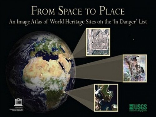
The USGS and UNESCO have produced a book that gives us a new way to look at our shared global heritage.

Groundwater in aquifers on the East Coast and in the Central U.S. has the highest risk of contamination from radium, a naturally occurring radioactive element and known carcinogen.
The proposed USGS budget reflects research priorities to respond to nationally relevant issues, including water quantity and quality, ecosystem restoration, hydraulic fracturing, natural disasters such as floods and earthquakes, and support for the National Ocean Policy, and has a large R&D component.
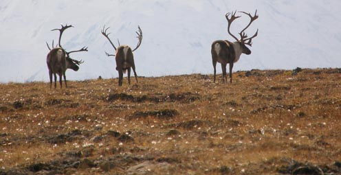
Caribou expert Layne Adams discusses the lives of reindeer — apart from their famous role on Christmas Eve. How they survive the cold.

Climate science is helping to predict food shortages, identify impacts on human health, and prepare for future conditions.

As demand grows, Landsat data can help us track trends in key resources. Remote-sensing satellites help scientists to observe our world, monitor changes, and detect critical trends in forestry, water, crops, and urban landscapes. Learn more.

A new study provides crucial information for difficult decisions regarding conservation, economic interests, and food and water security. Projected changes for 2010-2099

It's only the beginning of their careers, but these 3 young scientists have forged ahead with innovative research at the frontiers of science. How they've transformed their fields

Oct. 9-15, 2011, is Earth Science Week, themed "Our-Ever Changing Earth," and Oct. 12, 2011, is International Day for Natural Disaster Reduction. Answers to questions posed by a changing world

By 1936, devastating losses of wildlife populations were threatening the Nation’s natural resource heritage. America's first wildlife research center
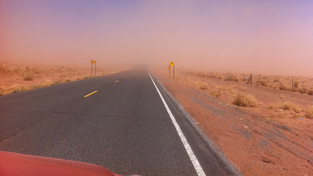
A dust storm on Tuesday, October 4, blinded motorists and caused a large string of motor vehicle crashes, multiple injuries, and at least one death. What’s causing the dust storms?
USGS scientists study walruses off the northwestern Alaska coast in August as part of their ongoing study of how the Pacific walrus are responding to reduced sea ice conditions in late summer and fall.
USGS scientists are collecting water samples and other data to determine trends in ocean acidification from the least explored ocean in the world.
In support of the Famine Early Warning Systems Network, USGS scientists use satellite remote sensing to assess agricultural conditions that foretell famine.
New USGS research shows that rice could become adapted to climate change and some catastrophic events by colonizing its seeds or plants with the spores of tiny naturally occurring fungi. The DNA of the rice plant itself is not changed; instead, researchers are re-creating what normally happens in nature.
Now that field work has wrapped up at the Ice Age "Snowmastodon" fossil site near Snowmass Village, Colo., USGS and other scientists will begin work on unraveling the climate and environmental history of the area.
USGS scientists are studying the Earth’s conditions 3 million years ago to gain insight into the impacts of future climate. Join us Aug. 3 in Reston, Va., to learn how this information is used to better understand the magnitude of changes forecast for the end of this century.
USGS crews continue to measure streamflow and collect water quality and sediment samples in the Ohio and Mississippi River basins using state-of-art instruments.
Over the past four decades, about 14% of the ice and permanent snow of Washington's Mount Rainier has melted due to combined recent warming and reduced precipitation.
USGS science supports management, conservation, and restoration of imperiled, at-risk, and endangered species.
In a unique application of data, this year's report provides the nation's first assessment of birds on public lands and waters.
The USGS, NASA, and other organizations and Federal agencies are studying how climate change affects wildlife and ecosystems.

Using coral growth records and measurements of changing ocean chemistry from increased atmospheric CO2, USGS scientists are providing a foundation for predicting future impacts of ocean acidification and sea-level rise to coral reefs.
Increased dust storm activity may result from enhanced aridity in the Southwest, according to a USGS study.
Provide your input on the draft USGS Global Change Science Strategy by April 8, 2011.
Sea-ice habitats essential to polar bears would likely respond positively should more curbs be placed on global greenhouse gas emissions, according to a new modeling study published today in the journal, Nature.
Landscape photos taken in the same place but many years apart reveal dramatic changes due to human and natural factors. The USGS Desert Laboratory Repeat Photography Collection, the largest archive of its kind in the world, is 50 years old.
Decreasing pH and warming temperatures are changing ocean conditions and affecting coral and algal growth in South Florida. USGS scientists are conducting field measurements to learn more.
Many coastal wetlands worldwide including several on the U.S. Atlantic coast may be more sensitive than previously thought to climate change and sea-level rise in the this century.
USGS findings support recent predictions that climate change will stress ecosystems at lower elevations more than higher elevations. This information may guide future conservation efforts in helping decision makers develop regional landscape predictions about biological responses to climate changes.
The Earth as Art 3 collection, the latest set of Landsat satellite images selected for their artistic quality, reveals an intricate beauty in Earth’s natural patterns.
USGS scientists are investigating sea turtles and their habitats in Dry Tortugas National Park to provide insight that will be used as decision-support tools for managing coral ecosystems.
Looking for information on natural resources, natural hazards, geospatial data, and more? The USGS Education site provides great resources, including lessons, data, maps, and more, to support teaching, learning, K-12 education, and university-level inquiry and research.
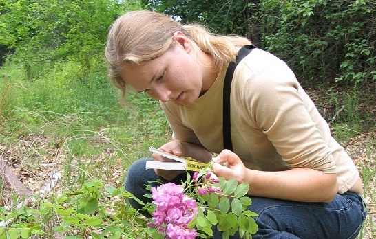
The timing of animal migration and reproduction, and observing when plants send out new leaves and bear fruit, is increasingly important in understanding how climate change affects biological and hydrologic systems. Photo credit Copyright C Brandon Cole.
The United States Group on Earth Observations (USGEO) is working to connect Earth observations with public health, agriculture, climate, and data management and dissemination.
USGS studies the relationships among earth surface processes, ecological systems, understanding current changes in the context of prehistoric and recent earth processes, distinguishing between natural and human-influenced changes, and recognizing ecological and physical responses to changes in climate.
The USGS Science Strategy is a comprehensive report to critically examine the USGS's major science goals and priorities for the coming decade. The USGS is moving forward with these strategic science directions in response to the challenges that our Nation's future faces and for the stewards of our Federal lands.

7 p.m.—Public lecture (also live-streamed over the Internet)

The U.S. Geological Survey had a very busy 2011 — below are a few of our highlights from last year.

Despite news articles warning of large-scale releases of methane due to climate change, recent research indicates that most of the world’s gas hydrate deposits should remain stable for the next few thousand years.

Although no one is quite sure where the coal for naughty kids custom came from, the truth is that coal has long been a very important part of our daily lives, let alone our holiday traditions. USGS has studied coal for much of our more than 130-year existence.
USGS scientists will join thousands of scientists, managers, and decision makers in Boston this week to present new findings on toxics at the Society for Environmental Toxicology and Chemistry (SETAC) conference in the Hynes Convention Center, Nov. 13-17.

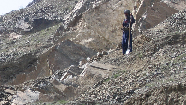
In research released September 29, 2011, USGS announced that it had mapped more than 96 percent ofAfghanistanwith hyperspectral imaging (also referred to as imaging spectroscopy data). That’s more than any other country in the world, including the U.S. Using a WB-57 aircraft as well as ground-based tools, USGS scientists directed a campaign to collect andContinue Reading

Join us on October 5th to learn more about the minerals we use on a daily basis, where these resources come from, and the steps involved from mineral discovery to mineral use.

7 p.m.—Public lecture (also live-streamed over the Internet)

USGS-led survey finds that national wildlife refuges rate highly with visitors.

As the climate has warmed, many plants are starting to grow leaves and bloom flowers earlier. A new study published in the journal, Nature, suggests that most field experiments may underestimate the degree to which the timing of leafing and flowering changes with global warming.

Stressed agricultural lands may be releasing less of the moisture needed to protect the breadbasket of a continent.

Spring rains in the eastern Horn of Africa are projected to begin late this year and be substantially lower than normal.

In recognition of World Forestry Day, let’s take a glimpse at USGS science to understand the fate of forests from climate change.

A new study concludes that fossil fuel emissions are likely contributors to a substantial amount of organic carbon found on glaciers in Alaska. Fossil fuel emissions, which contain organic carbon, can speed up the rate of glacier melt when deposited on glacier surfaces. In addition, the organic molecules associated with these deposits can be transportedContinue Reading
The U.S. Geological Survey had a very busy 2011 — below are a few of our highlights from last year.
Despite news articles warning of large-scale releases of methane due to climate change, recent research indicates that most of the world’s gas hydrate deposits should remain stable for the next few thousand years.
Join us on February 1 to view the Earth from space, and discuss the profound impact Landsat has on many facets of our economy, safety, and environment.

Scientists have discovered an outbreak of coral disease called Montipora White Syndrome in Kāneohe Bay, Oahu. The affected coral are of the species Montipora capitata, also known as rice coral.
USGS scientists will join thousands of scientists, managers, and decision makers in Boston this week to present new findings on toxics at the Society for Environmental Toxicology and Chemistry (SETAC) conference in the Hynes Convention Center, Nov. 13-17.

On Nov. 3, USGS scientists Patrick Barnard and William Ellsworth will present a public lecture in Menlo Park, CA, providing Bay Area residents information about USGS research in the San Francisco Bay Area, including recent discoveries beneath San Francisco Bay and ongoing studies to better understand earthquake probabilities and the potential hazards associated with strong ground shaking.

Rivers and streams in the United States are releasing substantially more carbon dioxide into the atmosphere than previously thought.

Climate Change Impacts to Tribal Communities The USGS is working with Native American communities and organizations to understand climate change impacts to their land and neighborhoods. Projects include interviews with indigenous Alaskans to understand their personal observations of climate change, as well as studying how climate change is impacting sand dunes and posing risksContinue Reading

As climate changes, it affects the timing of when leaves emerge, the amount of foliage that grows as well as the timeframe when leaves begin to fall.

How will accelerated glacial melting over the next 50 years as a result of climate change affect the unique Gulf of Alaska and Copper River coastal ecosystems? USGS scientists are studying these processes and impacts.

![]() U.S. Department of the Interior |
U.S. Geological Survey
U.S. Department of the Interior |
U.S. Geological Survey
URL: www.usgs.gov/blogs/features/usgs_science_pick/can-we-move-carbon-from-the-atmosphere-and-into-rocks-and-plants/
Page Contact Information: Ask USGS
Page Last Modified: September 14, 2011


