
Census.gov › Data › Data Visualization Gallery › Following the Frontier Line, 1790 to 1890
Data
Following the Frontier Line, 1790 to 1890
September 6, 2012


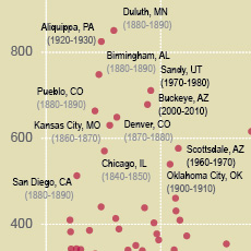
In 1890, the Superintendent of the Census described the western part of the country as having so many pockets of settled area that a frontier line could no longer be said to exist. The advance of the frontier line that characterized shifts in population distribution for the previous 100 years was complete. This series of maps highlights population expansion into new territory, subsequent gains in population density, and increasing urbanization.
SOURCE: Decennial censuses 1790 to 1890
NOTE: The official Census Bureau designation of "unsettled" or frontier territory was that which had population densities of less than 2 people per square mile. Data do not include "Indians not taxed." Selected cities shown are for reference and may not have existed for the entire period covered by the graphic.
Recent Data Visualizations
 I-5 Population Density Profile, 2010
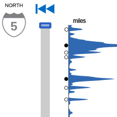 I-5 Population Density Profile, 2010
 Islands of High Income
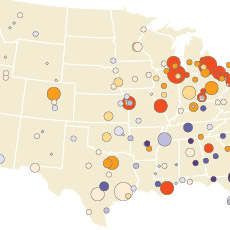 The Great Migration, 1910 to 1970
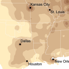 Following the Frontier Line, 1790 to 1890
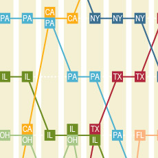 Changing Ranks of States by Congressional Representation
 Cartograms of State Populations in 1890, 1950, and 2010
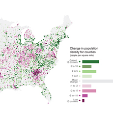 Before and After 1940: Change in Population Density
 From Physical to Political Geography
 Differential City Growth Patterns
 I-95 Population Density Profile
 Increasing Urbanization
 Gaining and Losing Shares
 Top 20 Cities
 Facebook
 Twitter
 Flickr
 YouTube