Alaska
The Bureau of Land Management’s National Landscape Conservation System (NLCS) offers some of Alaska's most spectacular landscapes, which the agency manages for conservation purposes under its multiple-use mandate. These wild and often remote places provide opportunities for scientific research, recreation, and a wide range of other uses.
These areas consist of the BLM’s National Conservation Areas, National Monuments, Wild and Scenic Rivers, Wilderness Areas, Wilderness Study Areas, and National Scenic and Historic Trails.
Steese National Conservation Area
 The Steese National Conservation Area (NCA) encompasses 1.2 million acres of public land about 100 miles northeast of Fairbanks. Created by the Alaska National Interest Lands Conservation Act in 1980, the Steese NCA's special values include Birch Creek Wild and Scenic River, crucial caribou calving grounds and home range, and Dall sheep habitat. While various land uses are allowed in the Steese NCA, the area is managed so that its scenic, scientific, cultural and other resources are protected. more>
Iditarod National Historic Trail
 The Iditarod National Historic Trail commemorates a 2,300-mile system of winter trails that first connected ancient Native Alaskan villages, opened up Alaska for the last great American gold rush, and now plays a vital role for travel and recreation in modern day Alaska. more>
Beaver Creek Wild and Scenic River

Beaver Creek National Wild River has its headwaters in the White Mountains. The river flows west past the jagged limestone ridges of the White Mountains before flowing to the north and east, where it enters the Yukon Flats and joins the Yukon River. The first 127 miles of Beaver Creek, most of it within the White Mountains National Recreation Area, were designated a national wild river by the Alaska National Interest Lands Conservation Act in 1980. The last 16 miles of designated wild river lie within the Yukon Flats National Wildlife Refuge. more>
Birch Creek Wild and Scenic River
 Birch Creek Wild and Scenic River flows from the windswept ridges and alpine tundra of the Steese National Conservation Area into the broad expanse of the Yukon Flats in central Alaska. The river offers one-week float trips notable not only for scenery and remoteness but for convenience -- floaters can access both ends of the Wild River segment from BLM recreation sites along the Steese Highway. more>
Delta Wild and Scenic River
 The Delta Wild and Scenic River Watershed originates south of the Denali Highway and includes all of the Upper and Lower Tangle Lakes, the Tangle River, and the Delta River. The Delta River drains north through the Alaska Range, eventually joining the Tanana River and emptying into the Yukon River. The watershed includes 150,000 acres of land, 160 miles of streams and 21 lakes, providing excellent habitat for over 100 species of migrating birds and waterfowl as well as grayling, whitefish, lake trout, burbot, and longnose suckers. more>
Gulkana Wild and Scenic River
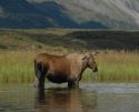
 The Gulkana is one of the most popular sportfishing rivers in Alaska, providing rich habitat for rainbow trout, arctic grayling, king salmon, red salmon, whitefish, longnose suckers, and lamprey. A poplular river for fisherman and boaters in the summer, this river has also played an important role in the lives of the Ahtna, providing access to subsistence resoucres throughout history and pre-history. During winter months the frozen Gulkana River was historically used as an important travel route from the Copper River to the Tangle Lakes and what is now known as the Denali Highway area. more>
Fortymile Wild and Scenic River
 Gold Rush prospectors gave the Fortymile River its name because it joins the Yukon River about 40 miles below Fort Reliance, an old Canadian trading post. In 1980, 392 miles of the river in east-central Alaska were designated as a Wild and Scenic River by the Alaska National Interest Lands Conservation Act. The BLM manages the wild and scenic river corridor as well as three campgrounds and Fort Egbert in the Eagle Historic District National Historic Landmark. more>
Unalakleet Wild and Scenic River
 The clear, smooth waters of the Unalakleet National Wild River meander gently among the rolling Nulato Hills and across broad expanses of arctic tundra to the seaside village of Unalakleet, Alaska, at the rocky shores of the Norton Sound. Located 400 miles from Anchorage, the village of Unalakleet has approximately 800 people and is accessible only by plane. more>
Similarly Designated Areas
White Mountains National Recreation Area
 Located just an hour's drive from Fairbanks, Alaska, the one-million-acre White Mountains National Recreation Area offers stunning scenery, peaceful solitude, and outstanding opportunities for year-round recreation. Summer visitors to the White Mountains pan for gold, fish, hike and camp under Alaska's 'midnight sun. In winter, visitors travel by ski, snowshoe, dog team and snowmobile to enjoy the 12 public-use cabins and 250 miles of groomed trails that make the White Mountains one of Interior Alaska's premier winter destinations. more>