
ShakeMaps
ShakeMap is a product of the U.S. Geological Survey Earthquake Hazards Program in conjunction with regional seismic network operators. ShakeMap sites provide near-real-time maps of ground motion and shaking intensity following significant earthquakes. These maps are used by federal, state, and local organizations, both public and private, for post-earthquake response and recovery, public and scientific information, as well as for preparedness exercises and disaster planning.
Networks producing ShakeMaps
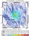
Click a network name to view a list of events, or on an image to view the event


Last 10 ShakeMaps from any Network
A list of all ShakeMaps is available in the ShakeMap Archive
| Mag | Location | Date | Network | Event ID |
|---|---|---|---|---|
| 4.1 | 17.1 km (10.6 mi) WNW of Ocotillo, CA32.8052, -116.156, 7km | Oct 02, 2012 08:28:15 UTC | S California | 15223417 |
| 6.2 | OFF THE EAST COAST OF HONSHU, JAPAN39.8527, 143.047, 10km | Oct 01, 2012 22:21:45 UTC | Global | c000cz76 |
| 7.3 | COLOMBIA1.916, -76.355, 168km | Sep 30, 2012 16:31:35 UTC | Global | 2012gdap |
| 5.5 | OAXACA, MEXICO16.3553, -98.3884, 10km | Sep 29, 2012 07:11:13 UTC | Global | c000cy2k |
| 3.5 | NEW MEXICO34.6721, -106.776, 6km | Sep 29, 2012 00:59:48 UTC | Global | c000cy0c |
| 3.8 | 48.2 km (29.9 mi) SSE of Calexico, CA32.2805, -115.267, 10km | Sep 28, 2012 16:27:31 UTC | S California | 15222209 |
| 6.0 | SOLOMON ISLANDS-8.8245, 157.557, 10km | Sep 27, 2012 23:53:49 UTC | Global | c000cxd5 |
| 6.4 | ANDREANOF ISLANDS, ALEUTIAN IS., ALASKA51.6339, -178.293, 10km | Sep 26, 2012 23:39:54 UTC | Global | c000cwni |
| 6.2 | ANDREANOF ISLANDS, ALEUTIAN IS., ALASKA51.4477, -178.162, 5km | Sep 26, 2012 23:39:53 UTC | Alaska | 10565764 |
| 6.2 | GULF OF CALIFORNIA24.8351, -110.152, 10km | Sep 25, 2012 23:45:26 UTC | Global | c000cw0l |
