

Shaking Hazard Map
Northwestern Alameda County
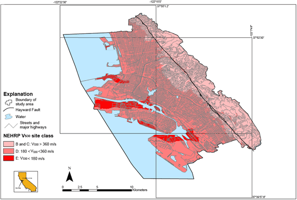
This map shows the capability of the ground to amplify earthquake shaking in the communities of Alameda, Berkeley, Emeryville, Oakland, and Piedmont. The National Earthquake Hazards Reduction Program recognizes 5 categories of soil types and assigns amplification factors to each. Type E soils in general have the greatest potential for amplification, and type A soils have the least. These soil types are recognized in many local building codes. Records from many earthquakes show that ground conditions immediately beneath a structure affect how hard the structure shakes. For example, sites underlain by soft clayey soils tend to shake more violently than those underlain by rock. The map depicts the amplification potential at a regional scale, and it should not be used for site specific design. Subsurface conditions can vary abruptly and borings are required to estimate amplification at a given location.
- Liquefaction Map for Northwestern Alameda County
- Complete USGS Open-file Report 02-296 includes full text and spatial database files.
- Cone Penetration Testing (CPT) data for Northwestern Alameda County
- CGS Seismic Hazard Zone Maps
